
Fowlmere is a Royal Society for the Protection of Birds nature reserve between Fowlmere and Melbourn in Cambridgeshire. It is designated a 39.9-hectare (99-acre) biological Site of Special Scientific Interest called Fowlmere Watercress Beds.
Chettisham Meadow is a 0.7-hectare (1.7-acre) biological Site of Special Scientific Interest west of Chettisham, 3 km (2 mi) north of Ely in Cambridgeshire. It is managed by the Wildlife Trust for Bedfordshire, Cambridgeshire and Northamptonshire.

Holme Fen is a 269.4-hectare (666-acre) biological Site of Special Scientific Interest near Holme in Cambridgeshire. It is also a National Nature Reserve and a Nature Conservation Review site, Grade I. It is part of the Great Fen project, which aims to create a 3,700-hectare wetland wildlife area including Holme Fen, Woodwalton Fen and other areas. It is home to a variety of birds, including the Eurasian siskin, Nightingale and Lesser redpoll, and around 450 species of fungi.
Soham Wet Horse Fen is a 33.8-hectare (84-acre) biological Site of Special Scientific Interest east of Soham in Cambridgeshire. A 3.6-hectare (8.9-acre) field in the north-west corner is managed by the Wildlife Trust for Bedfordshire, Cambridgeshire and Northamptonshire as Soham Meadow.
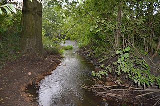
The River Ter SSSI is a stretch of the River Ter and its banks south of Great Leighs in Essex which has been designated a geological Site of Special Scientific Interest. It is a Geological Conservation Review site.
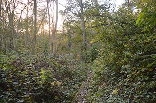
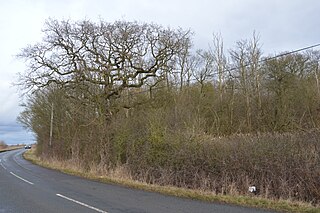
Brackland Rough is a 10.7-hectare (26-acre) biological Site of Special Scientific Interest in Fordham in Cambridgeshire. It is managed by the Wildlife Trust for Bedfordshire, Cambridgeshire and Northamptonshire as Fordham Woods.

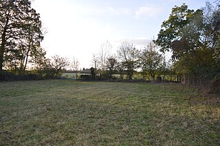
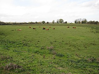
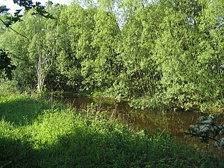
Snailwell Meadows is a 14.8-hectare (37-acre) biological Site of Special Scientific Interest in Snailwell in Cambridgeshire.

Upware Bridge Pit North is a 2.5-hectare (6.2-acre) geological Site of Special Scientific Interest northwest of Wicken in Cambridgeshire. It is a Geological Conservation Review site.
Weaveley and Sand Woods is a 62.0-hectare (153-acre) biological Site of Special Scientific Interest north of Gamlingay in Cambridgeshire.
Bozeat Meadow is a 2.6-hectare (6.4-acre) biological Site of Special Scientific Interest in Bozeat, east of Northampton.
Flixton Quarry is a 0.7 hectares geological Site of Special Scientific Interest 3.75 miles (6.04 km) south-west of Bungay in the English county of Suffolk. It is a Geological Conservation Review site located in the parish of Homersfield.

Potton Hall Fields, Westleton is a 16.7-hectare (41-acre) biological Site of Special Scientific Interest (SSSI) west of Dunwich in Suffolk. It is in the Suffolk Coast and Heaths Area of Outstanding Natural Beauty.

RAF Lakenheath is a 111 hectare biological Site of Special Scientific Interest covering parts of RAF Lakenheath Royal Air Force base, east of Lakenheath in Suffolk. It is in the Breckland Special Area of Conservation.

Pakenham Meadows is a 5.8-hectare (14-acre) biological Site of Special Scientific Interest north of Pakenham in Suffolk.
Hay Wood, Whepstead is a 10.4-hectare (26-acre) biological Site of Special Scientific Interest west of Whepstead in Suffolk.

Twenty Acre Piece is an 8.1-hectare (20-acre) biological Site of Special Scientific Interest and registered common land east of Loughborough in Leicestershire.

River Eye SSSI is a 6.0 hectares biological Site of Special Scientific Interest covering a stretch of the River Eye between Ham Bridge, north-west of Stapleford, and the eastern outskirts of Melton Mowbray in Leicestershire. It is a Nature Conservation Review site.
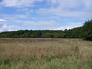
Wymondham Rough is a 6.0 hectares biological Site of Special Scientific Interest (SSSI) east of Stapleford in Leicestershire. The SSSI is part of the 12.5 hectare Wymondham Rough nature reserve, which is managed by the Leicestershire and Rutland Wildlife Trust.
Cranberry Rough is an 81.1-hectare (200-acre) biological and geological Site of Special Scientific Interest in the parish of Hockham, east of Attleborough in Norfolk. It is a Nature Conservation Review site, Grade 2, and the Great Eastern Pingo Trail, which is a Local Nature Reserve, goes through the site. Part of it is a Geological Conservation Review site, and it is part of the Breckland Special Protection Area.
