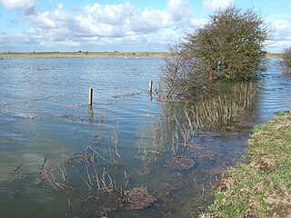
Nene Washes is a 1,522-hectare (3,760-acre) biological Site of Special Scientific Interest on the bank of the River Nene east of Peterborough in Cambridgeshire, England. It is also a Ramsar internationally important wetland site, a Special Area of Conservation, a Special Protection Area and a Nature Conservation Review site. An area of 280 hectares is managed by the Royal Society for the Protection of Birds. The total area of the Ramsar site is 1,517 hectares.

Ketton Quarries is a 115.6-hectare (286-acre) biological and geological Site of Special Scientific Interest east of Ketton in Rutland. It is a Geological Conservation Review site, and an area of 27.5 hectares is managed by the Leicestershire and Rutland Wildlife Trust.
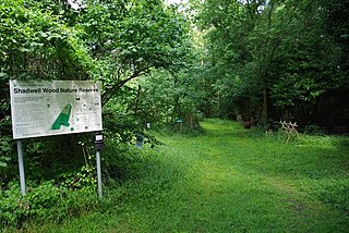
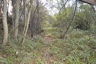
Hales and Shadwell Woods is a 15.4-hectare (38-acre) biological Site of Special Scientific Interest north-east of Saffron Walden in Essex. Shadwell Wood has an area of 7.1 hectares and it is managed by the Essex Wildlife Trust. Hales Wood is a National Nature Reserve, and it is listed in the Nature Conservation Review.
Eye Gravel Pit is a 0.4-hectare (0.99-acre) geological Site of Special Scientific Interest in Eye Green in Cambridgeshire. It is a Geological Conservation Review site, and part of it overlaps Eye Green Local Nature Reserve.

Upware Bridge Pit North is a 2.5-hectare (6.2-acre) geological Site of Special Scientific Interest northwest of Wicken in Cambridgeshire. It is a Geological Conservation Review site.
Upware North Pit is a 1.1-hectare (2.7-acre) biological Site of Special Scientific Interest north-west of Wicken in Cambridgeshire.
Upware South Pit is a 1.1-hectare (2.7-acre) geological Site of Special Scientific Interest (SSSI) north of Upware in Cambridgeshire. It is a Geological Conservation Review site.
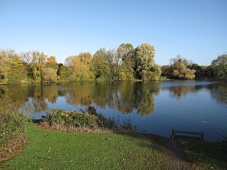
Ely Pits and Meadows is an 85.8-hectare (212-acre) Site of Special Scientific Interest (SSSI) on the eastern outskirts of Ely in Cambridgeshire. It is the only SSSI in the county which is designated both for its biological and geological interest. It is also a Geological Conservation Review site, and an area of 8 hectares is the Roswell Pits nature reserve, which is managed by the Wildlife Trust for Bedfordshire, Cambridgeshire and Northamptonshire.
Warboys Clay Pit is a 12.6-hectare (31-acre) geological Site of Special Scientific Interest west of Warboys in Cambridgeshire. It is a Geological Conservation Review site.

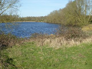
Upper Nene Valley Gravel Pits is a 1,382.4 hectare biological Site of Special Scientific Interest in a chain of flooded gravel pits along 35 kilometres of the valley of the River Nene between Northampton and Thorpe Waterville in Northamptonshire. It is a Ramsar wetland site of international importance, a Special Protection Area under the European Communities Birds Directive and part of the Nene Valley Nature Improvement Area. It is also part of the River Nene Regional Park. Two areas are managed by the Wildlife Trust for Bedfordshire, Cambridgeshire and Northamptonshire, Summer Leys and Titchmarsh Nature Reserve.

Ditchford Lakes and Meadows is a 31.1-hectare (77-acre) nature reserve Northamptonshire. It is managed by the Wildlife Trust for Bedfordshire, Cambridgeshire and Northamptonshire. It is part of the Upper Nene Valley Gravel Pits Site of Special Scientific Interest, Ramsar wetland site of international importance, and Special Protection Area under the European Communities Birds Directive.
Wilson's Pits is a 32 hectare nature reserve west of Higham Ferrers in Northamptonshire. It is managed by the Wildlife Trust for Bedfordshire, Cambridgeshire and Northamptonshire. It is part of the Upper Nene Valley Gravel Pits Site of Special Scientific Interest, Ramsar internationally important wetland site and Special Protection Area under the EC Birds Directive.

Crag Farm Pit, Sudbourne is a 4.8-hectare (12-acre) geological Site of Special Scientific Interest east of Sudbourne in Suffolk. It is a Geological Conservation Review site, and within the Suffolk Coast and Heaths Area of Outstanding Natural Beauty.

Valley Farm Pit, Sudbourne is a 0.5-hectare (1.2-acre) geological Site of Special Scientific Interest north of Orford in Suffolk. It is a Geological Conservation Review site, and in the Suffolk Coast and Heaths Area of Outstanding Natural Beauty.
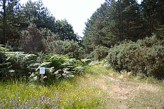
Breckland Forest is an 18,126 hectare biological and geological Site of Special Scientific Interest in many separate areas between Swaffham in Norfolk and Bury St Edmunds in Suffolk. It is part of the Breckland Special Protection Area under the European Union Directive on the Conservation of Wild Birds. It contains two Geological Conservation Review sites, Beeches Pit, Icklingham and High Lodge. Barton Mills Valley is a Local Nature Reserve in the south-west corner of the site.

Gipsy Lane Pit is a 0.5 hectares geological Site of Special Scientific Interest in Leicester. It is a Geological Conservation Review site.

Wells Chalk Pit is a 4-hectare (9.9-acre) biological and geological Site of Special Scientific Interest on the eastern outskirts of Wells-next-the-Sea in Norfolk. It is a Geological Conservation Review site, and it is in the Norfolk Coast Area of Outstanding Natural Beauty.

Wealden Edge Hangers is a 222.4-hectare (550-acre) biological Site of Special Scientific Interest north of Petersfield in Hampshire. An area of 48 hectares is Wealden Edge Hangers Local Nature Reserve and an area of 144.1 hectares is Ashford Hangers National Nature Reserve. Wealden Edge Hangers is part of the East Hampshire Hangers Special Area of Conservation.
