
Brampton Meadow is a one hectare biological Site of Special Scientific Interest north-west of Brampton in Cambridgeshire, England.
Houghton Meadows is a 4.7-hectare (12-acre) biological Site of Special Scientific Interest (SSSI) between Houghton and St Ives in Cambridgeshire. The SSSI covers three meadows south of Thicket Road; they are part of the 8-hectare (20-acre) Houghton Meadows nature reserve, which is owned and managed by the Wildlife Trust for Bedfordshire, Cambridgeshire and Northamptonshire, and which also includes Browns Meadow to the south.

Upwood Meadows is a 6 hectare biological Site of Special Scientific Interest west of Upwood in Cambridgeshire. It is also a National Nature Reserve and a Grade I Nature Conservation Review site. It is managed by the Wildlife Trust for Bedfordshire, Cambridgeshire and Northamptonshire.

Southorpe Meadow is a 2 hectares biological Site of Special Scientific Interest in Southorpe in Cambridgeshire. It is managed by the Wildlife Trust for Bedfordshire, Cambridgeshire and Northamptonshire.

Castor Hanglands is an 89.8-hectare (222-acre) biological Site of Special Scientific Interest west of Peterborough in Cambridgeshire. The site is also a National Nature Reserve, and it is a Nature Conservation Review site, Grade I for its woodlands and Grade 2 for its grassland. It is common land managed by Natural England.
Loughborough Meadows is a 60.5 hectares biological Site of Special Scientific Interest on the northern outskirts of Loughborough in Leicestershire, England. An area of 35.3 hectares is managed as a nature reserve by the Leicestershire and Rutland Wildlife Trust.
Yelden Meadows is a 2.8-hectare (6.9-acre) biological Site of Special Scientific Interest in Yelden in Bedfordshire. It was notified under Section 28 of the Wildlife and Countryside Act 1981, and the local planning authority is Bedford Borough Council.

Oxley Mead is a 3.7 hectares biological Site of Special Scientific Interest in the Oxley Park district of Shenley Church End in Milton Keynes, (ceremonial) Buckinghamshire.

Hemingford Grey Meadow is a 0.7-hectare (1.7-acre) biological Site of Special Scientific Interest south of Hemingford Grey in Cambridgeshire. It is managed by the Wildlife Trust for Bedfordshire, Cambridgeshire and Northamptonshire as Arthur's Meadow.

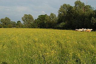
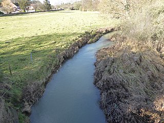
Portholme is a 106-hectare (260-acre) biological Site of Special Scientific Interest in the Parish of Brampton between Huntingdon and Godmanchester in Cambridgeshire, England. It is a Nature Conservation Review site, and a Special Area of Conservation.
Caldecote Meadows is a 9.1-hectare (22-acre) biological Site of Special Scientific Interest in Caldecote in Cambridgeshire.

Mill Crook is a 5.9-hectare (15-acre) biological Site of Special Scientific Interest east of Towcester in Northamptonshire. Mill Crook and Grafton Regis Meadow are a 7.9-hectare (20-acre) nature reserve managed by the Wildlife Trust for Bedfordshire, Cambridgeshire and Northamptonshire.
River Ise and Meadows is a 13.5-hectare (33-acre) biological Site of Special Scientific Interest along the River Ise in Northamptonshire between Geddington and the Kettering to Corby railway line east of Rushton.
Bugbrooke Meadows is a 10.1-hectare (25-acre) biological Site of Special Scientific Interest east of Nether Heyford in Northamptonshire. One of the fields with an area of 1.7 hectares is managed by the Wildlife Trust for Bedfordshire, Cambridgeshire and Northamptonshire.

Bulwick Meadows is a 4.2-hectare (10-acre) biological Site of Special Scientific Interest in Bulwick, north-east of Corby in Northamptonshire.

Seaton Meadows is an 11.4-hectare (28-acre) biological Site of Special Scientific Interest east of Seaton in Rutland. It is owned and managed by Plantlife.
Debdale Meadow, Muston is a 4.3-hectare (11-acre) biological Site of Special Scientific Interest north of Muston in Leicestershire.

Dereham Rush Meadow is a 22.2-hectare (55-acre) biological Site of Special Scientific Interest north-west of Dereham in Norfolk.
