
Catton Grove Chalk Pit is a 0.6-hectare (1.5-acre) geological Site of Special Scientific Interest on the northern outskirts of Norwich in Norfolk. It is a Geological Conservation Review site.

Totternhoe Stone is a relatively hard chalk outcropping in the middle of the Lower Chalk in the Chiltern Hills in Hertfordshire, Buckinghamshire, Bedfordshire and Cambridgeshire, England. Geologically, it is located in the upper part of the Cenomanian stage of the Cretaceous.
Southerham Works Pit is a 1-hectare (2.5-acre) geological Site of Special Scientific Interest in Lewes in East Sussex. It is a Geological Conservation Review site.

Ketton Quarries is a 115.6-hectare (286-acre) biological and geological Site of Special Scientific Interest east of Ketton in Rutland. It is a Geological Conservation Review site, and an area of 27.5 hectares is managed by the Leicestershire and Rutland Wildlife Trust.

Kensworth Chalk Quarry is a 131.3-hectare (324-acre) geological Site of Special Scientific Interest in Kensworth in Bedfordshire. It was notified under Section 28 of the Wildlife and Countryside Act 1981, and the local planning authority is Central Bedfordshire.

Totternhoe nature reserve is managed by the Wildlife Trust for Bedfordshire, Cambridgeshire and Northamptonshire (WTBCN). The 31-hectare (77-acre) site is in Totternhoe in Bedfordshire, and it includes parts of three Sites of Special Scientific Interest (SSSIs). Totternhoe Knolls is a biological SSSI owned by Central Bedfordshire Council and leased to the National Trust. Most of it is managed jointly by the National Trust and the WTBCN, excluding Totternhoe Castle, the earthworks of a Norman motte-and-bailey castle which is part of the SSSI but not of WTBCN's nature reserve. Totternhoe nature reserve also includes the geological SSSI, Totternhoe Stone Pit, which is not open to the public, and other areas owned by WTBCN, including part of Totternhoe Chalk Quarry, another biological SSSI.
Bugle Quarry is a 0.08-hectare (0.20-acre) geological Site of Special Scientific Interest in Hartwell in Buckinghamshire. The local planning authority is Aylesbury Vale District Council. It has two entries in the Geological Conservation Review of the Joint Nature Conservation Committee.

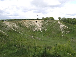
South Lodge Pit is a 0.5-hectare (1.2-acre) geological Site of Special Scientific Interest in Taplow in Buckinghamshire. It is a Geological Conservation Review site.
Barrington Pit is a 3.8-hectare (9.4-acre) geological Site of Special Scientific Interest near Barrington in Cambridgeshire. It is a Geological Conservation Review site.
Eye Gravel Pit is a 0.4-hectare (0.99-acre) geological Site of Special Scientific Interest in Eye Green in Cambridgeshire. It is a Geological Conservation Review site, and part of it overlaps Eye Green Local Nature Reserve.

Upware Bridge Pit North is a 2.5-hectare (6.2-acre) geological Site of Special Scientific Interest northwest of Wicken in Cambridgeshire. It is a Geological Conservation Review site.
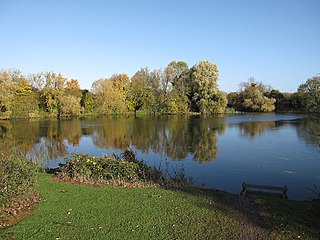
Ely Pits and Meadows is an 85.8-hectare (212-acre) Site of Special Scientific Interest (SSSI) on the eastern outskirts of Ely in Cambridgeshire. It is the only SSSI in the county which is designated both for its biological and geological interest. It is also a Geological Conservation Review site, and an area of 8 hectares is the Roswell Pits nature reserve, which is managed by the Wildlife Trust for Bedfordshire, Cambridgeshire and Northamptonshire.
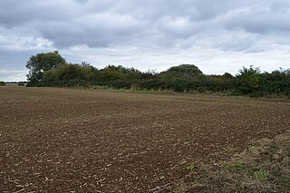
Orwell Clunch Pit is a 1.8-hectare (4.4-acre) biological Site of Special Scientific Interest on the northern outskirts of Orwell in Cambridgeshire. It is owned by Orwell Parish Council and managed by the Clunch Pit Management Trust.

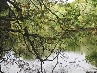
Limekiln Close and East Pit is a 10 hectare Local Nature Reserve (LNR) in Cherry Hinton, on the south-eastern outskirts of Cambridge. It is managed by the Wildlife Trust for Bedfordshire, Cambridgeshire and Northamptonshire as Cherry Hinton Chalk Pits. East Pit is part of the Cherry Hinton Pit biological Site of Special Scientific Interest, which excludes Limekiln Close but includes the neighbouring West Pit.

Grimston Warren Pit is a 6.6-hectare (16-acre) geological Site of Special Scientific Interest east of King's Lynn in Norfolk. It is a Geological Conservation Review site.

Wells Chalk Pit is a 4-hectare (9.9-acre) biological and geological Site of Special Scientific Interest on the eastern outskirts of Wells-next-the-Sea in Norfolk. It is a Geological Conservation Review site, and it is in the Norfolk Coast Area of Outstanding Natural Beauty.

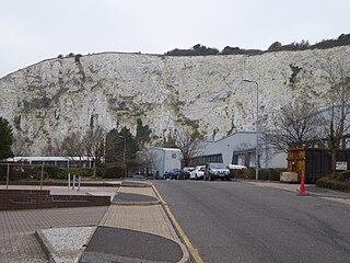
Chinnor Chalk Pit is a 20.4-hectare (50-acre) geological Site of Special Scientific Interest south of Chinnor in Oxfordshire. It is a Geological Conservation Review site.
