
The Wildlife Trust for Bedfordshire, Cambridgeshire and Northamptonshire (WTBCN) is a registered charity which manages 126 nature reserves covering 3,945 hectares. It has over 35,000 members, and 95% of people in Bedfordshire, Cambridgeshire and Northamptonshire live within five miles of a reserve. In the year to 31 March 2016 it employed 105 people and had an income of £5.1 million. It aims to conserve wildlife, inspire people to take action for wildlife, offer advice and share knowledge. The WTBCN is one of 36 wildlife trusts covering England, and 46 covering the whole of the United Kingdom.

Cooper's Hill is an 18.1-hectare (45-acre) biological Site of Special Scientific Interest in Ampthill in Bedfordshire. It was notified under Section 28 of the Wildlife and Countryside Act 1981 in 1984, and the planning authority is Central Bedfordshire Council. A smaller area of 12.7 hectares is also a Local Nature Reserve, Part of the site is managed by the Wildlife Trust for Bedfordshire, Cambridgeshire and Northamptonshire.

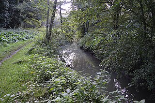
Felmersham Gravel Pits is a 21.6-hectare (53-acre) Site of Special Scientific Interest between the villages of Felmersham and Sharnbrook in Bedfordshire. It was notified under Section 28 of the Wildlife and Countryside Act 1981 in 1986 and the local planning authority is Bedford Borough Council. The site is managed by the Wildlife Trust for Bedfordshire, Cambridgeshire and Northamptonshire.
Flitwick Moor is a 59.8-hectare (148-acre) biological Site of Special Scientific Interest between Flitwick and Greenfield in Bedfordshire. It was notified under Section 28 of the Wildlife and Countryside Act 1981 in 1984 and the local planning authority is Central Bedfordshire Council. The site is managed by the Wildlife Trust for Bedfordshire, Cambridgeshire and Northamptonshire.

Buff Wood is a 15.8-hectare (39-acre) biological Site of Special Scientific Interest in Hatley in Cambridgeshire. It is managed by the Wildlife Trust for Bedfordshire, Cambridgeshire and Northamptonshire.

Dogsthorpe Star Pit is a 36.4-hectare (90-acre) biological Site of Special Scientific Interest (SSSI)) on the eastern outskirts of Peterborough in Cambridgeshire. It is also designated a Local Nature Reserve, and it is managed by the Wildlife Trust for Bedfordshire, Cambridgeshire and Northamptonshire.

Gamlingay Wood is a 48.4-hectare (120-acre) biological Site of Special Scientific Interest (SSSI) north of Gamlingay in Cambridgeshire. It is managed by the Wildlife Trust for Bedfordshire, Cambridgeshire and Northamptonshire.

Waresley and Gransden Woods is a 50-hectare (120-acre) nature reserve between Waresley and Great Gransden in Cambridgeshire, England. It is managed by the Wildlife Trust for Bedfordshire, Cambridgeshire and Northamptonshire. The site is a 54.2-hectare (134-acre) biological Site of Special Scientific Interest called Waresley Wood, with slightly different boundaries.

Hardwick Wood is a 15.5-hectare (38-acre) biological Site of Special Scientific Interest southwest of Hardwick in Cambridgeshire. It is managed by the Wildlife Trust for Bedfordshire, Cambridgeshire and Northamptonshire.

Southorpe Meadow is a 2 hectares biological Site of Special Scientific Interest in Southorpe in Cambridgeshire. It is managed by the Wildlife Trust for Bedfordshire, Cambridgeshire and Northamptonshire.
Wansford Pasture is a 3.1-hectare (7.7-acre) biological Site of Special Scientific Interest in Wansford in Cambridgeshire. It is part of the 7.3 hectare Wansford Pasture & Standen's Pasture, a nature reserve managed by the Wildlife Trust for Bedfordshire, Cambridgeshire and Northamptonshire (WTBCN).

Woodwalton Marsh is a 0.8-hectare (2.0-acre) biological Site of Special Scientific Interest north-east of Woodwalton in Cambridgeshire. It is managed by the Wildlife Trust for Bedfordshire, Cambridgeshire and Northamptonshire.

Hemingford Grey Meadow is a 0.7-hectare (1.7-acre) biological Site of Special Scientific Interest south of Hemingford Grey in Cambridgeshire. It is managed by the Wildlife Trust for Bedfordshire, Cambridgeshire and Northamptonshire as Arthur's Meadow.

Mill Crook is a 5.9-hectare (15-acre) biological Site of Special Scientific Interest east of Towcester in Northamptonshire. Mill Crook and Grafton Regis Meadow are a 7.9-hectare (20-acre) nature reserve managed by the Wildlife Trust for Bedfordshire, Cambridgeshire and Northamptonshire.
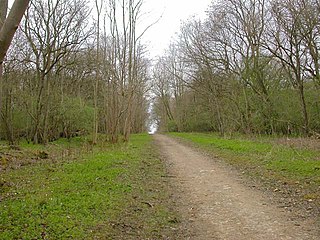
Old Sulehay Forest is a 34.8-hectare (86-acre) biological Site of Special Scientific Interest east of King's Cliffe in Northamptonshire. It is part of the 85-hectare (210-acre) Old Sulehay nature reserve, which is managed by the Wildlife Trust for Bedfordshire, Cambridgeshire and Northamptonshire.

Stoke and Bowd Lane Woods is a 36.4-hectare (90-acre) biological Site of Special Scientific Interest west of Corby in Northamptonshire. The eastern half of Stoke Wood is managed by the Woodland Trust, a triangular area of 0.7 hectares which stretches south from the middle is the Stoke Wood End Quarter, a nature reserve managed by the Wildlife Trust for Bedfordshire, Cambridgeshire and Northamptonshire, and the remaining western part of the wood is private property. Bowd Lane Wood is private property.

Collyweston Quarries is a 6.6-hectare (16-acre) biological Site of Special Scientific Interest in Easton on the Hill in Northamptonshire, south of Stamford. It is managed by the Wildlife Trust for Bedfordshire, Cambridgeshire and Northamptonshire.
