Raveley Wood

Last updated
Raveley Wood
Raveley Wood 2.jpg
Type Nature reserve
Location Upwood, Cambridgeshire
OS grid TL 244 817
Area 5.6 hectares
Managed by Wildlife Trust for Bedfordshire, Cambridgeshire and Northamptonshire

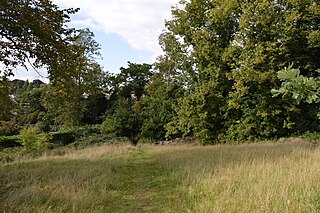
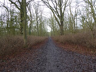
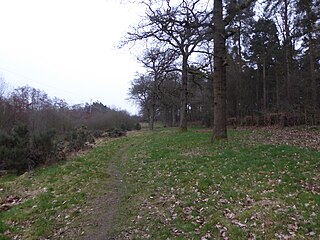
Raveley Wood is a 5.6 hectare nature reserve south-west of Upwood in Cambridgeshire. It is managed by the Wildlife Trust for Bedfordshire, Cambridgeshire and Northamptonshire. [1]

Upwood village in United Kingdom

Upwood is a village in the non-metropolitan district and historic county of Huntingdonshire, England, although in the administrative county of Cambridgeshire. Upwood lies approximately 7 miles (11 km) north of Huntingdon, near Bury. Upwood is in the civil parish of Upwood and The Raveleys.

Cambridgeshire County of England

Cambridgeshire is a county in the East of England, bordering Lincolnshire to the north, Norfolk to the north-east, Suffolk to the east, Essex and Hertfordshire to the south, and Bedfordshire and Northamptonshire to the west. The city of Cambridge is the county town. Modern Cambridgeshire was formed in 1974 as an amalgamation of the counties of Cambridgeshire and Isle of Ely and Huntingdon and Peterborough, the former covering the historic county of Cambridgeshire and the latter covering the historic county of Huntingdonshire and the Soke of Peterborough, historically part of Northamptonshire. It contains most of the region known as Silicon Fen.

Wildlife Trust for Bedfordshire, Cambridgeshire and Northamptonshire registered charity which manages 126 nature reserves covering 3,945 hectares across Bedfordshire, Cambridgeshire and Northamptonshire in the United Kingdom

The Wildlife Trust for Bedfordshire, Cambridgeshire and Northamptonshire (WTBCN) is a registered charity which manages 126 nature reserves covering 3,945 hectares. It has over 35,000 members, and 95% of people in Bedfordshire, Cambridgeshire and Northamptonshire live within five miles of a reserve. In the year to 31 March 2016 it employed 105 people and had an income of £5.1 million. It aims to conserve wildlife, inspire people to take action for wildlife, offer advice and share knowledge. The WTBCN is one of 36 wildlife trusts covering England, and 47 covering the whole of the United Kingdom.

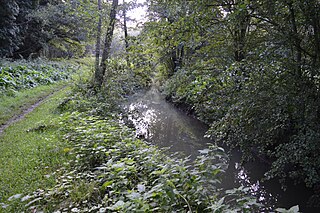
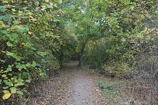
Trees in this wood include oak, ash and field maple, together with some elms, although many were killed by Dutch elm disease. Invertebrates include the rare white-spotted pinion moth, which depends on elms for food for its larvae, and white-letter hairstreak butterflies. The dead elms provide a habitat for a wide variety of fungi. [1]

Dutch elm disease plant disease caused by Ophiostoma ulmi fungus

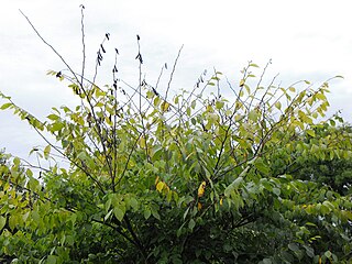
Dutch elm disease (DED) is caused by a member of the sac fungi (Ascomycota) affecting elm trees, and is spread by elm bark beetles. Although believed to be originally native to Asia, the disease was accidentally introduced into America and Europe, where it has devastated native populations of elms that did not have resistance to the disease. It has also reached New Zealand. The name "Dutch elm disease" refers to its identification in 1921 and later in the Netherlands by Dutch phytopathologists Bea Schwarz and Christine Buisman who both worked with Professor Johanna Westerdijk. The disease affects species in the genera Ulmus and Zelkova, therefore it is not specific to the Dutch elm hybrid.

<i>Cosmia diffinis</i> species of insect

The White-spotted Pinion is a moth of the Noctuidae family. It is found in central and southern Europe, north it is found up to central England and the southern parts of The Netherlands. There is a disjunct population in Gotland. South, it is found up to Spain, Italy, Russia, northern Greece and Bulgaria. East, it is found up to Lithuania and the Black Sea.

White-letter hairstreak species of insect

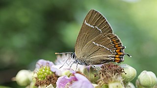
The white-letter hairstreak is a butterfly in the family Lycaenidae.

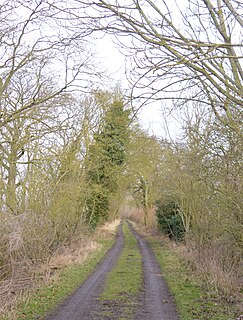
There is access from Raveley Road, which runs west from the hamlet of Great Raveley.

Related Research Articles

Brampton Wood nature reserve in the United Kingdom

Brampton Wood is a 132.1 hectare biological Site of Special Scientific Interest in Cambridgeshire. The site is west of Brampton in Cambridgeshire. It is managed by the Wildlife Trust for Bedfordshire, Cambridgeshire and Northamptonshire.

Cut-throat Meadow nature reserve in the United Kingdom

Cut-throat Meadow is a 1.5 hectare nature reserve in Ampthill in Bedfordshire. It is managed by the Wildlife Trust for Bedfordshire, Cambridgeshire and Northamptonshire.

Flitwick Moor nature reserve in the United Kingdom

Flitwick Moor is a 59.8 hectare biological Site of Special Scientific Interest between Flitwick and Greenfield in Bedfordshire. It was notified under Section 28 of the Wildlife and Countryside Act 1981 in 1984 and the local planning authority is Central Bedfordshire Council. The site is managed by the Wildlife Trust for Bedfordshire, Cambridgeshire and Northamptonshire.

Buff Wood nature reserve in the United Kingdom

Buff Wood is a 15.8 hectare biological Site of Special Scientific Interest in Hatley in Cambridgeshire. It is managed by the Wildlife Trust for Bedfordshire, Cambridgeshire and Northamptonshire.

Doghouse Grove nature reserve in the United Kingdom

Doghouse Grove is a 0.8 hectare nature reserve in Wilburton in Cambridgeshire. It is managed by the Wildlife Trust for Bedfordshire, Cambridgeshire and Northamptonshire.

Gamlingay Wood nature reserve in the United Kingdom

Gamlingay Wood is a 48.4 hectare biological Site of Special Scientific Interest (SSSI) north of Gamlingay in Cambridgeshire. It is managed by the Wildlife Trust for Bedfordshire, Cambridgeshire and Northamptonshire.

Gamsey Wood nature reserve in the United Kingdom

Gamsey Wood is a 4 hectare nature reserve north-east of Woodwalton in Cambridgeshire. It is managed by the Wildlife Trust for Bedfordshire, Cambridgeshire and Northamptonshire.

Hayley Wood nature reserve in the United Kingdom

Hayley Wood is a 51.7 hectare biological Site of Special Scientific Interest south-east of Great Gransden in Cambridgeshire. It is a Nature Conservation Review site, Grade 1, and it is managed by the Wildlife Trust for Bedfordshire, Cambridgeshire and Northamptonshire.

Ladys Wood nature reserve in the United Kingdom

Lady's Wood is a 7.1 hectare nature reserve west of Upwood in Cambridgeshire. It is managed by the Wildlife Trust for Bedfordshire, Cambridgeshire and Northamptonshire.

Shepherds Close nature reserve in the United Kingdom

Shepherd's Close is a 1.2 hectare nature reserve south of Spaldwick in Cambridgeshire. It is managed by the Wildlife Trust for Bedfordshire, Cambridgeshire and Northamptonshire.

Thorpe Wood nature reserve in the United Kingdom

Thorpe Wood is a 10 hectare nature reserve on the western outskirts of Peterborough in Cambridgeshire. It is managed by the Wildlife Trust for Bedfordshire, Cambridgeshire and Northamptonshire.

Warboys and Wistow Woods nature reserve in the United Kingdom

Warboys and Wistow Woods is a 44.5 hectare biological Site of Special Scientific Interest north of Warboys and west of Wistow in Cambridgeshire. Wistow Wood is an 8.5 hectare nature reserve owned and managed by the Wildlife Trust for Bedfordshire, Cambridgeshire and Northamptonshire.

Stoke and Bowd Lane Woods

Stoke and Bowd Lane Woods is a 36.4 hectare biological Site of Special Scientific Interest west of Corby in Northamptonshire. The eastern half of Stoke Wood is managed by the Woodland Trust, a triangular area of 0.7 hectares which stretches south from the middle is the Stoke Wood End Quarter, a nature reserve managed by the Wildlife Trust for Bedfordshire, Cambridgeshire and Northamptonshire, and the remaining western part of the wood is private property. Bowd Lane Wood is private property.

Kings Wood, Corby nature reserve in the United Kingdom

King's Wood is a 31.7 hectare Local Nature Reserve in Corby in Northamptonshire. It managed by the Wildlife Trust for Bedfordshire, Cambridgeshire and Northamptonshire.

Stoke Wood End Quarter nature reserve in the United Kingdom

Stoke Wood End Quarter is a 0.7 hectare nature reserve west of Corby in Northamptonshire. It is managed by the Wildlife Trust for Bedfordshire, Cambridgeshire and Northamptonshire, and is part of the Stoke and Bowd Lane Woods Site of Special Scientific Interest.

Barford Wood and Meadows nature reserve in the United Kingdom

Barford Wood and Meadows or Barford Meadow Nature Reserve is a 36 hectare nature reserve east of Rushton in Northamptonshire. It is managed by the Wildlife Trust for Bedfordshire, Cambridgeshire and Northamptonshire. The north-eastern end is part of the River Ise and Meadows Site of Special Scientific Interest.

Byfield Pool nature reserve in the United Kingdom

Byfield Pool is a 4 hectare nature reserve west of Byfield in Northamptonshire. It is managed by the Wildlife Trust for Bedfordshire, Cambridgeshire and Northamptonshire.

Harlestone Heath nature reserve in the United Kingdom

Harlestone Heath is a 2.6 hectare nature reserve north-west of Northampton in Northamptonshire. It is managed by the Wildlife Trust for Bedfordshire, Cambridgeshire and Northamptonshire.

Stoke Bruerne Brick Pits nature reserve in the United Kingdom

Stoke Bruerne Brick Pits is a six hectare nature reserve in Stoke Bruerne in Northamptonshire. It is managed by the Wildlife Trust for Bedfordshire, Cambridgeshire and Northamptonshire.

Short Wood and Southwick Wood nature reserve in the United Kingdom

Short Wood and Southwick Wood is a 54.7 hectare nature reserve north-west of Oundle in Northamptonshire. It is managed by the Wildlife Trust for Bedfordshire, Cambridgeshire and Northamptonshire. Short Wood is a 25.3 hectare biological Site of Special Scientific Interest.

References

  1. 1 2 "Raveley Wood". Wildlife Trust for Bedfordshire, Cambridgeshire and Northamptonshire. Retrieved 21 November 2016.

Coordinates: 52°25′08″N0°10′19″W / 52.419°N 0.172°W / 52.419; -0.172

Geographic coordinate system Coordinate system

A geographic coordinate system is a coordinate system that enables every location on Earth to be specified by a set of numbers, letters or symbols. The coordinates are often chosen such that one of the numbers represents a vertical position and two or three of the numbers represent a horizontal position; alternatively, a geographic position may be expressed in a combined three-dimensional Cartesian vector. A common choice of coordinates is latitude, longitude and elevation. To specify a location on a plane requires a map projection.