Barton Gravel Pit is a 1.1 hectare nature reserve east of Barton-le-Clay in Bedfordshire. It is managed by the Wildlife Trust for Bedfordshire, Cambridgeshire and Northamptonshire.
Cut-throat Meadow is a 1.5 hectare nature reserve in Ampthill in Bedfordshire. It is managed by the Wildlife Trust for Bedfordshire, Cambridgeshire and Northamptonshire.
Flitwick Moor is a 59.8 hectare biological Site of Special Scientific Interest between Flitwick and Greenfield in Bedfordshire. It was notified under Section 28 of the Wildlife and Countryside Act 1981 in 1984 and the local planning authority is Central Bedfordshire Council. The site is managed by the Wildlife Trust for Bedfordshire, Cambridgeshire and Northamptonshire.

Lancot Meadow is a 2 hectare nature reserve in western Dunstable in Bedfordshire. It is managed by the Wildlife Trust for Bedfordshire, Cambridgeshire and Northamptonshire.
Sallowsprings is a 1.3 hectare nature reserve in Whipsnade in Bedfordshire. It is managed by the Wildlife Trust for Bedfordshire, Cambridgeshire and Northamptonshire.
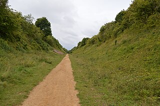
Sewell Cutting is a 3.6 hectare nature reserve at Sewell in Houghton Regis in Bedfordshire. It is owned by Central Bedfordshire Council and managed by the Wildlife Trust for Bedfordshire, Cambridgeshire and Northamptonshire.

Buff Wood is a 15.8 hectare biological Site of Special Scientific Interest in Hatley in Cambridgeshire. It is managed by the Wildlife Trust for Bedfordshire, Cambridgeshire and Northamptonshire.

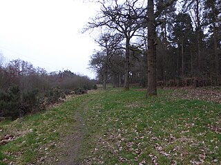
Gamlingay Wood is a 48.4 hectare biological Site of Special Scientific Interest (SSSI) north of Gamlingay in Cambridgeshire. It is managed by the Wildlife Trust for Bedfordshire, Cambridgeshire and Northamptonshire.

Gamsey Wood is a 4 hectare nature reserve north-east of Woodwalton in Cambridgeshire. It is managed by the Wildlife Trust for Bedfordshire, Cambridgeshire and Northamptonshire.
Hayley Wood is a 51.7 hectare biological Site of Special Scientific Interest south-east of Great Gransden in Cambridgeshire. It is a Nature Conservation Review site, Grade 1, and it is managed by the Wildlife Trust for Bedfordshire, Cambridgeshire and Northamptonshire.

Lady's Wood is a 7.1 hectare nature reserve west of Upwood in Cambridgeshire. It is managed by the Wildlife Trust for Bedfordshire, Cambridgeshire and Northamptonshire.

Raveley Wood is a 5.6 hectare nature reserve south-west of Upwood in Cambridgeshire. It is managed by the Wildlife Trust for Bedfordshire, Cambridgeshire and Northamptonshire.

Shepherd's Close is a 1.2 hectare nature reserve south of Spaldwick in Cambridgeshire. It is managed by the Wildlife Trust for Bedfordshire, Cambridgeshire and Northamptonshire.
Thorpe Wood is a 10 hectare nature reserve on the western outskirts of Peterborough in Cambridgeshire. It is managed by the Wildlife Trust for Bedfordshire, Cambridgeshire and Northamptonshire.

Kings and Bakers Woods and Heaths is a 212.8 hectare Site of Special Scientific Interest (SSSI) between Heath and Reach in Bedfordshire and Great Brickhill in Buckinghamshire. The site is mainly in Bedfordshire but includes Rammamere Heath in Buckinghamshire. It was notified in 1984 under Section 28 of the Wildlife and Countryside Act 1981, and the local planning authorities are Central Bedfordshire Council and Aylesbury Vale Council. Part of it is a National Nature Reserve, and part of it is a nature reserve managed by the Wildlife Trust for Bedfordshire, Cambridgeshire and Northamptonshire. it is also a Nature Conservation Review site.
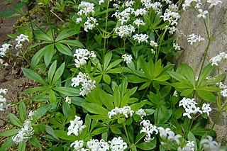
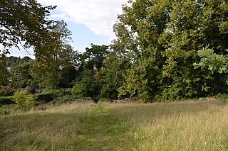
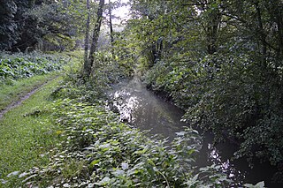
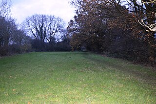
Fancott Woods and Meadows is a 13.3 hectare Site of Special Scientific Interest near the hamlet of Fancott in Bedfordshire. It was notified under Section 28 of the Wildlife and Countryside Act 1981, and the local planning authority is Central Bedfordshire Council. The site is managed by the Wildlife Trust for Bedfordshire, Cambridgeshire and Northamptonshire.

Stoke Wood End Quarter is a 0.7 hectare nature reserve west of Corby in Northamptonshire. It is managed by the Wildlife Trust for Bedfordshire, Cambridgeshire and Northamptonshire, and is part of the Stoke and Bowd Lane Woods Site of Special Scientific Interest.

Barford Wood and Meadows or Barford Meadow Nature Reserve is a 36 hectare nature reserve east of Rushton in Northamptonshire. It is managed by the Wildlife Trust for Bedfordshire, Cambridgeshire and Northamptonshire. The north-eastern end is part of the River Ise and Meadows Site of Special Scientific Interest.
Harlestone Heath is a 2.6 hectare nature reserve north-west of Northampton in Northamptonshire. It is managed by the Wildlife Trust for Bedfordshire, Cambridgeshire and Northamptonshire.