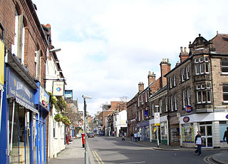
Ripley is a market and industrial town as well as a civil parish in the Amber Valley district of the ceremonial county of Derbyshire, England. It is located to the north-northeast of Derby, northwest of Heanor, southwest of Alfreton and northeast of Belper. The town forms a continuous urban area with Heanor, Eastwood and Ilkeston as part of the wider Nottingham Urban Area.

Amber Valley is a local government district with borough status in the east of Derbyshire, England, taking its name from the River Amber. Its council is based in Ripley. The district covers a semi-rural area lying to the north of the city of Derby. The district contains four main towns whose economy was based on coal mining and remains to some extent influenced by engineering, distribution and manufacturing, holding for instance the headquarters and production site of Thorntons confectionery.

Alfreton is a town and civil parish in the Amber Valley district of Derbyshire, England. The town was formerly a Norman Manor and later an Urban District. The population of the Alfreton parish was 8,799 at the 2021 Census. The villages of Ironville, Riddings, Somercotes and Swanwick were historically part of the Manor and Urban District, and the population including these was 24,476 in 2001.
Belper is a town and civil parish in the local government district of Amber Valley in Derbyshire, England, located about 7 miles (11 km) north of Derby on the River Derwent. Along with Belper, the parish includes the village of Milford and the hamlets of Bargate, Blackbrook, and Makeney.

Heanor (/ˈhiːnə/) is a town in the Amber Valley district of Derbyshire, England. It lies 8 miles (13 km) north-east of Derby and forms, with the adjacent village of Loscoe, the civil parish and town council-administered area of Heanor and Loscoe, which had a population of 17,251 in the 2011 census.
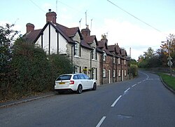
Heage is a village and former civil parish, now in the parish of Ripley, in the Amber Valley district, in the county of Derbyshire, England. It is situated midway between Belper and Ripley. The village is in the Heage and Ambergate ward, which in the 2011 census had a population of 5,013.

West Hallam is a large village and civil parish close to Ilkeston in the county of Derbyshire in the East Midlands region of England. West Hallam has had its own parish council since 1894 and, since 1974, has been part of the Erewash borough. The population of the civil parish was 4,829 at the 2001 census reducing to 4,686 at the 2011 census.

Denby Pottery Company Ltd is a British manufacturer of pottery, named after the village of Denby in Derbyshire where it is based. It primarily sells hand-crafted stoneware tableware, kitchenware and serveware products including dinner sets, mugs and serving dishes, as well as a variety of glassware products and cast-iron cookware.

Alrewas is a village and civil parish in the Lichfield District of Staffordshire, England.

Dethick, Lea and Holloway is a civil parish, in the Amber Valley borough of the English county of Derbyshire. The population of the civil parish taken at the 2011 census was 1,027.

Ticknall is a small village and civil parish in South Derbyshire, England. The population of the civil parish at the 2011 Census was 642. Situated on the A514 road, close to Melbourne, it has three pubs, several small businesses, and a primary school. Two hundred years ago it was considerably larger and noisier with lime quarries, tramways and potteries. Coal was also dug close to the village. Close to the village is Calke Abbey, now a National Trust property.

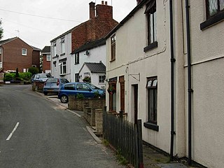
Codnor is a village and civil parish in the Amber Valley district of Derbyshire, England. Codnor is a former mining village and had a population of 3,766 taken at the 2011 Census. It is approximately 12 miles from Derby and 14 miles from Nottingham. Codnor forms a built up area with nearby Ripley.

Swarkestone is a village and civil parish in the South Derbyshire district of Derbyshire, England. The population at the 2011 Census was 187.

Kilburn is a village and civil parish in the English county of Derbyshire, known as Kilbourne until around 100 years ago. The population of the civil parish taken at the 2011 Census was 3,618.

Ockbrook is a village in the Erewash district, in the county of Derbyshire, England. It is almost contiguous with the village of Borrowash, the two only separated by the A52. The civil parish is Ockbrook and Borrowash. The population of this civil parish at the 2011 Census was 7,335. Ockbrook lies about 5 miles (8.0 km) east of Derby.

Breadsall is a village and civil parish in the Borough of Erewash in Derbyshire, England. The population of the village at the 2021 census was 792 Breadsall Priory is one of the oldest buildings in the village. The village is almost contiguous with both Derby to the south and southeast and Little Eaton to the north.

Little Eaton is a village and civil parish in the borough of Erewash, Derbyshire, England. The population as taken at the 2011 Census was 2,430. The name originated from Anglo Saxon times and means the "little town by the water".

Holbrook is a village in Derbyshire at the southern end of the Pennines around five miles north of Derby, England. The population of the civil parish at the 2011 census was 1,538.

Smalley is a village on the main A608 Heanor to Derby road in Derbyshire in the East Midlands of England. The population of the civil parish as of the 2011 census was 2,784.

Stanton by Dale, also written as Stanton-by-Dale, is a village and civil parish in the south east of Derbyshire, England. According to the University of Nottingham English Place-names project, the settlement name Stanton-by-Dale could mean 'Stony farm or settlement', stān for stone or rock; and tūn for an enclosure; farmstead; village; or an estate. It lies 2.65 miles (4.26 km) south of Ilkeston and 1.31 miles (2.11 km) north of Sandiacre. Since 1974 it has been part of the Erewash borough. The village is halfway between the cities of Derby 6.98 miles (11.23 km) and Nottingham 6.81 miles (10.96 km), as the crow flies, from each city. The population of the civil parish at the 2011 census was 505.