Related Research Articles

Cochrane is a town in the Canadian province of Alberta. The town is located 18 km (11 mi) west of the Calgary city limits along Highway 1A. Cochrane is one of the fastest growing communities in Canada, and with a population of 34,467 in 2021, it is one of the largest towns in Alberta. It is part of Calgary's census metropolitan area and a member community of the Calgary Metropolitan Region Board (CMRB). The town is surrounded by Rocky View County.

Fairview is a town in northern Alberta within the heart of the Peace Country. It is located 82 km (51 mi) southwest of the Town of Peace River and 115 km (71 mi) north of Grande Prairie at the intersection of Highway 2 and Highway 64A.

Manning is a town in northern Alberta, Canada. It is known as the "Land of the Mighty Moose". It is located on Highway 35 on the Notikewin River, approximately 73 km (45 mi) north of Peace River.

Whitecourt is a town in central Alberta, Canada within Woodlands County. It is located approximately 177 km (110 mi) northwest of Edmonton and 279 km (173 mi) southeast of Grande Prairie at the junction of Highway 43 and Highway 32, and has an elevation of 690 m (2,260 ft). The Whitecourt meteor impact crater is found on nearby Whitecourt Mountain.

Sexsmith is a town in northern Alberta, Canada. It is located on Highway 2, 20 kilometres (12 mi) north of the City of Grande Prairie.
Carstairs is a town in central Alberta, Canada. It is located on Highway 2A, 241 kilometres (150 mi) south of the provincial capital, Edmonton, and 48 kilometres (30 mi) north of Calgary, the nearest major city. The closest neighbouring communities are the towns of Didsbury and Crossfield. Carstairs is located entirely within the rural Mountain View County.

The County of Grande Prairie No. 1 is a municipal district in northwestern Alberta, Canada in Census Division No. 19.

Athabasca County is a municipal district in north central Alberta, Canada. It is located northeast of Edmonton and is in Census Division No. 13. Prior to an official renaming on December 1, 2009, Athabasca County was officially known as the County of Athabasca No. 12.
High River is a town within the Calgary Metropolitan Region of Alberta, Canada with a population of 13,584 (2016). It is 67.7 kilometres (42.1 mi) south of the City of Calgary, at the junction of Alberta Highways 2 and 23. High River is located approximately 54 km (34 mi) south of downtown Calgary.

High Prairie is a town in northern Alberta, Canada within Big Lakes County. It is located at the junction of Highway 2 and Highway 749, approximately 89 km (55 mi) northeast of Valleyview and 118 km (73 mi) west of Slave Lake.

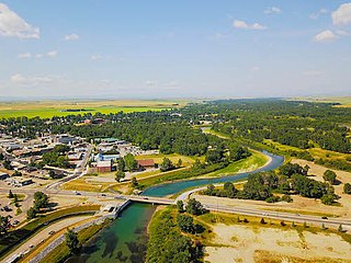
Grimshaw is a town in northern Alberta located 25 km (16 mi) west of the town of Peace River at the junction of Highway 35, Highway 2, and bypass Highway 2A, and the Mackenzie Northern Railway. By virtue of being the original starting point of Highway 35, which leads to the Northwest Territories, Grimshaw is referred to as Mile Zero of the Mackenzie Highway.

Berwyn is a village in northwestern Alberta, Canada. It is located approximately 37 km (23 mi) west of the Town of Peace River, 10 km (6.2 mi) southwest of the Town of Grimshaw, and 15 km (9.3 mi) northeast of the Duncan's First Nation reserve.

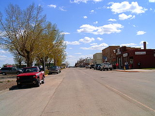
Hines Creek is a village in northern Alberta, Canada. It is located 67 km west of Grimshaw and 28 km north of Fairview, along Highway 64.

The County of Forty Mile No. 8 is a municipal district in south eastern Alberta, Canada. It is located in Census Division 1, southwest of Medicine Hat. Its municipal office is located in the Village of Foremost.

The Municipal District of Lesser Slave River No. 124 is a municipal district (MD) in north-central Alberta, Canada. Its municipal office is located in the Town of Slave Lake. Located in Census Division 17, the MD takes its name from Lesser Slave River, which drains Lesser Slave Lake into the Athabasca River.

Mackenzie County is a specialized municipality in northern Alberta, Canada. It is located in Census Division 17, along the Mackenzie Highway. Incorporated as a municipal district in 1995 from the former Improvement District No. 23., its status was changed to specialized municipality in 1999 to address the particularities of managing such a large territory, which is 10% larger than New Brunswick. Mackenzie County municipal office is located in the Hamlet of Fort Vermilion. The name was changed from the Municipal District of Mackenzie No. 23 to Mackenzie County in 2007.

The Municipal District of Smoky River No. 130 is a municipal district (MD) in northwestern Alberta, Canada. Located in Census Division No. 19, its municipal office is located in the Town of Falher.

The Municipal District of Spirit River No. 133 is a municipal district (MD) in northwest Alberta, Canada, north of Grande Prairie. Located in the Upper Peace Region, its municipal office is located in the Town of Spirit River. With an area of 683.6 km2 (263.9 sq mi), it is the smallest municipal district in Alberta.
Division No. 4, Subd. D is an unorganized subdivision on the island of Newfoundland in Newfoundland and Labrador, Canada. It is in Division No. 4. According to the 2016 Statistics Canada Census:
Division No. 3, Newfoundland and Labrador is a census division in the Canadian province of Newfoundland and Labrador, primarily comprising the South Coast of the island of Newfoundland. Like all census divisions in Newfoundland and Labrador, but unlike the census divisions of some other provinces, the division exists only as a statistical division for census data, and is not a political entity.
References
- ↑ "Data Table for Division No. 3, Subd. F" (HTML). 2016 Community Profiles. Statistics Canada. 2019-08-09. Retrieved 2021-08-22.
- ↑ "Standard Geographical Classification (SGC) 1996" (HTML). Statistics Canada. 2016-09-21. Retrieved 2021-08-22.
Places adjacent to Division No. 3, Subdivision F, Newfoundland and Labrador | ||||||||||
|---|---|---|---|---|---|---|---|---|---|---|
| ||||||||||
| | This Newfoundland and Labrador location article is a stub. You can help Wikipedia by expanding it. |