
Greenwood is a village in McHenry County, Illinois, United States. It is a commuter village, part of the Chicago metropolitan area It was incorporated as a village on 4 April 1995. The population was 255 at the 2010 census.

Sosnówka is a village in the administrative district of Gmina Kłoczew, within Ryki County, Lublin Voivodeship, in eastern Poland. It lies approximately 13 kilometres (8 mi) north of Ryki and 69 km (43 mi) north-west of the regional capital Lublin.
The canton of Barcelonnette is an administrative division in southeastern France. At the French canton reorganisation which came into effect in March 2015, the canton was expanded from 11 to 16 communes :
Krobonosz-Kolonia is a village in the administrative district of Gmina Sawin, within Chełm County, Lublin Voivodeship, in eastern Poland.
Kawka is a village in the administrative district of Gmina Niemce, within Lublin County, Lublin Voivodeship, in eastern Poland. It lies approximately 12 kilometres (7 mi) west of Niemce and 17 km (11 mi) north-west of the regional capital Lublin.
Nowinka is a village in the administrative district of Gmina Sokółka, within Sokółka County, Podlaskie Voivodeship, in north-eastern Poland, close to the border with Belarus.

Barum is a village in the Shamkir Rayon of Azerbaijan.
Komorniki is a village in the administrative district of Gmina Kluczewsko, within Włoszczowa County, Świętokrzyskie Voivodeship, in south-central Poland. It lies approximately 5 kilometres (3 mi) east of Kluczewsko, 10 km (6 mi) north of Włoszczowa, and 46 km (29 mi) west of the regional capital Kielce.
Sochocino-Czyżewo is a village in the administrative district of Gmina Bulkowo, within Płock County, Masovian Voivodeship, in east-central Poland. It lies approximately 20 kilometres (12 mi) east of Płock and 80 km (50 mi) north-west of Warsaw.
Stanisławów is a village in the administrative district of Gmina Zagórów, within Słupca County, Greater Poland Voivodeship, in west-central Poland. It lies approximately 9 kilometres (6 mi) south-east of Zagórów, 23 km (14 mi) south of Słupca, and 80 km (50 mi) south-east of the regional capital Poznań.
Asuny is a village in the administrative district of Gmina Barciany, within Kętrzyn County, Warmian-Masurian Voivodeship, in northern Poland, close to the border with the Kaliningrad Oblast of Russia. It lies approximately 12 kilometres (7 mi) north of Barciany, 27 km (17 mi) north of Kętrzyn, and 84 km (52 mi) north-east of the regional capital Olsztyn.
Kępa Kalnicka is a village in the administrative district of Gmina Morąg, within Ostróda County, Warmian-Masurian Voivodeship, in northern Poland. It lies approximately 10 kilometres (6 mi) north-west of Morąg, 33 km (21 mi) north of Ostróda, and 49 km (30 mi) north-west of the regional capital Olsztyn.
Jezierzyce is a village in the administrative district of Gmina Myślibórz, within Myślibórz County, West Pomeranian Voivodeship, in north-western Poland. It lies approximately 7 kilometres (4 mi) north-west of Myślibórz and 51 km (32 mi) south of the regional capital Szczecin.

Donja Lokošnica is a village in the municipality of Leskovac, Serbia. According to the 2002 census, the village has a population of 1060 people.

Navalin is a village in the municipality of Leskovac, Serbia. According to the 2002 census, the village has a population of 898 people.
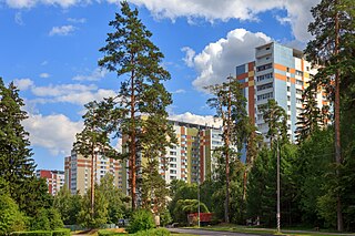
Staroye Kryukovo is a district of Moscow within Zelenogradsky Administrative Okrug.
Baileys is an unincorporated community in Gloucester County, in the U. S. state of Virginia.
Tabanovac is a village situated in Petrovac na Mlavi municipality in Serbia.
San Pasqual, the Kumeyaay pueblo, in San Diego County, California, that was once located in the San Pasqual Valley and for which the valley is named.
Putinci railway station is a railway station on Belgrade–Šid railway. Located in Putinci, Ruma, Serbia. Railroad continued to Ruma in one and the other direction to Golubinci. Putinci railway station consists of 5 railway track.
