East Berbice-Corentyne Region 6 | |
|---|---|
Administrative Region | |
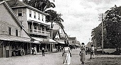 Strand, New Amsterdam (before 1900) | |
 Flag | |
 Map of Guyana showing East Berbice-Corentyne region | |
| Country | Guyana |
| Regional Capital | New Amsterdam |
| Area | |
• Total | 36,234 km2 (13,990 sq mi) |
| Population (2022 census) | |
• Total | 114,574 |
| • Density | 3.1621/km2 (8.1897/sq mi) |
| [1] | |
East Berbice-Corentyne (Region 6) is one of ten regions in Guyana covering the whole of the east of the country. It borders the Atlantic Ocean to the north, the Nickerie District and Sipaliwini District of Suriname to the east, Brazil to the south and the regions of Mahaica-Berbice, Upper Demerara-Berbice, Potaro-Siparuni and Upper Takutu-Upper Essequibo to the west.
Contents
Towns in the region include New Amsterdam, Corriverton and Rose Hall.
The Corentyne River forms the whole of the eastern border with Suriname, though the southernmost section is claimed by Suriname and is known in Guyana as the New River Triangle or Tigri Area in Suriname.