Related Research Articles

Islam is the third largest religion in Guyana, after Christianity and Hinduism, respectively. According to the 2012 census, 7% of the country’s population is Muslim. However, a Pew Research survey from 2010 estimates that 6.4% of the country is Muslim. Islam was first introduced to Guyana via enslaved people from West Africa, but was suppressed on plantations until Muslims from British India were brought to the country as indentured labour. The current President of Guyana, Mohamed Irfaan Ali is the first Muslim president.

Lethem is a town in Guyana, located in the Upper Takutu-Upper Essequibo region. It is the regional capital of Upper Takutu-Upper Essequibo.

Linden is the second largest city in Guyana after Georgetown, and capital of the Upper Demerara-Berbice region, located at 6°0′0″N58°18′0″W, altitude 48 m (160 ft). It was declared a town in 1970, and includes the communities of MacKenzie, Christianburg, and Wismar. It lies on the Demerara River and has a population of 27,277 as of 2012. It is primarily a bauxite mining town, containing many mines 60–90 m deep, with many other pits now in disuse.

East Berbice-Corentyne is one of ten regions in Guyana covering the whole of the east of the country. It borders the Atlantic Ocean to the north, the Nickerie District and Sipaliwini District of Suriname to the east, Brazil to the south and the regions of Mahaica-Berbice, Upper Demerara-Berbice, Potaro-Siparuni and Upper Takutu-Upper Essequibo to the west.

Mahaica-Berbice is a region of Guyana, bordering the Atlantic Ocean to the north, the region of East Berbice-Corentyne to the east, the region of Upper Demerara-Berbice to the south and the region of Demerara-Mahaica to the west.
Demerara-Mahaica is a region of Guyana, bordering the Atlantic Ocean to the north, the region of Mahaica-Berbice to the east, the region of Upper Demerara-Berbice to the south and the region of Essequibo Islands-West Demerara to the west.

Afro-Guyanese are generally descended from the enslaved people brought to Guyana from the coast of West Africa to work on sugar plantations during the era of the Atlantic slave trade. Coming from a wide array of backgrounds and enduring conditions that severely constrained their ability to preserve their respective cultural traditions contributed to the adoption of Christianity and the values of British colonists.

The Canje River, located in northeastern Guyana, is the main tributary of the Berbice River. It runs roughly parallel to the Atlantic Ocean coast in East Berbice-Corentyne, region 6.
The Torani Canal in northeastern Guyana serves to move water from the Berbice River into the Canje River. It was to serve as irrigation for the sugar industry, and subsequently the rice industry.
Mission Chapel, a Congregational Church, was built around 1814 in New Amsterdam, Berbice, Guyana. Mission Chapel is located at 12 Chapel Street, New Amsterdam, Berbice.
Crabwood Creek is a small community on the Corentyne River in the East Berbice–Corentyne region of Guyana. The population of 4,459 people as of 2012 and primarily Indo-Guyanese.
Orealla is an Indigenous community in the East Berbice-Corentyne Region of Guyana, on the Courantyne River, approximately 33 miles (53 km) south of Crabwood Creek and 11 miles (18 km) north of Epira, located at 5°17′50″N57°20′50″W, altitude 11 metres. 15 miles (24 km) south-east on the other side of the Courantyne River lies the Surinamese village of Apoera. Orealla is an indigenous village.
Abary is a small community in the Mahaica-Berbice Region of Guyana, near the mouth of the Abary River, 43 miles (69 km) from Georgetown. Abary is known for the Abary Bridge located on the Main Highway. The bridge was originally a railway bridge with a very steep grade. The bridge was designed by Joseph Walter Holder who also built the Demerara Harbour Bridge.

Caribbean Hindustani is an Indo-Aryan language spoken by Indo-Caribbean people and the Indo-Caribbean diaspora. It is a koiné language mainly based on the Bhojpuri and Awadhi dialects. These Hindustani dialects were the most spoken dialects by the Indians who came as immigrants to the Caribbean from Colonial India as indentured laborers. It is closely related to Fiji Hindi and the Bhojpuri-Hindustani spoken in Mauritius and South Africa.
Port Mourant is a town on the Atlantic coast in East Berbice-Corentyne, Guyana. It is the birthplace of the late president Cheddi Jagan as well as many of Guyana's most famous cricketers. Port Mourant was originally a sugar estate. Many residents are self-employed, but the sugar industry continues to be a source of employment.

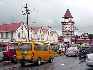
Guyana, officially the Co-operative Republic of Guyana, is a country on the northern coast of South America, part of the historic mainland British West Indies. Georgetown is the capital of Guyana and is also the country's largest city. Guyana is bordered by the Atlantic Ocean to the north, Brazil to the south and southwest, Venezuela to the west, and Suriname to the east. With a land area of 214,969 km2 (83,000 sq mi), Guyana is the third-smallest sovereign state by area in mainland South America after Uruguay and Suriname, and is the second-least populous sovereign state in South America after Suriname; it is also one of the least densely populated countries on Earth. The official language of the country is English, although a large part of the population is bilingual in English and the indigenous languages. It has a wide variety of natural habitats and very high biodiversity. The country also hosts a part of the Amazon rainforest, the largest tropical rainforest in the world.

Rockstone is a village on the right bank of the Essequibo River in the Upper Demerara-Berbice Region of Guyana, altitude 6 metres. Rockstone is approximately 26 km west of Linden and is linked by road.
Albion is a village in East Berbice-Corentyne, Guyana.

The Tigri Area or New River Triangle is a forested area in the East Berbice-Corentyne region of Guyana that has been disputed by Suriname since the 19th century. In Suriname, it is seen as an integral part of the Coeroeni Resort located in the Sipaliwini District.
Fort Wellington is a village located in the Mahaica-Berbice region of Guyana, serving as its regional capital.
References
- ↑ "Bush Lot: A village with resilient old world aura; great ethnic harmony". Guyana Chronicle. Retrieved 2021-02-14.
- 1 2 3 "Publications – Bureau of Statistics – Guyana" . Retrieved 2021-02-14.
- ↑ "Schoolchildren, cops attacked as Berbice protests over elections turn violent". Stabroek News. 2020-03-07. Retrieved 2021-02-14.
- ↑ "THE PLEASANT SURPRISE THAT IS BUSH LOT VILLAGE, WCB". Guyana Chronicle. Retrieved 2021-02-14.
- ↑ "Race Courses | Welcome | Guyana Horse Racing". guyanahorseracing.com. Retrieved 2021-02-14.
| | This Guyana location article is a stub. You can help Wikipedia by expanding it. |