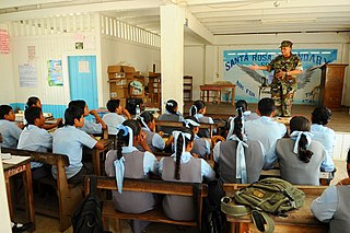
Barima-Waini is a region of Guyana and is located in the northwest of the country. Barima-Waini has three sub-regions: Mabaruma, Matakai, and Moruca.

Port Kaituma is a small village within the Barima-Waini administrative region of Guyana. It became known internationally as a gateway village to the Peoples Temple settlement in nearby Jonestown. It has long been a hub for mining in the area.

Mabaruma is the administrative centre and regional capital for Region One (Barima-Waini) of Guyana. It is located close to the Aruka River on a narrow plateau above the surrounding rainforest at an elevation of 13 metres.

Santa Rosa is a community in the Barima-Waini region of northern Guyana. Santa Rosa mission was established in 1840, and is one of the earliest Catholic Missions in Guyana. The village is part of the North West Amerindian District.
Kwebanna is an Amerindian village in Barima-Waini region, in the north of Guyana. Kwebanna is connected by road to Kumaka, Barima-Waini.
Assakata or Asakata is a village in Barima-Waini region, in the north of Guyana. Assakata is an Amerindian village inhabited by Warao and Arawak people, located in the swamps and marshes between the Barima and Pomeroon River.
Baramita, is a community in the Barima-Waini region of northern Guyana, standing about 20 miles west of Matthew's Ridge, at an altitude of 99 metres.
Hosororo is a community in the Barima-Waini region of northern Guyana, on the west bank of the Aruka River, 10 km (6.2 mi) from the river's mouth, and three miles from Mabaruma.
Arakaka is a community in the Barima-Waini region of Guyana, standing on the Barima River and 12 miles southerly of Port Kaituma, at an altitude of 63 metres (209 feet).
Baracara was founded as a maroon community in the East Berbice-Corentyne Region of Guyana, located on the Canje River. The community has also been called New Ground Village or Wel te Vreeden. Baracara is 20 miles west of Corriverton and just north of the Torani Canal's connection to the Canje River.
Koriabo is a community in the Barima-Waini region of Guyana, standing at an altitude of 36 metres. Barima and Koriba form an Amerindian community which is mainly inhabited by Warao people with a minority of Arawak and Kalina people.
Port Kaituma Community School (PKCS) is a learning centre in Port Kaituma within the Barima-Waini administrative region of Guyana.
Jean La Rose is an Arawak environmentalist and indigenous rights activist in Guyana. She was awarded the Goldman Environmental Prize in 2002 for her work to halt mining in their territories, to secure inhabitants full rights to traditional lands, and to save Guyana's forests.
The Barama River is a tributary of the Waini River, both being in the Barima-Waini administrative region of Guyana.
The Kaituma River is a river of Guyana in the Barima-Waini region. The mouth is at the upper Barima River, and the area is made up of mostly mangrove swamps.
Morawhanna is a small Atlantic coast village in Guyana, on the left side of the Barima River and in close proximity to Venezuela.
Issano is a village of Cuyuni-Mazaruni, Guyana. It's located along the Mazaruni River, and is a hub for mining.
Isseneru is an Amerindian settlement in the Cuyuni-Mazaruni region of Guyana, approximately 15–20 miles west of Kurupung.
Whitewater is a village in the Barima-Waini Region of Guyana. Whitewater is located close to the border with Venezuela and is inhabited by Warao Amerindians.


