Tuschen | |
|---|---|
Village | |
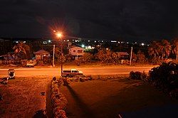 Tuschen at night | |
 Tuschen Location in Guyana | |
| Coordinates: 6°52′26″N58°20′49″W / 6.8739°N 58.3469°W | |
| Country | |
| Region | Essequibo Islands-West Demerara |
| Neighbourhood Council | Tuschen/Uitvlugt |
| Population (2012) [1] | |
• Total | 8,286 |
Tuschen is a village in the Essequibo Islands-West Demerara Region of Guyana. It is located along the Atlantic Ocean coast. The original name of the village was Tuschen de Vrienden (Dutch for between friends). [2] During the 20th century, it was a small village. The Tuschen Housing Scheme resulted in a considerable growth, [3] and is one of the largest housing schemes in Guyana. [4]