The transport sector comprises the physical infrastructure, docks and vehicle, terminals, fleets, ancillary equipment and service delivery of all the various modes of transport operating in Guyana. The transport services, transport agencies providing these services, the organizations and people who plan, build, maintain, and operate the system, and the policies that mold its development.

Essequibo Islands-West Demerara is a region of Guyana.

Pomeroon-Supenaam is a region of Guyana. Venezuela claims the territory as part of Guayana Esequiba.
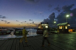
Parika is a port village located in the Essequibo Islands-West Demerara region of Guyana. Its ferry service is operated by the Ministry of Transportation, to and from the Essequibo Islands and West Demerara area. It is a hub for land transport, since it is a route stop for local taxis commonly called "buses."

Charity is a small township in Guyana, located in the Pomeroon-Supenaam Region No.2, which is part of the Essequibo County.
The Railways of Guyana comprised two public railways, the Demerara-Berbice Railway and the Demerara-Essequibo railway. There are also several industrial railways mainly for the bauxite industry. The Demerara-Berbice Railway is the oldest in South America. None of the railways are in operation in the 21st century.
Adventure is a village located in the Pomeroon-Supenaam Region of Guyana, on the Atlantic coast, at sea level, one mile south of Onderneeming.
Anna Regina is the capital of the Pomeroon-Supenaam Region of Guyana. Anna Regina stands on the Atlantic coast, northwest of the mouth of the Essequibo River, 19 km north of Adventure, and was established as a town in 1970. Its population was 2,064 in 2012.
Annandale is a village in the Pomeroon-Supenaam Region of Guyana, located on the Atlantic coast, a few kilometres northerly of the mouth of the Essequibo River. It was formerly a sugar plantation.

Leguan Island is a small island situated in the delta of the Essequibo River on the coast of Guyana, South America. The island is shaped like a gull wing and is nine miles (14 km) long and 2 miles (3.2 km) wide at its widest making it roughly 12 miles (19 km) square in area. When settlers first arrived on the island, they found many iguanas, hence the name Leguan Island.
Bethany Village is a mission located on the Araburia River, a tributary three miles up the Supenaam River in Pomeroon-Supenaam, Essequibo in Guyana.
St. Monica Karawab is a village in the Pomeroon-Supenaam region of Guyana. The village is an Amerindian village.
Spring Garden is a village in the region of Pomeroon-Supenaam of Guyana.
Onderneeming is a village in the Pomeroon-Supenaam region of Guyana. The village is located on the Atlantic coast. Its population was 1,095 in 2012.

Fort Island is an island in the Essequibo River located in the Essequibo Islands-West Demerara region of Guyana. It is about 16 kilometres (10 mi) from the mouth of the river, and to the east of Hogg Island. In 1687, a wooden fort was built on the island. In 1744, Fort Zeelandia was constructed and served as the capital of Essequibo, a Dutch colony which is nowadays part of Guyana. In 1752, the Court of Policy was built on the island as the legislative body for the colony.

Jacklow is a village in the Pomeroon-Supenaam Region of Guyana. The village is mainly inhabited by Indo-Guyanese and Amerindian people. Jacklow is situated on the Pomeroon River.
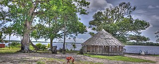
Capoey is a village in the Pomeroon-Supenaam Region of Guyana. The village is mainly inhabited by Lokono Amerindians. It is located on Lake Capoey, a blackwater lake, which is one of largest lakes of Essequibo.
Queenstown is a village in the Pomeroon-Supenaam Region of Guyana. It is located on the Atlantic Ocean coast. It is one of the first villages where the emancipated African slaves bought the lands. Queenstown is home to the oldest extant mosque of Guyana.

Lima Sands is a village in the Pomeroon-Supenaam Region of Guyana. It is located to the west of Anna Regina. The Cheddi Jagan Bio Diversity Park is in Lima Sands.

