Surama

Last updated
Surama
Amerindian village
Guyana location map.svg
Red pog.svg
Surama
Location in Guyana
Coordinates: 4°8′13″N59°4′6″W / 4.13694°N 59.06833°W / 4.13694; -59.06833 Coordinates: 4°8′13″N59°4′6″W / 4.13694°N 59.06833°W / 4.13694; -59.06833 [1]
Country Flag of Guyana.svg Guyana
Region Upper Takutu-Upper Essequibo
Founded1974
Founded byFred and Theo Allicock [2]
Government
  Senior CouncilorMichael Allicock (2012) [2]
Area
[2]
  Total10 km2 (5 sq mi)
Population
 (2012) [3]
  Total274
  Density21/km2 (55/sq mi)

Surama is an Amerindian village in the North Rupununi area and the Upper Takutu-Upper Essequibo Region of Guyana, with a population of 274 people as of 2012. [3]

Contents

The village is primarily inhabited by Makushi people. [4] [5] [6]

History

The area of land in which Surama is located has been inhabited sporadically for many years. An established cattle-trail ran through the area in the early twentieth century, and Surama was an important stopping-point on that trail. As the cattle-trail dwindled, however, so did the number of inhabitants in the area, and by the 1970s Surama was completely deserted. The modern village of Surama was founded in the 1974 [2] by two brothers, Fred and Theo Allicock. [7]

Eco-Tourism

Surama Eco-Lodge (2009) Surama Eco Lodge.jpg
Surama Eco-Lodge (2009)

Following the construction of the Linden-Lethem road in the mid to late 1970s, Surama and surrounding areas became more accessible to the general public. In 1996, Surama received its first tourists, and the money they gave the community to pay for their stay funded the construction of Surama's first guest-lodge. Since that time the village has become a leader in community-based, eco-tourism in Guyana. [7] In 2011, Surama Eco-Lodge was listed by the National Geographic as one of the "best hotels in Colombia, Guyana and Venezuela"; and in the same year it was the joint winner of the Caribbean Tourism Organisation Excellence in Sustainable Tourism Award, along with Harrison's Cave in Barbados. [8] [9]

Description and Location

Surama village extends across 12.95 squared kilometres (5 square miles) of land, and is located in a valley on the border of the Guyanese rainforest and the North Rupununi savannahs. It is bounded by Iwokrama Forest protected area, the Burro-Burro River, and the Pacaraima Mountains. Surama Mountain lies to the East of the village. [7]

Economy

Up until the mid-1990s, Surama's economy relied primarily on subsistence agriculture, with a minority of male villagers taking paid jobs as loggers or gold-miners in the North-West region of Guyana or across the border in Brazil. [7] Following the increasing success with eco-tourism, however, Surama Eco-Tourism now provides approximately 60% of Surama's income, with 75% of households deriving income from the tourist trade. [10]

Related Research Articles

Rupununi River in Guyana

The Rupununi is a region in the south-west of Guyana, bordering the Brazilian Amazon. The Rupununi river, also known by the local indigenous peoples as Raponani, flows through the Rupununi region. The name Rupununi originates from the word rapon in the Makushi language, in which it means the black-bellied whistling duck found along the river.

<span class="mw-page-title-main">Rupununi savannah</span>

The Rupununi savannah is a savanna plain in Guyana, in the Upper Takutu-Upper Essequibo region. It is part of the Guianan savanna ecoregion of the tropical and subtropical grasslands, savannas, and shrublands biome.

Macushi

The Macushi are an indigenous people living in the borderlands of southern Guyana, northern Brazil in the state of Roraima, and in an eastern part of Venezuela.

Apoteri is a village in the Upper Takutu-Upper Essequibo Region of Guyana, near the confluence of the Rupununi River with the Essequibo, at an altitude of 53 metres. Apoteri started to develop as the centre of the balatá industry. The population is mainly Amerindian of the Macushi and Wapishana people.

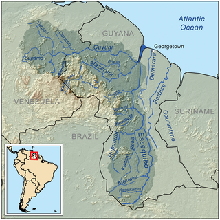
The Siparuni River is a river in the Potaro-Siparuni Region of Guyana. It is a tributary of the Essequibo River. Tributaries of the Siparuni River include the Takutu River, Burro-Burro River, Tipuru River and Levai Creek.

Dadanawa Ranch is located on the Rupununi River in the Rupununi savannah in the Upper Takutu-Upper Essequibo Region of Guyana. It is the largest and one of the most isolated cattle ranches in Guyana.

<span class="mw-page-title-main">Annai, Guyana</span> Place in Upper Takutu-Upper Essequibo, Guyana

Annai is an Amerindian village in the Upper Takutu-Upper Essequibo Region of Guyana.

Aishalton is an Amerindian village that is situated in the Rupununi savannah of southern Guyana, in the Upper Takutu-Upper Essequibo Region of the country.

The Burro-Burro River is a river of Guyana.

Wowetta is an indigenous village in the Upper Takutu-Upper Essequibo Region in Guyana. The village is mainly inhabited by Macushi people.

Karinambo Village in Upper Takutu-Upper Essequibo, Guyana

Karinambo is a village in Guyana. Charles Barrington Brown stayed in the Amerindian village near the Takutu Savanna in the 1870s.

Fairview (Kurupukari) is an indigenous settlement on the Essequibo River, in the Upper Demerara-Berbice region of Guyana. It is the entry point to the Iwokrama Forest. Former president David A. Granger once referred to Iwokrama as the "green heart of Guyana."

Sydney Allicock Guyanese politician

Sydney Charles Allicock was minister of Indigenous People's Affairs in Guyana from 2015-2020, and was vice-president of Guyana from 2015-2020.

Rewa is an Amerindian village in the Upper Takutu-Upper Essequibo region of Guyana.

Tourism in Guyana is a fledgling industry compared to other countries in the Caribbean. Tourism is mainly focused on ecotourism, and accommodations for business travelers. Guyana is home to Kaieteur Falls and St. George's Cathedral.

Yupukari Village in Upper Takutu-Upper Essequibo, Guyana

Yupukari is an indigenous village of Macushi and Wapishana Amerindians in the Upper Takutu-Upper Essequibo Region of Guyana. It is located between the Kanuku and Pakaraima Mountains along the Rupununi River.

St. Ignatius is an Amerindian village in the Upper Takutu-Upper Essequibo region of Guyana, near the regional capital Lethem and the border of Brazil. It was originally a mission founded by Jesuit priests to serve the Amerindians in the Rupununi savannah.

Katoonarib is a village in the Upper Takutu-Upper Essequibo Region of Guyana. Katoonarib is inhabited by Wapishana, Macushi and other Amerindians. It is located near the Rupununi River. The main language spoken in the village is Wapishana with English as secondary language.

Nappi is an indigenous village of Macushi Amerindians in the Upper Takutu-Upper Essequibo Region of Guyana. It is located in the Rupununi savannah along the Nappi and Maipaima creeks on the edge of the Kanuku Mountains.

Sawariwau is a village in the Upper Takutu-Upper Essequibo Region of Guyana. Sawariwau is inhabited by Wapishana Amerindians. It is located about 70 miles (110 km) south of Lethem in the Rupununi savannah. The main language spoken in the village is Wapishana.

References

  1. Guyana and the Guianas (Map) (2nd ed.). 1,200,000. Vancouver: ITMB:International Travel Maps. 2004. ISBN   978-1553412373.
  2. 1 2 3 4 "Surama". Ministry of Indigenous Peoples’ Affairs. Retrieved 18 August 2020.
  3. 1 2 "2012 Population by Village". Statistics Guyana. Retrieved 16 August 2020.
  4. Smock, Kirk (2009). Guyana: The Bradt Travel Guide . UK: Bradt Travel Guides. pp.  234. ISBN   9781841622231. surama guyana.
  5. Hammond, Richard (21 April 2007). "Clean break: Surama Village, Guyana". The Guardian. Retrieved 24 August 2012.
  6. Barrell, Sarak (24 September 2005). "Guyana's Rainforest: Rumble in the Jungle" . The Independent. Archived from the original on 2022-05-25. Retrieved 24 August 2012.
  7. 1 2 3 4 Laughlin, Nicholas (September–October 2006). "Great Beyond: Guyana's Rupununi". Caribbean Beat. 81.
  8. Anon. "Best Hotels in Colombia, Guyana and Venezuela". National Geographic Official Website. National Geographic. Retrieved 25 August 2012.
  9. Stabroek Staff (12 April 2011). "Surama Lodge gets ecotourism kudos from CTO". Stabroek News. Retrieved 25 August 2012.
  10. Marks, Neil (10 October 2010). "Visionary Amerindian Leader, Sydney Allicock, is a 'Special Person'". Kaieteur News. Retrieved 25 August 2012.