
Georgetown is the capital and largest city of Guyana. It is situated in Demerara-Mahaica, region 4, on the Atlantic Ocean coast, at the mouth of the Demerara River. It is nicknamed the "Garden City of the Caribbean." It is the retail, administrative, and financial services centre of the country, and the city accounts for a large portion of Guyana's GDP. The city recorded a population of 118,363 in the 2012 census.
Guyanese culture reflects the influence of African, Indian, Amerindian, British, Portuguese, Chinese, Creole, and Dutch cultures. Guyana is part of the mainland Caribbean region. Guyanese culture shares a continuum with the cultures of islands in the West Indies.
Rosignol is a village on the west bank of the Berbice River in Mahaica-Berbice, Guyana.
Crabwood Creek is a small community on the Corentyne River in the East Berbice–Corentyne region of Guyana. The population of 4,459 people as of 2012 and primarily Indo-Guyanese.
Lusignan is a community in Demerara-Mahaica region of Guyana and approximately 16 km from the capital city Georgetown. Located on the East Coast of Demerara, it has population of 1,868 persons as of 2012 mostly Indo-Guyanese.
Esau and Jacob is a village in the Mahaica-Berbice Region of Guyana. One of the oldest villages on the Mahaicony River, Esau and Jacob was named by Dutch settlers after the pair of twins in the Bible.
Enmore is a village in the Demerara-Mahaica region along the coastal belt of Guyana. It is about two square miles (5.1 km2) in size and has a multi-ethnic population of 1,002 as of 2012, with large concentrations of Indo-Guyanese.
Ryhaan Shah is an Indo-Guyanese writer born in Berbice, Guyana. She is active in Guyanese public life as the President of the Guyanese Indian Heritage Association (GIHA).
Moleson Creek is a community on the Corentyne River in the East Berbice-Corentyne region of Guyana, and home to the Guyana-Suriname ferry stelling. It is north of Orealla Mission, 10 km (6.2 mi) south of Corriverton, and approximately 90 km (56 mi) from New Amsterdam.
Port Mourant is a town on the Atlantic coast in East Berbice-Corentyne, Guyana. It is the birthplace of the late president Cheddi Jagan as well as many of Guyana's most famous cricketers. Port Mourant was originally a sugar estate. Many residents are self-employed, but the sugar industry continues to be a source of employment.

Clonbrook is a village in the Demerara-Mahaica region of Guyana. The village itself has a population of about 1,193 as of 2012. The village is located along the East Coast Highway and is about 16.5 miles from Georgetown and about 6 miles from Mahaica. It is bordered in the east by the village of Bee Hive and by Ann's Grove in the west.
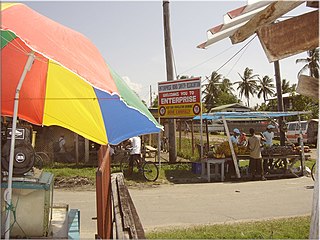
Enterprise is a village in the Demerara-Mahaica region along the coastal belt of Guyana. It is about two square miles in size and has a population of 2,657 as of 2012. It is located about 14 miles (23 km) southeast of the capital city Georgetown. This small community is flanked by Bachelors Adventure and a little further, Enmore to the east; Strasthpey on its west; Melanie Damishana and the Atlantic Ocean sits to the North. Some of the country's largest sugarcane fields are just beyond its southern horizon.
There are several communities named Bush Lot in Guyana. This article covers four locations.
Zeeburg is a village located on the West Coast of Demerara in Guyana, South America. The village, in the administrative region Essequibo Islands-West Demerara was named by the Dutch during their occupation of Guyana.

Rockstone is a village on the right bank of the Essequibo River in the Upper Demerara-Berbice Region of Guyana, altitude 6 metres. Rockstone is approximately 26 km west of Linden and is linked by road.
Albion is a village in East Berbice-Corentyne, Guyana.
Sophia is a ward of Georgetown, the capital of Guyana. It's a predominantly Afro-Guyanese community, and one of Georgetown's poorest neighborhoods.
Stewartville is a village district in Guyana on the Atlantic coast of West Demerara, just east of the mouth of the Essequibo River. There are four sections in the village: Stewartville Housing Scheme, Sarah Lodge, Stewartville Old Road and Stewartville Sea View.
Fort Wellington is a village located in the Mahaica-Berbice region of Guyana, serving as its regional capital.
Windsor Forest is a village in the Essequibo Islands-West Demerara Region of Guyana. It is located along the Atlantic Ocean coast. It was the first Chinese settlement in Guyana, however few Chinese remain.
