Demerara-Mahaica

Last updated
Demerara-Mahaica
Region 4
Administrative Region
Georgetown Market.jpg
Red and black flag.svg
Demerara-Mahaica in Guyana.svg
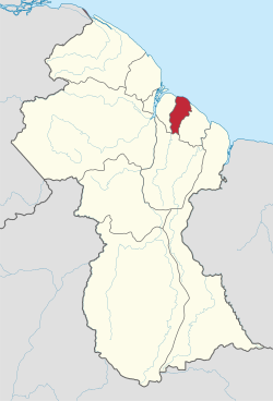
Map of Guyana showing Demerara-Mahaica region
CountryFlag of Guyana.svg Guyana
Area
  Total
2,232 km2 (862 sq mi)
Population
 (2022 census)
  Total
347,759
  Density155.8/km2 (403.5/sq mi)
Time zone UTC-4
[1]

Demerara-Mahaica (Region 4) is a region of Guyana, bordering the Atlantic Ocean to the north, the region of Mahaica-Berbice to the east, the region of Upper Demerara-Berbice to the south and the region of Essequibo Islands-West Demerara to the west.

Contents

It contains the country's capital Georgetown. Notable villages in the region include Buxton, Enmore, Victoria and Paradise.

Population

The Government of Guyana has administered five official censuses since the 1980 administrative reforms, in 1980, 1991, 2002, 2012 and 2022. [2] Even though this administrative region is the smallest, it has the largest population out of all Guyana's Administrative Regions. In 2012, the population of Demerara-Mahaica was recorded at 313,429 people. [3] Official census records for the population of the Demerara-Mahaica region are as follows:

Communities

With name variants in parentheses. [5]

See also

References

  1. Macmillan Publishers (2009). "Administrative Region - 4". Macmillan Junior Atlas: Guyana. Oxford: Macmillan Caribbean. p. 33. ISBN   9780333934173.
  2. Beaie, Sonkarley Tiatun (19 September 2007). "Chapter 3: National Redistribution and Internal Migration" (PDF). 2002 Population and Housing Census - Guyana National Report. Bureau of Statistics. p. 51. Archived from the original (PDF) on 17 February 2012. Retrieved 29 August 2012.
  3. Beaie, Sonkarley Tiatun (19 September 2007). "National Population Trends: Size, Growth and Distribution". 2002 Population and Housing Census - Guyana National Report. Bureau of Statistics. p. 25. Archived from the original (PDF Download) on 9 September 2012. Retrieved 29 August 2012.
  4. "Guyana: Regions, Major Towns & Rural Localities - Population Statistics, Maps, Charts, Weather and Web Information". www.citypopulation.de. Archived from the original on 2026-01-31. Retrieved 2026-02-04.
  5. "2012 Population by Village". Statistics Guyana. Retrieved 8 December 2021.

6°45′N57°59′W / 6.750°N 57.983°W / 6.750; -57.983