
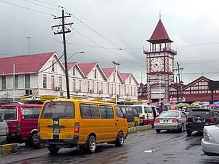
Georgetown is the capital and largest city of Guyana. It is situated in Demerara-Mahaica, region 4, on the Atlantic Ocean coast, at the mouth of the Demerara River. It is nicknamed the "Garden City of the Caribbean." It is the retail, administrative, and financial services centre of the country, and the city accounts for a large portion of Guyana's GDP. The city recorded a population of 118,363 in the 2012 census.

British Guiana was a British colony, part of the mainland British West Indies, which resides on the northern coast of South America. Since 1966 it has been known as the independent nation of Guyana.
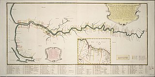
Demerara is a historical region in the Guianas, on the north coast of South America, now part of the country of Guyana. It was a colony of the Dutch West India Company between 1745 and 1792 and a colony of the Dutch state from 1792 until 1815. It was merged with Essequibo in 1812 by the British who took control. It formally became a British colony in 1815 until Demerara-Essequibo was merged with Berbice to form the colony of British Guiana in 1831. In 1838, it became a county of British Guiana until 1958. In 1966, British Guiana gained independence as Guyana and in 1970 it became a republic as the Co-operative Republic of Guyana. It was located around the lower course of the Demerara River, and its main settlement was Georgetown.
Demerara-Mahaica is a region of Guyana, bordering the Atlantic Ocean to the north, the region of Mahaica-Berbice to the east, the region of Upper Demerara-Berbice to the south and the region of Essequibo Islands-West Demerara to the west.

Charity is a small township in Guyana, located in the Pomeroon-Supenaam Region No.2, which is part of the Essequibo County.

Afro-Guyanese are generally descended from the enslaved people brought to Guyana from the coast of West Africa to work on sugar plantations during the era of the Atlantic slave trade. Coming from a wide array of backgrounds and enduring conditions that severely constrained their ability to preserve their respective cultural traditions contributed to the adoption of Christianity and the values of British colonists.
The Railways of Guyana comprised two public railways, the Demerara-Berbice Railway and the Demerara-Essequibo Railway. There are also several industrial railways mainly for the bauxite industry. The Demerara-Berbice Railway is the oldest in South America. None of the railways are in operation in the 21st century.
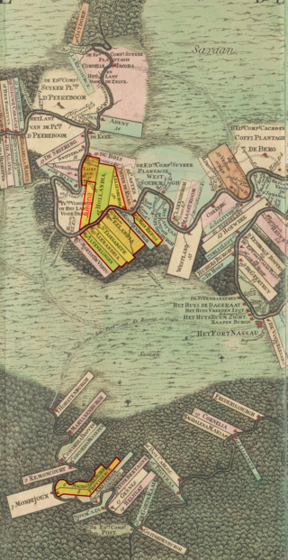
The Berbice slave uprising was a slave revolt in Guyana that began on 23 February 1763 and lasted to December, with leaders including Coffy. The first major slave revolt in South America, it is seen as a major event in Guyana's anti-colonial struggles, and when Guyana became a republic in 1970 the state declared 23 February as a day to commemorate the start of the Berbice slave revolt.
Vreed en Hoop is a village at the mouth of the Demerara River on its west bank, in the Essequibo Islands-West Demerara region of Guyana, located at sea level. It is the location of the Regional Democratic Council office making it the administrative center for the region. There is also a police station, magistrate's court and post office.

Lord William Piercy Austin was the inaugural and long serving Bishop of Guyana from 1842 until his death.
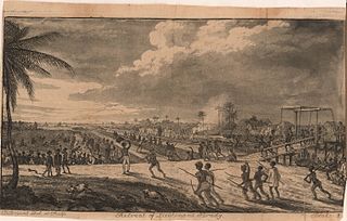
The Demerara rebellion of 1823 was an uprising involving between 9,000 and 12,000 enslaved people that took place in the British colony of Demerara-Essequibo in what is now Guyana. The exact number of how many took part in the uprising is a matter of debate. The rebellion, which began on 18 August 1823 and lasted for two days. Their goal was full emancipation. The uprising was triggered by a widespread but mistaken belief that Parliament had passed a law that abolished slavery and that this was being withheld by the colonial rulers. Instigated chiefly by Jack Gladstone, an enslaved man from the "Success" plantation, the rebellion also involved his father, Quamina, and other senior members of their church group. Its English pastor, John Smith, was implicated.

Quamina Gladstone, most often referred to simply as Quamina, was a Guyanese slave from Africa and father of Jack Gladstone. He and his son were involved in the Demerara rebellion of 1823, one of the largest slave revolts in the British colonies before slavery was abolished.
Bourda Cemetery is an eighteenth-century cemetery situated on Bourda Street in Georgetown, Guyana. Formerly known as "Bourda's Walk", Bourda cemetery is the oldest cemetery in Georgetown, and the only surviving plantation cemetery in the city. It is considered a national landmark and has been listed as a monument by the National Trust of Guyana.

Plantation Peter's Hall was a plantation on the east bank of the River Demerara in Dutch Guiana and British Guiana. It was probably laid out in the mid-eighteenth century and by the early nineteenth century had over 200 slaves before that institution was abolished in the British Empire.
Cummingsburg, or historically Cumingsburg, is a ward in Georgetown, Guyana. It began as 500-acre plantation, La Bourgade about 1759. When Thomas Cumming, a Scotsman, bought the property, he developed a town plan with residential and commercial lots and streets. The town layout was modified after a fire that burnt much of the town in 1864. Today, it is the site of several museums, including a national and anthropological museum.

Laurens Storm van 's Gravesande was a Dutch governor of the colonies of Essequibo and Demerara from 1743 to 1772. He turned Demerara in a successful plantation colony, and the borders of Guyana are mainly based on his expeditions into the interior. He is also noted for his treatment of the Amerindians.
Borsselen is an island in the Demerara River of Guyana, and was the capital of Demerara between 1755 and 1782.
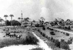
Kingston is a former village in Demerara. In 1837, it became a ward of Georgetown. The ward is located along the Atlantic Ocean coast. Kingston is home to many landmarks and historic buildings.
Vriesland is a village in the Essequibo Islands-West Demerara Region of Guyana. It is located on the west bank of the Demerara River.
Le Repentir Cemetery is a cemetery established in the nineteenth century on Princess St, Georgetown, Guyana. It is the main Georgetown cemetery and the largest cemetery in Guyana.


