Demerara-Mahaica is a region of Guyana, bordering the Atlantic Ocean to the north, the region of Mahaica-Berbice to the east, the region of Upper Demerara-Berbice to the south and the region of Essequibo Islands-West Demerara to the west.
Rosignol is a village on the west bank of the Berbice River in Mahaica-Berbice, Guyana.
Lusignan is a community in Demerara-Mahaica region of Guyana and approximately 16 km from the capital city Georgetown. Located on the East Coast of Demerara, it has population of 1,868 persons as of 2012 mostly Indo-Guyanese.
The Mahaica River is a small river in northern Guyana that drains into the Atlantic Ocean. The village of Mahaica is found at its mouth.
The Railways of Guyana comprised two public railways, the Demerara-Berbice Railway and the Demerara-Essequibo railway. There are also several industrial railways mainly for the bauxite industry. The Demerara-Berbice Railway is the oldest in South America. None of the railways are in operation in the 21st century.
Silver Hill is a very small settlement in the Demerara-Mahaica Region of Guyana, 48 km (30 mi) up the Soesdyke-Linden Highway, which runs along the east bank of the Demerara River.
Enmore is a village in the Demerara-Mahaica region along the coastal belt of Guyana. It is about two square miles (5.1 km2) in size and has a multi-ethnic population of 1,002 as of 2012, with large concentrations of Indo-Guyanese.
Vreed en Hoop is a village at the mouth of the Demerara River on its left bank, in the Essequibo Islands-West Demerara region of Guyana, located at sea level. It is the location of the Regional Democratic Council office making it the administrative center for the region. There is also a police station, magistrate's court and post office.
Jonestown is a village in the Demerara-Mahaica region of Guyana. The old name of the village was Voorzigtigheid. The village is located 37.5 kilometres from Georgetown between Hand-en-Veldt and the Atlantic Ocean, and near the town of Mahaica. Therefore, it tends to be called "Jonestown, Mahaica" or "Jonestown, Mahaica, ECD", even today, although by current Guyanese administrative regions it is in Demerara-Mahaica.

Clonbrook is a village in the Demerara-Mahaica region of Guyana. The village itself has a population of about 1,193 as of 2012. The village is located along the East Coast Highway and is about 16.5 miles from Georgetown and about 6 miles from Mahaica. It is bordered in the east by the village of Bee Hive and by Ann's Grove in the west.
Unity is a rural village in the East Coast district of the Demerara-Mahaica region of Guyana. The village is notable for being the birthplace of both Shivnarine Chanderpaul, former captain of the West Indies cricket team and Bharrat Jagdeo, former president of Guyana. Colin Croft is also from the area.
St. Cuthbert's Mission is an Amerindian village on the Mahaica River in the Demerara-Mahaica region of Guyana. It comprises approximately 200 households. St. Cuthbert's is regarded by many people in Guyana as the "cultural capital" for Amerindians.
Mahaica is a village located in region 4 of Demerara-Mahaica in Guyana. Mahaica is often used as a subregion for the adjoining villages near the Mahaica River like Hand-en-Veldt, Good Hope, Chelsey Park, and Jonestown, which is often referred to as Mahaica or its old Dutch plantation name Voorzigtigheid.
Paradise is a village located in the Demerara-Mahaica region of Guyana, and used to be its regional capital, however the administrative building burnt down in 2006, and the regional capital moved to Triumph.
Fort Wellington is a village located in the Mahaica-Berbice region of Guyana, serving as its regional capital.
Better Hope is a village located in the Demerara-Mahaica region of Guyana. The village has been named after the Plantation Betterhoop It was originally a fishing village with many working on the sugar estates and nearby farms. The majority of the population is Indo-Guyanese with a minority of Afro-Guyanese.
Triumph is a village and regional capital of the Demerara-Mahaica region in Guyana.
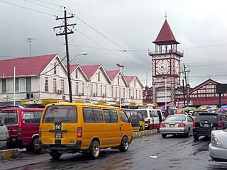
Kingston is a former village in Demerara. In 1837, it became a ward of Georgetown. The ward is located along the Atlantic Ocean coast. Kingston is home to many landmarks and historic buildings.
Windsor Forest is a village in the Essequibo Islands-West Demerara Region of Guyana. It is located along the Atlantic Ocean coast. It was the first Chinese settlement in Guyana, however few Chinese remain.
Tuschen is a village in the Essequibo Islands-West Demerara Region of Guyana. It is located along the Atlantic Ocean coast. The original name of the village was Tuschen de Vrienden. During the 20th century, it was a small village. The Tuschen Housing Scheme resulted in a considerable growth, and is one of the largest housing schemes in Guyana.
