List of cities and towns in Guyana

Last updated

Map of Guyana Gy-map.png
Map of Guyana
Georgetown, Capital of Guyana St George's Cathedral.jpg
Georgetown, Capital of Guyana
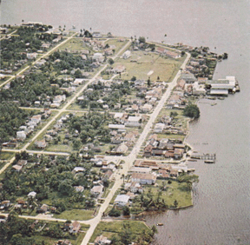
Bartica Bartica.png
Bartica

This is a list of settlements in Guyana . The following definitions have been used:

Contents

Cities

Towns

Villages

A–M

N–Z

Communities

Estates

Missions

Largest cities

Largest cities and towns of Guyana
Rank Name Region Population
1 Georgetown Demerara-Mahaica 118,363 [3]
2 Linden Upper Demerara-Berbice 27,277 [3]
3 New Amsterdam East Berbice-Corentyne 17,329 [3]
4 Corriverton East Berbice-Corentyne 11,386 [3]
5 Bartica Cuyuni-Mazaruni 8,004 [4]
6 Mahaica Demerara-Mahaica 4,867 [4]
7 Rose Hall East Berbice-Corentyne 4,413 [4]
8 Parika Essequibo Islands-West Demerara 4,385 [4]
9 Triumph Demerara-Mahaica 3,788 [4]
10 Uitvlugt Essequibo Islands-West Demerara 2,980 [4]

See also

Related Research Articles

<span class="mw-page-title-main">Barima-Waini</span> Region of Guyana

Barima-Waini is a region of Guyana and is located in the northwest of the country. Barima-Waini has three sub-regions: Mabaruma, Matakai, and Moruca.

<span class="mw-page-title-main">Mabaruma</span> Town and regional capital in Barima-Waini, Guyana

Mabaruma is the administrative centre and regional capital for Region One (Barima-Waini) of Guyana. It is located close to the Aruka River on a narrow plateau above the surrounding rainforest at an elevation of 13 metres.

<span class="mw-page-title-main">East Berbice-Corentyne</span> Region of Guyana

East Berbice-Corentyne is one of ten regions in Guyana covering the whole of the east of the country. It borders the Atlantic Ocean to the north, the Nickerie District and Sipaliwini District of Suriname to the east, Brazil to the south and the regions of Mahaica-Berbice, Upper Demerara-Berbice, Potaro-Siparuni and Upper Takutu-Upper Essequibo to the west.

<span class="mw-page-title-main">Demerara-Mahaica</span> Region of Guyana

Demerara-Mahaica is a region of Guyana, bordering the Atlantic Ocean to the north, the region of Mahaica-Berbice to the east, the region of Upper Demerara-Berbice to the south and the region of Essequibo Islands-West Demerara to the west.

<span class="mw-page-title-main">Essequibo Islands-West Demerara</span> Region of Guyana

Essequibo Islands-West Demerara is a region of Guyana. It is situated around the Essequibo River, the largest river in Guyana that lies between the Orinoco and Amazon rivers of South America.

<span class="mw-page-title-main">Pomeroon-Supenaam</span> Region of Guyana

Pomeroon-Supenaam is a region of Guyana. It borders the Atlantic Ocean to the north, the region of Essequibo Islands-West Demerara to the east, the region of Cuyuni-Mazaruni to the south and the region of Barima-Waini to the west. Pomeroon-Supenaam contains the town of Anna Regina and the villages of Charity, Pickersgill, Spring Garden and Suddie. In 2012, an Official Census by the Government of Guyana listed the population of the Pomeroon-Supenaam Region at 46,810.

<span class="mw-page-title-main">Upper Demerara-Berbice</span> Region of Guyana

Upper Demerara-Berbice is a region of Guyana, bordering the regions of Essequibo Islands-West Demerara, Demerara-Mahaica and Mahaica-Berbice to the north, the region of East Berbice-Corentyne to the east, and the regions of Potaro-Siparuni and Cuyuni-Mazaruni to the west.

<span class="mw-page-title-main">Potaro-Siparuni</span> Region of Guyana

Potaro-Siparuni is a region of Guyana. It borders the region of Cuyuni-Mazaruni to the north, the regions of Upper Demerara-Berbice and East Berbice-Corentyne to the east, the region of Upper Takutu-Upper Essequibo to the south and Brazil to the west.

Lusignan is a community in Demerara-Mahaica region of Guyana and approximately 16 km from the capital city Georgetown. Located on the East Coast of Demerara, it has population of 1,868 persons as of 2012 mostly Indo-Guyanese.

<span class="mw-page-title-main">Mahdia, Guyana</span> Town and regional capital in Potaro-Siparuni, Guyana

Mahdia is a town in Guyana, located near the centre of the country at an altitude of 415 m (1,362 ft).

<span class="mw-page-title-main">Neighbourhood Councils of Guyana</span>

The regions of Guyana are divided into three types of councils: municipal or town councils, neighbourhood democratic councils and Amerindian villages.

There are several communities named Bush Lot in Guyana. This article covers four locations.

Bethany Village is a mission located on the Araburia River, a tributary three miles up the Supenaam River in Pomeroon-Supenaam, Essequibo in Guyana.

St. Cuthbert's Mission is an Amerindian village on the Mahaica River in the Demerara-Mahaica region of Guyana. It comprises approximately 200 households. St. Cuthbert's is regarded by many people in Guyana as the "cultural capital" for Amerindians.

Soesdyke is a village in the Demerara-Mahaica Region, Guyana, located between the Demerara River and the East Bank Public Road. Soesdyke is located just after the village called Den Heuvel (Coverden) if you are coming from Georgetown, which is the capital of Guyana. On the other end of Soesdyke is the village Timehri about 3 miles northeast of the Cheddi Jagan International Airport.

Moraikobai is an Amerindian village located in the Mahaica-Berbice of Guyana.

Paradise is a village located in the Demerara-Mahaica region of Guyana, and used to be its regional capital, however the administrative building burnt down in 2006, and the regional capital moved to Triumph.

Fort Wellington is a village located in the Mahaica-Berbice region of Guyana, serving as its regional capital.

Triumph is a village and regional capital of the Demerara-Mahaica region in Guyana.

Helena is a village in the Demerara-Mahaica Region of Guyana. Administratively the village is subdivided in Helena No.1 and Helena No.2 and is part of the Mahaica subregion.

References

  1. World Gazetteer, Guyana: Largest cities and towns with statistics of their population [ dead link ]
  2. "Municipalities | Ministry of Local Government and Regional Development" . Retrieved 2021-02-20.
  3. 1 2 3 4 Guyana Population and Housing Census 2012: Preliminary Report (PDF) (Report). Bureau of Statistics, Guyana. June 2014. p. 23. Archived (PDF) from the original on 10 October 2020. Retrieved 10 March 2021.
  4. 1 2 3 4 5 6 "2012 Population by Village". Statistics Guyana. Archived from the original on 17 April 2021. Retrieved 16 August 2020.