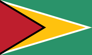
Demerara is a historical region in the Guianas, on the north coast of South America, now part of the country of Guyana. It was a Dutch colony until 1815 and a county of British Guiana from 1838 to 1966. It was located around the lower course of the Demerara River, and its main settlement was Georgetown.

The Tiriyó are an Amerindian ethnic group native to parts of northern Brazil, Suriname, and Guyana. In 2014, there were approximately 3,640 Tiriyó in the three countries. They live in several major villages and a number of minor villages in the border zone between Brazil and Suriname. They speak the Tiriyó language, a member of the Cariban language family and refer to themselves as tarëno, etymologically 'people from here' or 'local people'.

Berbice is a region along the Berbice River in Guyana, which was between 1627 and 1815 a colony of the Dutch Republic. After having been ceded to the United Kingdom of Great Britain and Ireland in the latter year, it was merged with Essequibo and Demerara to form the colony of British Guiana in 1831. In 1966, British Guiana gained independence as Guyana.

Essequibo Islands-West Demerara is a region of Guyana.

Upper Demerara-Berbice is a region of Guyana, bordering the regions of Essequibo Islands-West Demerara, Demerara-Mahaica and Mahaica-Berbice to the north, the region of East Berbice-Corentyne to the east, and the regions of Potaro-Siparuni and Cuyuni-Mazaruni to the west.
The Arawak village of Wakapau is located in the Pomeroon-Supenaam Region of Guyana, on the Wakapau River, a tributary on the west bank of the Pomeroon River, 3 kilometres (1.9 mi) from its mouth. The name originates from the Lokono word ‘Wakokwãn’, which means pigeon. The village is composed of twenty inhabited islands. Some of the islands only contain a single family.
Weldaad is a community in the Mahaica-Berbice Region of Guyana on the Atlantic Ocean coast. It contains the areas' post office and a police station. The origin of the names comes from the plantation Weldaad, which was founded when the areas that make up Guyana were Dutch colonies.
Orealla is an Indigenous community in the East Berbice-Corentyne Region of Guyana, on the Courantyne River, approximately 33 miles (53 km) south of Crabwood Creek and 11 miles (18 km) north of Epira, located at 5°17′50″N57°20′50″W, altitude 11 metres. 15 miles (24 km) south-east on the other side of the Courantyne River lies the Surinamese village of Apoera. Orealla is an indigenous village.
Koriabo is a community in the Barima-Waini region of Guyana, standing at an altitude of 36 metres. Barima and Koriba form an Amerindian community which is mainly inhabited by Warao people with a minority of Arawak and Kalina people.
Vreed en Hoop is a village at the mouth of the Demerara River on its left bank, in the Essequibo Islands-West Demerara region of Guyana, located at sea level. It is the location of the Regional Democratic Council office making it the administrative center for the region. There is also a police station, magistrate's court and post office.
Met-en-Meerzorg is a village located on the West Coast of Demerara in the region of Essequibo Islands-West Demerara in Guyana. The village was named after the sugar plantation Met en Meerzorg.
Beterverwagting, also Betterverwagting or abbreviated to B.V., is a village in Guyana, on the East Coast of the Demerara River.
Zeeburg is a village located on the West Coast of Demerara in Guyana, South America. The village, in the administrative region Essequibo Islands-West Demerara was named by the Dutch during their occupation of Guyana.

Guyana, officially the Co‑operative Republic of Guyana, is a country on the northern mainland of South America. Guyana is an indigenous word which means "Land of Many Waters". The capital city is Georgetown. Guyana is bordered by the Atlantic Ocean to the north, Brazil to the south and southwest, Venezuela to the west, and Suriname to the east. With 215,000 km2 (83,000 sq mi), Guyana is the third-smallest sovereign state by area in mainland South America after Uruguay and Suriname, and is the second-least populous sovereign state in South America after Suriname; it is also one of the least densely populated countries on Earth. It has a wide variety of natural habitats and very high biodiversity.
Leonora is a village in Essequibo Islands-West Demerara, one of Guyana's 10 regions. Its subdivisions are Pasture, Sea Field, Para Field, Groenveldt and Sea Spray. The neighboring villages are Anna Catherina and Uitvlugt. Leonora encompasses an area of about 13 square kilometres (5 sq mi), once part of the Parish of St. Luke. It stretches from Edinburgh in the east to Stewartville in the west, and from the Atlantic Ocean in the north, to the south as far as the West Demerara Water Conservancy.
Uitvlugt is a village in the Essequibo Islands-West Demerara region of Guyana. On the coastal public road on the west bank of the Demerara River, it lies immediately to the west of Stewartville and to the south of Zeeburg, about 20 minutes by road from Vreed-en-Hoop.

The Tigri Area is a wooded area that has been disputed since around 1840 by Guyana and Suriname. It involves the area between the Upper Corentyne River, the Coeroeni River and the Kutari River. This triangular area is in Guyana known as the New River Triangle. In 1969 the conflict ran high on and since then the Tigri Area is controlled by Guyana and claimed by Suriname. In 1971 both governments in Trinidad agreed that they continue talks over the border issue and withdraw their military forces from the disputed Triangle. Guyana has never held upon this agreement.
Kasuela is an indigenous village of the Tiriyó people in the East Berbice-Corentyne region of Guyana. The village has a population of about 80 people. The inhabitants are of the subgroup Mawayana or the Frog people.
Vriesland is a village in the Essequibo Islands-West Demerara Region of Guyana. It is located on the west bank of the Demerara River.


