East Millinocket (CDP), Maine

Last updated

East Millinocket, Maine
USA Maine location map.svg
Red pog.svg
East Millinocket, Maine
Location within the state of Maine
Coordinates: 45°37′41″N68°34′23″W / 45.62806°N 68.57306°W / 45.62806; -68.57306
CountryUnited States
State Maine
County Penobscot
Area
[1]
  Total1.13 sq mi (2.92 km2)
  Land1.13 sq mi (2.92 km2)
  Water0.00 sq mi (0.00 km2)
Elevation
367 ft (112 m)
Population
 (2020)
  Total1,560
  Density1,384.21/sq mi (534.27/km2)
Time zone UTC-5 (Eastern (EST))
  Summer (DST) UTC-4 (EDT)
ZIP code
07727
Area code 207
FIPS code 23-21065
GNIS feature ID0565639

East Millinocket is a census-designated place (CDP) consisting of the main settlement in the town of East Millinocket in Penobscot County, Maine, United States. The population was 1,567 at the 2010 census. [2]

Contents

Geography

East Millinocket is located at 45°37′40″N68°34′22″W / 45.62778°N 68.57278°W / 45.62778; -68.57278 (45.627932, −68.572961). [3]

According to the United States Census Bureau, the CDP has a total area of 0.97 square miles (2.5 km2), all land. [2]

Demographics

Historical population
CensusPop.Note
2020 1,560
U.S. Decennial Census [4]

As of the census [5] of 2000, there were 1,701 people, 734 households, and 515 families residing in the CDP. The population density was 1,769.2 inhabitants per square mile (683.1/km2). There were 829 housing units at an average density of 862.2 per square mile (332.9/km2). The racial makeup of the CDP was 98.47% White, 0.29% Native American, 0.24% Asian, 0.06% from other races, and 0.94% from two or more races. Hispanic or Latino of any race were 0.29% of the population.

There were 734 households, out of which 28.5% had children under the age of 18 living with them, 57.1% were married couples living together, 9.9% had a female householder with no husband present, and 29.8% were non-families. 27.7% of all households were made up of individuals, and 14.6% had someone living alone who was 65 years of age or older. The average household size was 2.32 and the average family size was 2.77.

In the CDP, the population was spread out, with 23.1% under the age of 18, 4.6% from 18 to 24, 25.1% from 25 to 44, 24.9% from 45 to 64, and 22.3% who were 65 years of age or older. The median age was 44 years. For every 100 females, there were 91.3 males. For every 100 females age 18 and over, there were 88.7 males.

The median income for a household in the CDP was $31,767, and the median income for a family was $39,286. Males had a median income of $46,184 versus $23,333 for females. The per capita income for the CDP was $18,975. About 11.8% of families and 13.9% of the population were below the poverty line, including 24.0% of those under age 18 and 6.1% of those age 65 or over.

Related Research Articles

<span class="mw-page-title-main">Essex Village, Connecticut</span> Census-designated place in Connecticut, United States

Essex Village is a village and census-designated place (CDP) in the town of Essex, Connecticut, in the United States. The population was 2,583 at the 2020 census, out of 6,733 in the entire town of Essex. The government offices of the town are located within the village.

<span class="mw-page-title-main">Wabasso Beach, Florida</span> CDP in Florida, United States

Wabasso Beach is a census-designated place (CDP) in Indian River County, Florida, United States. The population was 1,853 at the 2010 census, an increase of 72.4% since 2000. It is part of the Sebastian–Vero Beach Metropolitan Statistical Area.

<span class="mw-page-title-main">Paisley, Florida</span> Census-designated place in Florida

Paisley is an unincorporated community and census-designated place (CDP) in Lake County, Florida, United States. The population was 818 at the 2010 census, up from 734 at the 2000 census. It is part of the Orlando–Kissimmee Metropolitan Statistical Area.

<span class="mw-page-title-main">Yalaha, Florida</span> Census-designated place in Florida

Yalaha is an unincorporated area and census-designated place (CDP) in Lake County, Florida, United States. The population was 1,364 at the 2010 census, up from 1,175 at the 2000 census. It is part of the Orlando–Kissimmee Metropolitan Statistical Area.

Plantation Mobile Home Park is a census-designated place (CDP) in Palm Beach County, Florida, United States. The population was 1,462 at the 2020 census.

<span class="mw-page-title-main">Fairview, Georgia</span> CDP in Georgia, United States

Fairview is a census-designated place (CDP) in Walker County, Georgia, United States. In the 2020 census, the population was 6,409. It is part of the Chattanooga, TN–GA Metropolitan Statistical Area.

Woodville is a town in Penobscot County, Maine, United States. The population was 201 at the 2020 census.

<span class="mw-page-title-main">Wareham Center, Massachusetts</span> Census-designated place in Massachusetts, United States

Wareham Center is a census-designated place (CDP) in the town of Wareham in Plymouth County, Massachusetts, United States. The population was 2,896 at the 2010 census.

<span class="mw-page-title-main">Burt, Michigan</span> Census-designated place & unincorporated community in Michigan, United States

Burt is a census-designated place (CDP) and Unincorporated community for statistical purposes in Taymouth Township, Saginaw County in the U.S. state of Michigan. The CDP's population was 1,122 at the 2000 census. Burt is also the name of a post office with ZIP code 48417, which includes the area of the CDP as well as portions of Taymouth Township to the north of the CDP and the eastern part of Albee Township and a small area of southeastern Spaulding Township. The town is named for Wellington R. Burt.

<span class="mw-page-title-main">Brinckerhoff, New York</span> Census-designated place in New York, United States

Brinckerhoff is a hamlet and census-designated place (CDP) in Dutchess County, New York, United States. The population was 2,900 at the 2010 census. It is part of the Poughkeepsie–Newburgh–Middletown, NY Metropolitan Statistical Area as well as the larger New York–Newark–Bridgeport, NY-NJ-CT-PA Combined Statistical Area.

<span class="mw-page-title-main">Pumpkin Center, North Carolina</span> CDP in North Carolina, United States

Pumpkin Center is a census-designated place (CDP) in Onslow County, North Carolina, United States. The population was 2,228 at the 2000 census. It is part of the Jacksonville, North Carolina Metropolitan Statistical Area.

<span class="mw-page-title-main">Sanatoga, Pennsylvania</span> Census-designated place in Pennsylvania, United States

Sanatoga is a community and census-designated place (CDP) in Lower Pottsgrove Township, Montgomery County, Pennsylvania, United States. It is immediately east of the borough of Pottstown on U.S. Route 422. The population was 8,378 at the 2010 census.

<span class="mw-page-title-main">Fairview-Ferndale, Pennsylvania</span> CDP in Pennsylvania, United States

Fairview-Ferndale is a census-designated place (CDP), located in Coal Township, in Northumberland County, Pennsylvania, United States. The population was 2,411 at the 2000 census.

<span class="mw-page-title-main">Susquehanna Trails, Pennsylvania</span> CDP in Pennsylvania, United States

Susquehanna Trails is a census-designated place (CDP) in York County, Pennsylvania, United States. The population was 2,264 at the 2010 census.
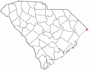
<span class="mw-page-title-main">Little River, South Carolina</span> CDP in South Carolina, United States

Little River is a census-designated place (CDP) in Horry County, South Carolina, United States. The population was 11,711 at the 2020 census.
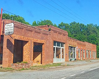
<span class="mw-page-title-main">Tuleta, Texas</span> Census-designated place in Texas, United States

Tuleta is a census-designated place (CDP) in Bee County, Texas, United States. The population was 288 at the 2010 census.

<span class="mw-page-title-main">La Puerta, Texas</span> CDP in Texas, United States

La Puerta is a census-designated place (CDP) in Starr County, Texas, United States. The population was 632 at the 2010 census down from 1,636 at the 2000 census.

<span class="mw-page-title-main">Brookhaven, West Virginia</span> CDP in West Virginia

Brookhaven is a census-designated place (CDP) in Monongalia County, West Virginia, United States. The population was 5,707 at the 2020 census. It is included in the Morgantown, West Virginia Metropolitan Statistical Area.

<span class="mw-page-title-main">East Millinocket, Maine</span> Town in the state of Maine, United States

East Millinocket is a town in Penobscot County, Maine, United States. The population was 1,572 at the 2020 census.

Millinocket is a census-designated place (CDP) comprising most of the developed land within the town of Millinocket in Penobscot County, Maine, United States. The population of the CDP was 4,466 at the 2010 census.

References

  1. "2020 U.S. Gazetteer Files". United States Census Bureau. Retrieved April 8, 2022.
  2. 1 2 "Geographic Identifiers: 2010 Demographic Profile Data (G001): East Millinocket CDP, Maine". U.S. Census Bureau, American Factfinder. Archived from the original on February 12, 2020. Retrieved November 20, 2012.
  3. "US Gazetteer files: 2010, 2000, and 1990". United States Census Bureau. February 12, 2011. Retrieved April 23, 2011.
  4. "Census of Population and Housing". Census.gov. Retrieved June 4, 2016.
  5. "U.S. Census website". United States Census Bureau . Retrieved 2008-01-31.