Newport (CDP), Maine

Last updated

Newport, Maine
USA Maine location map.svg
Red pog.svg
Newport, Maine
Location within the state of Maine
Coordinates: 44°50′13″N69°16′21″W / 44.83694°N 69.27250°W / 44.83694; -69.27250
CountryUnited States
State Maine
County Penobscot
Area
[1]
  Total4.87 sq mi (12.61 km2)
  Land3.52 sq mi (9.11 km2)
  Water1.35 sq mi (3.50 km2)
Elevation
207 ft (63 m)
Population
 (2020)
  Total1,690
  Density480.66/sq mi (185.57/km2)
Time zone UTC-5 (Eastern (EST))
  Summer (DST) UTC-4 (EDT)
ZIP code
04953
Area code 207
FIPS code 23-49100
GNIS feature ID0572149

Newport is a census-designated place (CDP) consisting of the main area of settlement within the town of Newport in Penobscot County, Maine, United States. The population of the CDP was 1,776 at the 2010 census. [2]

Contents

Geography

Newport is located at 44°50′13″N69°16′20″W / 44.83694°N 69.27222°W / 44.83694; -69.27222 (44.837007, −69.272454). [3]

According to the United States Census Bureau, the CDP has a total area of 4.9 square miles (12.6 km2), of which 3.5 square miles (9.1 km2) is land and 1.4 square miles (3.5 km2), or 27.98%, is water.

Demographics

Historical population
CensusPop.Note
2020 1,690
U.S. Decennial Census [4]

As of the census [5] of 2000, there were 1,754 people, 781 households, and 474 families residing in the CDP. The population density was 501.8 inhabitants per square mile (193.7/km2). There were 898 housing units at an average density of 256.9 per square mile (99.2/km2). The racial makeup of the CDP was 98.29% White, 0.23% Black or African American, 0.46% Native American, 0.29% Asian, 0.06% Pacific Islander, 0.06% from other races, and 0.63% from two or more races. Hispanic or Latino of any race were 0.68% of the population.

There were 781 households, out of which 28.8% had children under the age of 18 living with them, 44.0% were married couples living together, 11.5% had a female householder with no husband present, and 39.3% were non-families. 33.0% of all households were made up of individuals, and 12.9% had someone living alone who was 65 years of age or older. The average household size was 2.25 and the average family size was 2.82.

In the CDP, the population was spread out, with 23.7% under the age of 18, 8.4% from 18 to 24, 28.4% from 25 to 44, 23.7% from 45 to 64, and 15.7% who were 65 years of age or older. The median age was 38 years. For every 100 females, there were 94.2 males. For every 100 females age 18 and over, there were 90.3 males.

The median income for a household in the CDP was $26,793, and the median income for a family was $36,146. Males had a median income of $27,708 versus $17,258 for females. The per capita income for the CDP was $15,102. About 7.9% of families and 15.3% of the population were below the poverty line, including 8.9% of those under age 18 and 19.0% of those age 65 or over.

Related Research Articles

<span class="mw-page-title-main">Inverness Highlands South, Florida</span> Census-designated place in Florida, US

Inverness Highlands South is a census-designated place (CDP) in Citrus County, Florida, United States. As of the 2010 census, the population was 6,542, up from 5,781 in 2000.

<span class="mw-page-title-main">Progress Village, Florida</span> Census-designated place in Florida, United States

Progress Village is a census-designated place (CDP) in Hillsborough County, Florida, United States. Per the 2020 census, the population was 11,188.

<span class="mw-page-title-main">North Sarasota, Florida</span> Census-designated place in Florida, United States

North Sarasota is a census-designated place (CDP) in Sarasota County, Florida, United States. The population was 6,982 at the 2010 census. It is part of the Bradenton–Sarasota–Venice Metropolitan Statistical Area.

<span class="mw-page-title-main">Carnot-Moon, Pennsylvania</span> Census-designated place in Pennsylvania, United States

Carnot-Moon is a census-designated place (CDP) in central Moon Township, Allegheny County, Pennsylvania, United States. The population was 13,151 at the 2020 census.

<span class="mw-page-title-main">Russellton, Pennsylvania</span> Census-designated place in Pennsylvania, United States

Russellton is a census-designated place (CDP) in Allegheny County, Pennsylvania, United States. The population was 1,330 at the 2020 census.

<span class="mw-page-title-main">Oglala, South Dakota</span> CDP in South Dakota, United States

Oglala is a census-designated place (CDP) in West Oglala Lakota Unorganized Territory equivalent, Oglala Lakota County, South Dakota, United States. The population was 1,282 at the 2020 census. Its location is in the northwest of the Pine Ridge Indian Reservation.

<span class="mw-page-title-main">Evadale, Texas</span> Census-designated place in Texas, United States

Evadale is an unincorporated community and census-designated place (CDP) in Jasper County, Texas, United States. The population was 1,246 at the 2020 census.

Onion Creek is a neighborhood in Austin.

<span class="mw-page-title-main">Canyon Creek, Washington</span> CDP in Washington, United States

Canyon Creek is a census-designated place (CDP) in Snohomish County, Washington, United States. The population was 3,200 at the 2010 census. Prior to the 2010 census, the CDP was known as Jordan Road-Canyon Creek.

<span class="mw-page-title-main">Oso, Washington</span> CDP in Washington, United States

Oso is a census-designated place (CDP) in Snohomish County, Washington, United States. It is located to the west of Darrington, south of the North Fork of the Stillaguamish River and approximately 50 air miles (80 km) from Seattle. The population of Oso was 180 at the 2010 census. The area was the site of a large landslide in March 2014 that killed 43 people, the deadliest incident of its kind in U.S. history.

<span class="mw-page-title-main">Brunswick (CDP), Maine</span> Census-designated place in Maine, United States

Brunswick is a census-designated place (CDP) in the town of Brunswick in Cumberland County, Maine, United States. The population was 15,175 at the 2010 census. It is part of the Portland–South Portland–Biddeford, Maine Metropolitan Statistical Area.

<span class="mw-page-title-main">Thomaston (CDP), Maine</span> Census-designated place in Maine, United States

Thomaston is a census-designated place (CDP) comprising the main village in the town of Thomaston in Knox County, Maine, United States. The population was 1,875 at the 2010 census, out of 2,781 in the town of Thomaston as a whole.

Norway is a census-designated place (CDP) in the town of Norway in Oxford County, Maine, United States. The population was 2,623 at the 2000 census.

Anson is a census-designated place (CDP) in the town of Anson in Somerset County, Maine, United States. The population was 818 at the 2000 census.
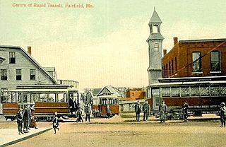
Hartland is a census-designated place (CDP) in the town of Hartland in Somerset County, Maine, United States. The population was 872 at the 2000 census.

Madison is a census-designated place (CDP) in the town of Madison in Somerset County, Maine, United States. The population was 2,733 at the 2000 census.

Norridgewock is a census-designated place (CDP) in the town of Norridgewock in Somerset County, Maine, United States. The population was 1,557 at the 2000 census.

Pittsfield is a census-designated place (CDP) in the town of Pittsfield in Somerset County, Maine, United States. The population was 3,217 at the 2000 census.

<span class="mw-page-title-main">Skowhegan (CDP), Maine</span> CDP in Maine, United States

Skowhegan is a census-designated place (CDP) in the town of Skowhegan in Somerset County, Maine, in the United States. The population was 6,696 at the 2000 census.

<span class="mw-page-title-main">Unity (CDP), Maine</span> CDP in Maine, United States

Unity is a census-designated place (CDP) in the town of Unity in Waldo County, Maine, United States. The population was 486 at the 2000 census.

References

  1. "2020 U.S. Gazetteer Files". United States Census Bureau. Retrieved April 8, 2022.
  2. "Geographic Identifiers: 2010 Demographic Profile Data (G001): Newport CDP, Maine". U.S. Census Bureau, American Factfinder. Archived from the original on February 12, 2020. Retrieved November 20, 2012.
  3. "US Gazetteer files: 2010, 2000, and 1990". United States Census Bureau. February 12, 2011. Retrieved April 23, 2011.
  4. "Census of Population and Housing". Census.gov. Retrieved June 4, 2016.
  5. "U.S. Census website". United States Census Bureau . Retrieved January 31, 2008.