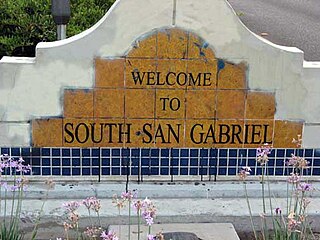
Millinocket (CDP), Maine

Last updated

Millinocket, Maine
USA Maine location map.svg
Red pog.svg
Millinocket, Maine
Location within the state of Maine
Coordinates: 45°39′29″N68°42′21″W / 45.65806°N 68.70583°W / 45.65806; -68.70583
CountryUnited States
State Maine
County Penobscot
Area
[1]
  Total5.83 sq mi (15.10 km2)
  Land5.67 sq mi (14.70 km2)
  Water0.16 sq mi (0.41 km2)
Elevation
371 ft (113 m)
Population
 (2020)
  Total4,104
  Density723.30/sq mi (279.26/km2)
Time zone UTC-5 (Eastern (EST))
  Summer (DST) UTC-4 (EDT)
ZIP code
04462
Area code 207
FIPS code 23-45845
GNIS feature ID0571390

Millinocket is a census-designated place (CDP) comprising most of the developed land within the town of Millinocket in Penobscot County, Maine, United States. The population of the CDP was 4,466 at the 2010 census. [2]

Contents

Geography

Millinocket is located at 45°39′28″N68°42′21″W / 45.65778°N 68.70583°W / 45.65778; -68.70583 (45.658039, −68.705855). [3]

According to the United States Census Bureau, the CDP has a total area of 5.6 square miles (14.6 km2), of which 5.5 square miles (14.3 km2) is land and 0.12 square miles (0.3 km2), or 2.32%, is water. [2]

Demographics

Historical population
CensusPop.Note
2020 4,104
U.S. Decennial Census [4]

As of the census [5] of 2000, there were 5,190 people, 2,289 households, and 1,551 families residing in the CDP. The population density was 954.7 inhabitants per square mile (368.6/km2). There were 2,673 housing units at an average density of 491.7 per square mile (189.8/km2). The racial makeup of the CDP was 98.52% White, 0.10% Black or African American, 0.54% Native American, 0.37% Asian, 0.02% from other races, and 0.46% from two or more races. Hispanic or Latino of any race were 0.23% of the population.

There were 2,289 households, out of which 25.7% had children under the age of 18 living with them, 55.7% were married couples living together, 9.1% had a female householder with no husband present, and 32.2% were non-families. 28.3% of all households were made up of individuals, and 14.5% had someone living alone who was 65 years of age or older. The average household size was 2.25 and the average family size was 2.69.

In the CDP, the population was spread out, with 21.1% under the age of 18, 4.8% from 18 to 24, 25.0% from 25 to 44, 29.6% from 45 to 64, and 19.4% who were 65 years of age or older. The median age was 44 years. For every 100 females, there were 93.9 males. For every 100 females age 18 and over, there were 90.4 males.

The median income for a household in the CDP was $29,337, and the median income for a family was $40,918. Males had a median income of $41,136 versus $23,289 for females. The per capita income for the CDP was $17,139. About 11.9% of families and 14.8% of the population were below the poverty line, including 20.4% of those under age 18 and 12.5% of those age 65 or over.

Related Research Articles

<span class="mw-page-title-main">Fortuna Foothills, Arizona</span> CDP in Yuma County, Arizona

Fortuna Foothills is a census-designated place (CDP) in Yuma County, Arizona, United States. The population was 26,265 at the 2010 census. It is part of the Yuma Metropolitan Statistical Area. Development of the area began in the 1960s, when local developer Hank Schechert purchased 3,000 acres east of Yuma. Fortuna Foothills serves as a bedroom community for Yuma, Yuma Proving Ground, and Marine Corps Air Station Yuma. Fortuna Foothills is also an area with a large amount of seasonal residents.

<span class="mw-page-title-main">Derby Acres, California</span> Census-designated place in California, United States

Derby Acres is a census-designated place (CDP) in Kern County, California, United States. Derby Acres is located 5.5 miles (8.9 km) north-northwest of Fellows, at an elevation of 1,375 feet (419 m). The population was 322 at the 2010 census, down from 376 at the 2000 census. The town is on State Route 33 at the northern extremity of the Midway-Sunset Oil Field, about five miles (8 km)five miles southeast of McKittrick.

<span class="mw-page-title-main">Old Mystic, Connecticut</span> Census-designated place in Connecticut, United States

Old Mystic is a village and census-designated place (CDP) located in the town of Groton, Connecticut. The population was 3,554 at the 2010 census.

<span class="mw-page-title-main">Mango, Florida</span> Census-designated place in Florida, United States

Mango is a census-designated place (CDP) in Hillsborough County, Florida, United States. The population was 11,313 at the 2010 census, up from 8,842 at the 2000 census.

<span class="mw-page-title-main">Sunset, Florida</span> Census-designated place in Florida, United States

Sunset is a census-designated place (CDP) in Miami-Dade County, Florida, United States. The population was 15,912 at the 2020 census. The U.S. Postal Service uses the ZIP Codes of 33173 and 33183 for Sunset.

<span class="mw-page-title-main">Westview, Florida</span> Census-designated place in Florida, United States

Westview is a census-designated place (CDP) in Miami-Dade County, Florida, United States. The population was 9,923 at the 2020 census.

<span class="mw-page-title-main">Mākaha Valley, Hawaii</span> Census-designated place in Hawaii, United States

Mākaha Valley is a census-designated place (CDP) in Honolulu County, Hawaiʻi, United States. The population was 198 at the 2020 census.

Medway is a town in Penobscot County, Maine, United States. The population was 1,187 at the 2020 census.

Woodville is a town in Penobscot County, Maine, United States. The population was 201 at the 2020 census.

<span class="mw-page-title-main">South Dennis, Massachusetts</span> Census-designated place in Massachusetts, United States

South Dennis is a census-designated place (CDP) in the town of Dennis in Barnstable County, Massachusetts, United States. The population was 3,643 at the 2010 census, the most of the 5 CDPs in Dennis.

<span class="mw-page-title-main">East Atlantic Beach, New York</span> Hamlet and census-designated place in New York, United States

East Atlantic Beach is a hamlet and census-designated place (CDP) in Nassau County, New York, United States. The population was 2,049 at the 2010 census. The unincorporated hamlet is governed by the Town of Hempstead, one of three towns in Nassau County.

<span class="mw-page-title-main">Willington, South Carolina</span> CDP in South Carolina, United States

Willington is a census-designated place (CDP) in McCormick County, South Carolina, United States. The population was 177 at the 2000 census.

<span class="mw-page-title-main">Timber Lakes, Utah</span> CDP in Utah, United States

Timber Lakes is a census-designated place (CDP) in Wasatch County, Utah, United States. The population was 607 at the 2010 census, up from 289 in 2000.

<span class="mw-page-title-main">Stimson Crossing, Washington</span> Former CDP in Washington, United States

Stimson Crossing is a former census-designated place (CDP) in Snohomish County, Washington, United States. The population was 773 at the 2000 census. The CDP was discontinued at the 2010 census.

<span class="mw-page-title-main">Fort Kent (CDP), Maine</span> Census-designated place in Maine, United States

Fort Kent is a census-designated place (CDP) that comprises the main village in the town of Fort Kent in Aroostook County, Maine, United States. In 2010, Fort Kent's population was 2,488 of 4,097 for the entire town.

East Millinocket is a census-designated place (CDP) consisting of the main settlement in the town of East Millinocket in Penobscot County, Maine, United States. The population was 1,567 at the 2010 census.

<span class="mw-page-title-main">East Millinocket, Maine</span> Town in the state of Maine, United States

East Millinocket is a town in Penobscot County, Maine, United States. The population was 1,572 at the 2020 census.

Hampden is a census-designated place (CDP) consisting of the eastern portion of the town of Hampden in Penobscot County, Maine, United States. The population of the CDP was 4,343 at the 2010 census.

Orono is a census-designated place (CDP) consisting of the eastern portion of the town of Orono in Penobscot County, Maine, United States. The population of the CDP was 9,474 at the 2010 census.

<span class="mw-page-title-main">Milo (CDP), Maine</span> CDP in Maine, United States

Milo is a census-designated place (CDP) in the town of Milo in Piscataquis County, Maine, United States. The population was 1,898 at the 2000 census.

References

  1. "2020 U.S. Gazetteer Files". United States Census Bureau. Retrieved April 8, 2022.
  2. 1 2 "Geographic Identifiers: 2010 Demographic Profile Data (G001): Millinocket CDP, Maine". U.S. Census Bureau, American Factfinder. Archived from the original on February 12, 2020. Retrieved November 20, 2012.
  3. "US Gazetteer files: 2010, 2000, and 1990". United States Census Bureau. February 12, 2011. Retrieved April 23, 2011.
  4. "Census of Population and Housing". Census.gov. Retrieved June 4, 2016.
  5. "U.S. Census website". United States Census Bureau . Retrieved January 31, 2008.