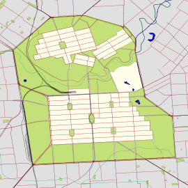
North Terrace is one of the four terraces that bound the central business and residential district of Adelaide, the capital city of South Australia. It runs east–west, along the northern edge of "the square mile". The western end continues on to Port Road, and the eastern end continues across the Adelaide Parklands as Botanic Road.

King William Street is the part of a major arterial road that traverses the CBD and centre of Adelaide, continuing as King William Road to the north of North Terrace and south of South Terrace. At approximately 40 metres (130 ft) wide, King William Street is the widest main street of all the Australian State capital cities. Named after King William IV in 1837, it is historically considered one of Adelaide's high streets, for its focal point of businesses, shops and other prominent establishments. The Glenelg tram line runs along the middle of the street through the city centre.
Greenhill Road is a major road in Adelaide, South Australia, that provides a connection to the eastern and hills suburbs.

The East End is a part of the Adelaide central business district, in the north-east corner of the Adelaide city centre. This area is a popular office and retail district and has an increasing residential interest from the building of high-density luxury apartments in the area.
The Electricity Trust of South Australia (ETSA) was the South Australian Government-owned monopoly vertically integrated electricity provider from 1946 until its privatisation in 1999.

Rymill Park / Murlawirrapurka, and numbered as Park 14, is a recreation park located in the East Park Lands of the South Australian capital of Adelaide. There is an artificial lake with rowboats for hire, a café, children's playground and rose garden, and the Adelaide Bowling Club is on the Dequetteville Terrace side. The Adelaide O-Bahn passes underneath it, to emerge at the western side opposite Grenfell Street.

Adelaide city centre is the inner city locality of Greater Adelaide, the capital city of South Australia. It is known by locals simply as "the City" or "Town" to distinguish it from Greater Adelaide and from the City of Adelaide local government area. The population was 15,115 in the 2016 census.

Pulteney Street is a main road which runs north-south through the middle of the eastern half of the Adelaide city centre, in Adelaide, South Australia. It runs north-south from North Terrace, through Hindmarsh and Hurtle Squares, to South Terrace, where it becomes Unley Road, and subsequently,, becomes Belair Road.
The Tandanya National Aboriginal Cultural Institute, usually referred to as Tandanya, is an art museum located on Grenfell Street in Adelaide, South Australia. It specialises in promoting Indigenous Australian art, including visual art, music and storytelling. It is the oldest Aboriginal-owned and -run cultural centre in Australia.

Bonython Hall is the "great hall" of the University of Adelaide, located in the university grounds and facing North Terrace, Adelaide. The building is on the now-defunct Register of the National Estate and the South Australian Heritage Register. It is primarily used for University graduation ceremonies, examinations, expositions and public lectures and meetings likely to draw large audiences.

Gilles Street is a street in the south-eastern sector of the centre of Adelaide, South Australia. It runs east–west between East Terrace and King William Street, crossing Hutt Street and Pulteney Street. It was named after Osmond Gilles, an early treasurer of the colony of South Australia on 23 May 1837.

Hutt Street is the most easterly of the five major north–south roads running through the City of Adelaide. It runs from Pirie Street to South Terrace, from where it continues south as Hutt Road. Hutt Street is named after Sir William Hutt, a British MP who was heavily involved in colonial South Australia.

Pirie Street is a road on the east side of the Adelaide city centre, South Australia. It runs east–west, between East Terrace and King William Street. After crossing King William Street, it continues as Waymouth Street. It forms the southern boundary of Hindmarsh Square which is in the centre of the north-east quadrant of the city centre.

Grenfell Street is a major street in the north-east quarter of the Adelaide city centre, South Australia. The street runs west-east from King William Street to East Terrace. On the other side of King William Street, it continues as Currie Street. Its intersection with Pulteney Street is encircled by Hindmarsh Square.
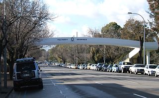
South Terrace is one of the four terraces which bound the city centre of Adelaide, the capital of South Australia.
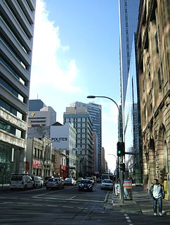
Waymouth Street, often spelt as Weymouth Street in the early days, is an east–west street running between King William Street and West Terrace in the Adelaide city centre in South Australia. The street is named after Henry Waymouth, a founding director of the South Australian Company, whose name was also sometimes spelt as Weymouth.
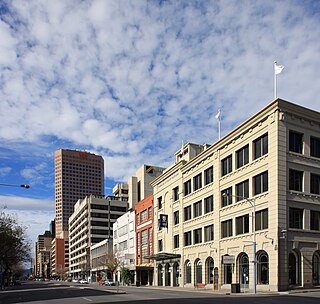
Currie Street is a main street in the Adelaide city centre, South Australia. It runs east–to–west from King William Street, through Light Square, to West Terrace on the western edge of the city centre.

Wakefield Street is a main thoroughfare intersecting the centre of the South Australian capital, Adelaide from east to west.

Frome Street is a street in the East End of the city centre of Adelaide, the capital of South Australia. It runs from North Terrace in the north to Angas Street, and then as Regent Street North to Carrington Street in the south. North of North Terrace, Frome Street continues towards North Adelaide as Frome Road.
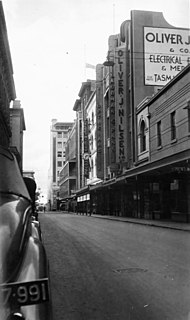
Gawler Place is a single-lane road in the city centre of Adelaide, the capital of South Australia. It runs north to south from North Terrace to Wakefield Street, parallel to and approximately midway between King William and Pulteney Streets.

