Ottawa County is a county located in the U.S. state of Michigan. As of the United States 2020 Census, the population was 296,200. The county seat is Grand Haven. The county is named for the Ottawa Nation, was set off in 1831 and organized in 1837. Ottawa County is included in the Grand Rapids-Kentwood, MI Metropolitan Statistical Area and has a significant Dutch American population.

Burt Township is a civil township of Alger County in the U.S. state of Michigan. As of the 2020 census, its population was 411.
Otisco Township is a civil township of Ionia County in the U.S. state of Michigan. As of the 2000 census, the township population was 2,243. Township offices are located in the community of Smyrna.

Ada Township is a civil township of Kent County in the U.S. state of Michigan. The population was 14,388 at the 2020 census.

Alpine Township is a civil township of Kent County in the U.S. state of Michigan. The population was 14,079 at the 2020 census.
Cannon Township is a civil township of Kent County in the U.S. state of Michigan. The population was 13,336 at the 2010 census.

Chesterfield Charter Township is a charter township of Macomb County in the U.S. state of Michigan. As of the 2020 census the population was 45,376.
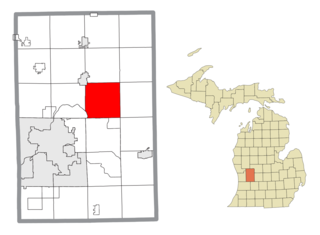
Montcalm Township is a civil township of Montcalm County in the U.S. state of Michigan. The population was 3,394 at the 2020 census, up from 3,350 in 2010.

Allendale is a census-designated place (CDP) in Ottawa County in the U.S. state of Michigan. The population was 17,579 at the 2010 census. It is located within Allendale Charter Township, occupying approximately the northern two-thirds of the township, from the eastern boundary with the Grand River west along Pierce St., north along 75th Ave., then west along Lake Michigan Drive (M-45) to the western boundary of the township. It is a part of the Grand Rapids-Muskegon-Holland, Michigan combined statistical area, and is an exurb of Grand Rapids, due to its major commuter routes into the city.

Allendale Charter Township is a charter township of Ottawa County in the U.S. state of Michigan. At the 2020 Census, the township population was 26,583. Allendale Charter Township is best known as being home to the main campus of Grand Valley State University.
Chester Township is a civil township of Ottawa County in the U.S. state of Michigan. As of the 2000 United States Census, the township population was 2,315.
Polkton Charter Township is a charter township of Ottawa County in the U.S. state of Michigan. The population was 2,335 at the 2000 census. It was organized in 1845.
Tallmadge Charter Township is a charter township of Ottawa County in the U.S. state of Michigan. The population was 7,575 at the 2010 census.
Wright Township is a civil township of Ottawa County in the U.S. state of Michigan. The population was 3,147 at the 2010 census.

Owosso Township, formally named Owosso Charter Township, is a charter township of Shiawassee County in the U.S. state of Michigan. The population was 4,821 at the 2010 census. The township borders the city of Owosso on the east, but the two are administered autonomously.

Coopersville is a city located in north central Ottawa County in the U.S. state of Michigan. The population was 4,828 at the 2020 census. It is primarily a farming community.
Crockery Township is a civil township of Ottawa County in the U.S. state of Michigan. As of the 2010 census, the township population was 3,960.
Nunica is an unincorporated community in the U.S. state of Michigan. The community is located near the center of Crockery Township in Ottawa County, close to the junction of Interstate 96 (I-96) M-104 and M-231 at 43°04′47″N86°04′02″W. The first white settlers were Manley Patchin in 1836 and William Hathaway, Jr., in 1839. Hathaway became the first postmaster of Crockery Creek on February 7, 1848. The name of the post office was changed to Nunica on January 8, 1859. The settlement was first platted by Henry Ernst in 1865. The name Nunica is derived from the Native American word menonica, meaning "clay earth", from which pottery was made. This clay was also the origin for the name of Crockery Creek. The Nunica ZIP code 49448 serves most of Crockery Township, as well as portions of Sullivan Township in Muskegon County to the north and small areas of Polkton Township to the east.

Eagle River is an unincorporated community and census-designated place (CDP) in the U.S. state of Michigan. It is the county seat of Keweenaw County. Its population was 65 at the 2020 census, which makes it by far the least-populated county seat in the state of Michigan. As an unincorporated community, Eagle River has no legal autonomy and is part of Allouez Township and Houghton Township.
Home Township is a civil township of Montcalm County in the U.S. state of Michigan. As of the 2020 census, the township population was 2,716.