| Edgehead | |
|---|---|
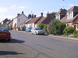 Village of Edgehead | |
 Edgehead Location within Midlothian | |
| Population | 115 (2008) |
| OS grid reference | NT373650 |
| Council area | |
| Shire county | |
| Country | Scotland |
| Sovereign state | United Kingdom |
| Post town | Pathhead |
| Postcode district | EH37 |
| Dialling code | 01875 |
| Police | Scotland |
| Fire | Scottish |
| Ambulance | Scottish |
| UK Parliament | |
| Scottish Parliament | |
Edgehead (also known as Chesterhill) is a village in Midlothian, Scotland.

