
The Pyrenees are a mountain range straddling the border of France and Spain. They extend nearly 500 km (310 mi) from their union with the Cantabrian Mountains to Cap de Creus on the Mediterranean coast, reaching a maximum altitude of 3,404 metres (11,168 ft) at the peak of Aneto.
Hautes-Pyrénées is a department in the region of Occitania, southwestern France. The department is bordered by Pyrénées-Atlantiques to the west, Gers to the north, Haute-Garonne to the east, as well by the Spanish province of Huesca in the autonomous community of Aragon to the south. In 2019, its population was 229,567; its prefecture is Tarbes. It is named after the Pyrenees mountain range.
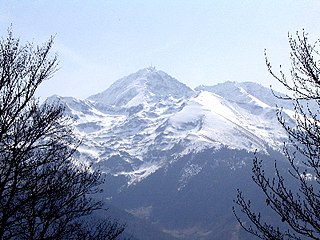
The Pic du Midi de Bigorre or simply the Pic du Midi is a mountain in the French Pyrenees. It is the site of the Pic du Midi Observatory.
Pic du Midi or Pic-du-Midi may refer to:

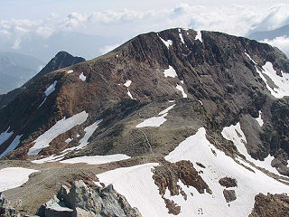
The Pic du Midi d'Ossau is a mountain rising above the Ossau Valley in the French Pyrenees. Despite possessing neither a glacier nor, in the context of the range, a particularly high summit, its distinctive shape makes it a symbol of the French side of the Pyrenees. This familiar shape also makes it easily recognisable from afar, and it is particularly distinctive from the Boulevard des Pyrénées in Pau, some 55 km to the north.

The Gave d'Ossau is the torrential river flowing through the Ossau Valley, one of the three main valleys of the High-Béarn (Pyrénées-Atlantiques), in the Southwest of France.

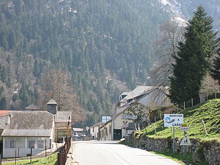
The village of La Mongie is at 1,800 m (5,900 ft) altitude. There are also residences at 1850 and the Tourmalet building at 1900. It lies below the Col du Tourmalet 2,115 m (6,939 ft). It is in the canton of Campan in the Midi-Pyrénées region of France and around 20 kilometres (12 mi) from the Spanish border. La Mongie is a winter ski resort offering alpine skiing, snowboarding, snowpark, cross-country skiing, snowmobiles and hiking in snowshoes. In the summer cycling and the use of trials motorcycles is popular. The village has two small supermarkets, a tourist information centre, gift shops and many restaurants and ski rental shops. The nearby spa town of Bagnères-de-Bigorre offers large supermarkets and shops, restaurants, a casino, an 18-hole golf course and the natural spa baths themselves.

Louis François Élisabeth Ramond, baron de Carbonnières, was a French politician, geologist and botanist. He is regarded as one of the first explorers of the high mountains of the Pyrenees who can be described as a pyreneist.
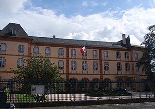
Bourréac is a commune in the Hautes-Pyrénées department in southwestern France near the city of Lourdes (4,5 km).
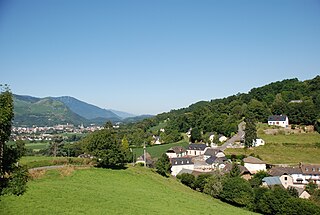
Laruns is a commune in the Pyrénées-Atlantiques department in south-western France.

The Boulevard des Pyrénées is a boulevard in the town of Pau in the Pyrénées-Atlantiques département of south-west France. With buildings on its northern side only, and a terrace overlooking the valley of the Gave de Pau to its south, the boulevard is notable for its panoramic view of the peaks of the Pyrenees some 50 km to the south.
Gabas is a hamlet in the valley of the Gave d'Ossau in the French Pyrenees. It is located where that river is formed by the confluence of two mountain streams, the Gave de Bious and the Gave du Brousset, which flow respectively from the western and eastern sides of the Pic du Midi d'Ossau.
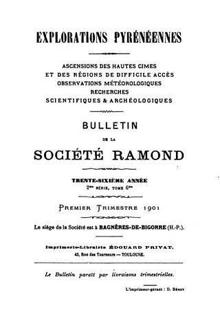
The Société Ramond is a French learned society devoted to the study of the Pyrenees mountain range that forms a natural border between France and Spain. It is named after the French politician, geologist, botanist and explorer Louis Ramond de Carbonnières and is based in Bagnères-de-Bigorre in southwestern France.

Erebia cassioides, the common brassy ringlet, is a member of the subfamily Satyrinae of family Nymphalidae.

Puig Neulós is the highest mountain of Albera Range, an eastern prolongation of the Pyrenees in Catalonia, between France and Spain. It has an elevation of 1,256 metres above sea level.
Bisaurin, or less frequently Visaurin, is a mountain on the Spanish side of the Pyrenees, located in the northwest of Jacetania comarca, in Aragon. At 2,668 m (8,893 ft) high, it is the highest peak between the Atlantic Ocean and the Pic du Midi d'Ossau. Its summit boasts views of many peaks including the Pic du Midi d'Ossau, the Balaïtous, and the central Pyrenean summits and Collarada to the east, as well as the Pic d'Anie to the northwest.

The Casque du Marboré, or Casque de Gavarnie or simply le Casque, is a pyrenean summit, culminating at 3,006 m (9,862 ft), located on the crest of three-thousanders in the Monte Perdido Range above Cirque de Gavarnie on the Franco-Spanish border.

Pic du Taillon or Pico Taillón is a summit in the Pyrenees, culminating at 3,144 m (10,315 ft) on the Franco-Spanish border in the Monte Perdido Range.
Pic de Montcalm is a French pyrenean summit, culminating at 3,077 m (10,095 ft), located in the Ariège department, Midi-Pyrénées region of France.
