Lincoln is a cathedral city and district in Lincolnshire, England, of which it is the county town. In the 2021 Census, the city's district had a population of 103,813. The 2021 census gave the urban area of Lincoln, including Bracebridge Heath, North Hykeham, South Hykeham and Waddington, a recorded population of 127,540.

Sleaford is a market town and civil parish in the North Kesteven district of Lincolnshire, England. On the edge of the Fenlands, it is 11 miles north-east of Grantham, 16 mi (26 km) west of Boston, and 17 mi (27 km) south of Lincoln. It is the largest settlement in North Kesteven with a population of 19,807 in 2021. Centred on the former parish of New Sleaford, the modern boundaries and urban area include Quarrington to the south-west, Holdingham to the north-west and Old Sleaford to the east. The town is bypassed by the A17 and the A15 roads, which link it to Lincoln, Newark, Peterborough, Grantham, Boston and King's Lynn. Sleaford railway station is on the Nottingham to Skegness and Peterborough to Lincoln lines.

The A46 is a major A road in England. It starts east of Bath, Somerset and ends in Cleethorpes, Lincolnshire, but it does not form a continuous route. Large portions of the old road have been lost, bypassed, or replaced by motorway development. Between Leicester and Lincoln the road follows the course of the Roman Fosse Way, but between Bath and Leicester, two cities also linked by the Fosse Way, it follows a more westerly course.

Horncastle is a market town and civil parish in the East Lindsey district in Lincolnshire, England. It is 17 miles (27 km) east of Lincoln. Its population was 6,815 at the 2011 census and estimated at 7,123 in 2019. A section of the ancient Roman walls remains.

Stamford is a town and civil parish in the South Kesteven district of Lincolnshire, England. The population at the 2011 census was 19,701 and estimated at 20,645 in 2019. The town has 17th- and 18th-century stone buildings, older timber-framed buildings and five medieval parish churches. It is a frequent film location. In 2013 it was rated a top place to live in a survey by The Sunday Times. Its name has been passed on to Stamford, Connecticut, founded in 1641.

West Lindsey is a local government district in Lincolnshire, England. Its council is based in Gainsborough, the district's largest town. The district also includes the towns of Caistor and Market Rasen, along with numerous villages and surrounding rural areas. The east of the district includes part of the Lincolnshire Wolds, a designated Area of Outstanding Natural Beauty.

Nettleham is a village and civil parish within the West Lindsey district of Lincolnshire, England, 4 miles (6.4 km) north-east of Lincoln between the A46 and A158.

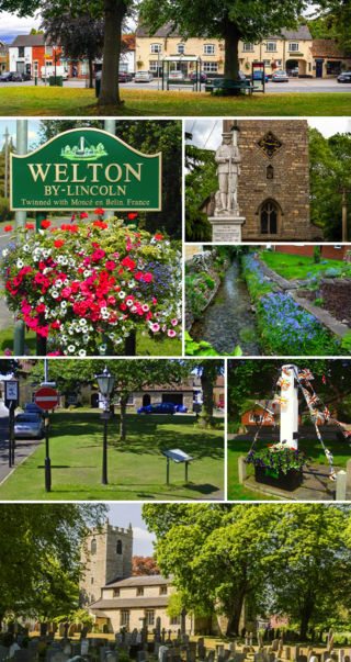
Welton is a large village and civil parish in the West Lindsey district of Lincolnshire, England. The population of the civil parish was recorded as 4,327 in the 2011 census. It is geographically situated 6 miles (9.7 km) north from Lincoln. The name Welton by Lincoln is also used to distinguish from other similarly named villages in Lincolnshire: Welton le Wold and Welton le Marsh.
Lincolnshire is a large county in England with a sparse population distribution, which leads to problems funding all sorts of transport. The transport history is long and varied, with much of the road network still based on the Roman model, and the once extensive rail network a shadow of its former self.

Saxilby is a village and civil parish in the West Lindsey district of Lincolnshire, England, about 6 miles (9.7 km) north-west from Lincoln, on the A57 road at the junction of the B1241. It is part of the civil parish of Saxilby and Ingleby, which includes the village of Ingleby. The population of the civil parish in 2001 was 3,679, increasing to 3,992 at the 2011 census.

Kirton in Lindsey, also abbreviated to Kirton Lindsey, is a market town and civil parish in North Lincolnshire, England. It is 7 miles (11 km) south-east from Scunthorpe.

Great Ponton is an English village and civil parish in the South Kesteven district of Lincolnshire, 3 miles (5 km) south of Grantham on the A1 trunk road, which bisects the village. The tower of the parish church is a roadside landmark. The 2001 census recorded a population of 333, of whom all were of white ethnic origin and 87 per cent described themselves as Christian. The average age was 40. The population of the civil parish had risen to 379 at the 2011 census. It was estimated at 369 in 2019.

Dunholme is a village and civil parish in the West Lindsey district of Lincolnshire, England. It is situated on the A46 road, and 5 miles (8 km) north-east of Lincoln. The earliest written evidence concerning Dunholme is found in the 1086 Domesday Book.

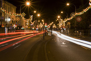
High Street in Lincoln, Lincolnshire, England extends from the St Catherine's roundabout and ends approximately 1.2 miles further north at The Strait. The historic High Street has evolved through many changes over its 2000 year history, encompassing Roman roads and settlement, medieval buildings, markets, places of worship, civic buildings, bridges, the arrival of the railways and heavy industry.

The A607 is an A road in England that starts in Belgrave, Leicester and heads northeastwards through Leicestershire and the town of Grantham, Lincolnshire, terminating at Bracebridge Heath, a village on the outskirts of Lincoln. It is a primary route from Thurmaston to the A1 junction at Grantham.

Skellingthorpe is a village and civil parish in the North Kesteven district of Lincolnshire, England. The population of the village at the 2011 census was 3,465. It is situated 3 miles (5 km) west of Lincoln, 4 miles (6 km) southeast of Saxilby, 6 miles (10 km) northwest of North Hykeham and 15 miles (24 km) east of Tuxford.
William Farr School, formally William Farr C of E Comprehensive School, is a Church of England academy school for 11 to 18-year-olds in the village of Dunholme, Lincolnshire but officially in Welton, Lincolnshire, England, 8 km (5 mi) north-east of Lincoln, near the A46. Despite officially being a part of Welton, most of the school grounds are in the civil parish of Dunholme.

Lincoln City Centre is the historical and cultural area of Lincoln in Lincolnshire, England. It is defined as the areas along the city's High Street. Each part of the centre brings a differing main sector or sectors to the city with a small overlap between each area.

Ermine is an inner-city suburb and housing estate of Lincoln in Lincolnshire, England. Located to the north of the city, it is named after Ermine Street. The area is one of the city's largest suburbs and was at one point the roughest area of Lincoln. It also includes the neighborhoods of Ermine East and Ermine West.

Ermine East is a neighborhood of Lincoln in Lincolnshire, England. It is one of two parts of the wider district of Ermine along with Ermine West. It is bordered by the A15 road to the north and the A46 road at Riseholme Roundabout. It also bordered by the B1226 road to the west, the B1273 road to the south, and the B1182 road to the southeast and east. Its main shopping centres are both the Carlton Centre and Woodhall Drive/Sudbrooke Drive. It has been nicknamed the "roughest neighbourhood of Lincoln".


