
The Los Angeles Basin is a sedimentary basin located in southern California, in a region known as the Peninsular Ranges. The basin is also connected to an anomalous group of east-west trending chains of mountains collectively known as the California Transverse Ranges. The present basin is a coastal lowland area, whose floor is marked by elongate low ridges and groups of hills that is located on the edge of the Pacific plate. The Los Angeles Basin, along with the Santa Barbara Channel, the Ventura Basin, the San Fernando Valley, and the San Gabriel Basin, lies within the greater southern California region. On the north, northeast, and east, the lowland basin is bound by the Santa Monica Mountains and Puente, Elysian, Repetto hills. To the southeast, the basin is bordered by the Santa Ana mountains and the San Joaquin Hills. The western boundary of the basin is marked by the Continental Borderland and is part of the onshore portion. The California borderland is characterized by north-west trending offshore ridges and basins. The Los Angeles Basin is notable for its great structural relief and complexity in relation to its geologic youth and small size for its prolific oil production. Yerkes et al. identify 5 major stages of the basin's evolution that begins in the Upper Cretaceous and ends in the Pleistocene. This basin can be classified as an irregular pull-apart basin accompanied by rotational tectonics during the post-early Miocene.

The Roxbury Conglomerate, also informally known as Roxbury puddingstone, is a name for a rock formation that forms the bedrock underlying most of Roxbury, Massachusetts, now part of the city of Boston. The bedrock formation extends well beyond the limits of Roxbury, underlying part or all of Quincy, Canton, Milton, Dorchester, Dedham, Jamaica Plain, Brighton, Brookline, Newton, Needham, and Dover. It is named for exposures in Roxbury, Boston area.

Alderley Edge in Cheshire is one of the classic locations for the study of Triassic sandstones in the United Kingdom]. Numerous scientists from the early 19th century up to the present day have studied the area and it is a popular field site for universities around the UK.
The Enon Formation is a geological formation found in the Eastern and Western Cape provinces in South Africa. It is the lowermost of the four formations found within the Uitenhage Group of the Algoa Basin, its type locality, where it has been measured at a maximum thickness of 480 metres (1,570 ft). Discontinuous outcrops are also found in the Worcester-Pletmos and Oudshoorn-Gamtoos Basins, including isolated occurrences in the Haasvlakte, Jubilee, and Soutpansvlakte Basins near the small town Bredasdorp.
Igneous rocks are found in Bukit Timah, Woodlands, and Pulau Ubin island. Granite makes up the bulk of the igneous rock. Gabbro is also found in the area and is found in an area called Little Guilin, named for its resemblance to Guilin in Southern China. This area is in Bukit Gombak. Sedimentary rocks are found on the western part of Singapore, and is mainly made of sandstone and mudstones. It also includes the southwestern area. Metamorphic rocks are found in the northeastern part of Singapore, and also on Pulau Tekong, off the east coast of Singapore. The rocks are mainly made up of quartzite, and also make up the Sajahat Formation.

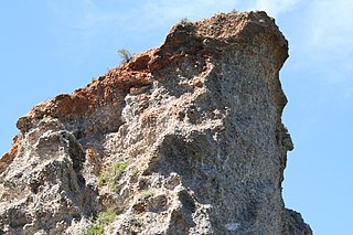
The Hakatai Shale is a Mesoproterozoic rock formation that outcrops in the Grand Canyon, Coconino County, Arizona. It consists of colorful strata that exhibit colors that vary from purple to red to brilliant orange on outcrop. The colors are the result of the oxidation of iron-bearing minerals in the Hakatai Shale. It consists of lower and middle members that consist of bright-red, slope-forming, highly fractured, argillaceous mudstones and shale and an upper member composed of purple and red, cliff-forming, medium-grained sandstone. Its thickness, which apparently increases eastwards, varies form 137 to 300 m. In general, the Hakatai Shale and associated strata of the Unkar Group rocks dip northeast (10°-30°) toward normal faults that dip 60° or more toward the southwest. This can be seen at the Palisades fault in the eastern part of the main Unkar Group outcrop area. In addition, thick, prominent, and dark-colored basaltic sills and dikes cut across the purple to red to brilliant orange strata of the Hakatai Shale.
The Caerfai Group is a Cambrian lithostratigraphic group in west Wales. The name is derived from Caerfai Bay on the north coast of St Brides Bay on the Pembrokeshire coast where the strata are well exposed in coastal cliffs. This rock succession has previously been known variously as the Caerfai Series, Caerfai Formation and Caerfai Beds and largely ascribed to the British regional stratigraphic unit Comley Epoch, though these terms are now obsolete.

The Menevian Group is a Cambrian lithostratigraphic group in west Wales. The name is derived from Menevia, the Roman name for the St Davids area north of St Brides Bay on Pembrokeshire’s west coast where the strata are well exposed in coastal cliffs. This rock succession has previously been known variously as the Menevian Series and Menevian Beds and largely ascribed to the British regional stratigraphic unit St David’s Epoch, though these terms are now obsolete.

The La Toca Formation is a geologic formation in the northern and eastern part of the Dominican Republic. The formation, predominantly an alternating sequence of marls and turbiditic sandstones, breccias and conglomerates, is renowned for the preservation of insects and other arthropods in amber, known as Dominican amber. The formation is dated to the Burdigalian to Langhian stages of the Miocene period.

Santo Domingo Formation is a mainly marine Miocene sedimentary formation located in south–central Chile. The formation was defined by R. Martínez Pardo and Mario Pino in 1979 and named after the roadcut locality they studied about 19 kilometres (12 mi) southeast of Valdivia. Sediments of the formation accumulated in Valdivia and Osorno–Llanquihue Basin.
Pan de Azúcar Formation is a geologic formation of Hettangian–Sinemurian (Jurassic) age made up of chiefly by sandstone, tuff, mudstone and limestone. The formation is located in the Coast Range of northern Chile. The formation interdigitates and is coeval with the Posada de los Hidalgo Formation. It concordantly overlies the Cifuncho Formation and is overlain by the La Negra Formation.
Way Group is a geologic group of Lower Cretaceous age located in northern Chile. The sediments of the group deposited in Coloso Basin, a small intra-arc basin made up by a half graben. The now inactive Coloso Basin is elongated along a NNW-SSE oriented axis and has its southwestern border made up by faults.
Estratos de Pupunahue is the name given to the sedimentary strata of Oligocene-Miocene age that crop out in Pupunahue and Mulpún near Valdivia, Chile. Outside this locality Estratos de Pupunahue extends below the surface over a larger area. The thickness of the strata varies from a few meters to 530 meters. The strata were initially described by Henning Illies. The strata are made up of conglomerate, sandstone and mudstone. The clast of the conglomerates are made up of metamorphic rock and the disposition of the conglomerates varies from clast-supported to matrix-supported. The sandstone and mudstone contain layers of lignite coal that exceed 30 cm in thickness.
Nacientes del Biobío Formation is a geological formation that crops out near the uppermost reaches of Bío Bío River, in south-central Chile, and nearby areas of Argentina. The formation is made up of basalt and pyroclastic rocks and marine sedimentary rocks, such as sandstone and mudstone. Some less abundant sedimentary lithologies are conglomerate, volcaniclastic sedimentary rock. The formation is intruded by Grupo Plutónico Galletué which is of Late Jurassic to Late Cretaceous age. Further north in Chile the formation is similar to Nacientes del Teno Formation while in Argentina it is similar to Los Molles Formation and Lotena Formation.
Cheuquemó Formation is a geological formation of sedimentary rock in south-central Chile. The sediments of the formation were deposited during the Late Oligocene and Early Miocene epochs. The formations lower sections are made up of conglomerate, then successions of sandstone, tuff and mudstone rich in organic material follows. The formation indicates that sedimentation occurred in a estuarine (paralic) and other non-marine (continental) environments. It contains fossils of the following genera: Mytilus, Cardium and Turritella. Stratigraphically it overlies the Bahía Mansa Metamorphic Complex and underlies the Miocene Santo Domingo Formation.
Parga Formation is a geological formation of sedimentary rock in south-central Chile. The sediments of the formation were deposited during the Late Oligocene and Middle Miocene epochs. The formation's lower sections are made up of conglomerate, sandstone and mudstone some of which is rich in organic material. Additionally there are thin beds of tuff and coal. The formation's composition indicates that sedimentation occurred in a estuarine (paralic) and marine environments. Stratigraphically it overlies the Bahía Mansa Metamorphic Complex and is similar in age and type to Lacui Formation to the south and Cheuquemó and Santo Domingo Formation to the north. It is overlain across an angular unconformity by Pliocene or Quaternary sediments. The formation is intruded by porphyritic trachyte of Oligocene to Miocene age. The outcrops of the formation are restricted to a NW-SE strip near Caleta Parga north of the estuary of Maullín River.
Mininco Formation is a geological formation composed of sediments that deposited during the Pliocene in central Chile. Near Angol the formation reaches thicknesses of up to 300 m. The upper strata of the formation contain tuff layers and coal beds that are rich in leaf fossils. Other fossils that have been found in the formation include fresh-water diatoms and bivalves.
Mulpún is a coal mine and locality in Los Ríos Region, Chile. Mulpún lies in the commune of Máfil a few kilometers to the west of the Chile Route 5 and north of the Calle-Calle and San Pedro River.
The geology of Morocco formed beginning up to two billion years ago, in the Paleoproterozoic and potentially even earlier. It was affected by the Pan-African orogeny, although the later Hercynian orogeny produced fewer changes and left the Maseta Domain, a large area of remnant Paleozoic massifs. During the Paleozoic, extensive sedimentary deposits preserved marine fossils. Throughout the Mesozoic, the rifting apart of Pangaea to form the Atlantic Ocean created basins and fault blocks, which were blanketed in terrestrial and marine sediments—particularly as a major marine transgression flooded much of the region. In the Cenozoic, a microcontinent covered in sedimentary rocks from the Triassic and Cretaceous collided with northern Morocco, forming the Rif region. Morocco has extensive phosphate and salt reserves, as well as resources such as lead, zinc, copper and silver.

The Omingonde Formation is an Early to Middle Triassic geologic formation, part of the Karoo Supergroup, in the western Otjozondjupa Region and northeastern Erongo Region of north-central Namibia. The formation has a maximum thickness of about 600 metres (2,000 ft) and comprises sandstones, shales, siltstones and conglomerates, was deposited in a fluvial environment, alternating between a meandering and braided river setting.

