Fauncetown, Pennsylvania

Last updated
Fauncetown, Pennsylvania
USA Pennsylvania location map.svg
Red pog.svg
Fauncetown, Pennsylvania
Usa edcp location map.svg
Red pog.svg
Fauncetown, Pennsylvania
Coordinates: 41°37′09″N79°51′25″W / 41.61917°N 79.85694°W / 41.61917; -79.85694 Coordinates: 41°37′09″N79°51′25″W / 41.61917°N 79.85694°W / 41.61917; -79.85694
Country United States
State Pennsylvania
County Crawford
Elevation
1,329 ft (405 m)
Time zone UTC-5 (Eastern (EST))
  Summer (DST) UTC-4 (EDT)
Area code(s) 814
GNIS feature ID1203558 [1]

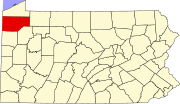
Fauncetown is an unincorporated community in Crawford County, Pennsylvania, United States. [1] [2]

Crawford County, Pennsylvania County in the United States

Crawford County is a county located in the U.S. state of Pennsylvania. As of the 2010 census, the population was 88,765. Its county seat is Meadville. The county was created on March 12, 1800, from part of Allegheny County and named for Colonel William Crawford.

Pennsylvania State of the United States of America

Pennsylvania, officially the Commonwealth of Pennsylvania, is a state located in the northeastern, Great Lakes and Mid-Atlantic regions of the United States. The Appalachian Mountains run through its middle. The Commonwealth is bordered by Delaware to the southeast, Maryland to the south, West Virginia to the southwest, Ohio to the west, Lake Erie and the Canadian province of Ontario to the northwest, New York to the north, and New Jersey to the east.

Notes

  1. 1 2 "Fauncetown, Pennsylvania". Geographic Names Information System . United States Geological Survey.
  2. Fauncetown Topo Map in Crawford County PA

Related Research Articles

Warren County, Pennsylvania County in the United States

Warren County is a county located in the U.S. state of Pennsylvania. As of the 2010 census, the population was 41,815. Its county seat is Warren. The county was formed in 1800 from parts of Allegheny and Lycoming counties; attached to Crawford County until 1805 and then to Venango County until Warren was formally organized in 1819.

Venango County, Pennsylvania County in the United States

Venango County is a county located in the Commonwealth of Pennsylvania. As of the 2010 census, the population was 54,984. Its county seat is Franklin. The county was created in 1800 and later organized in 1805.

Erie County, Pennsylvania County in the United States

Erie County is a county located in the U.S. state of Pennsylvania. As of the 2018, the population was 272,061. Its county seat is Erie. The county was created in 1800 and later organized in 1803.

Bloomfield Township, Crawford County, Pennsylvania Township in Pennsylvania, United States

Bloomfield Township is a township in Crawford County, Pennsylvania, United States. The population was 1,919 at the 2010 census.

Cambridge Township, Crawford County, Pennsylvania Township in Pennsylvania, United States

Cambridge Township is a township in Crawford County, Pennsylvania, United States. The population was 1,563 at the 2010 census.

Cambridge Springs, Pennsylvania Home Rule Municipality in Pennsylvania, United States

Cambridge Springs is a borough with home rule status in Crawford County, Pennsylvania, United States. The population was 2,595 at the 2010 census.

Buells Corners is an unincorporated community in Crawford County, Pennsylvania, United States, located in the northwest part of the state. The village is located at the intersection of Pennsylvania Route 89 and Buells Corners Road in Rome Township.

Oil Creek (Allegheny River tributary) river in the United States of America

Oil Creek is a 46.7-mile (75.2 km) tributary of the Allegheny River in Venango and Crawford counties in the U.S. state of Pennsylvania. It has a drainage area of 319 square miles (830 km2) and joins the Allegheny at Oil City. Attractions along the river include the Drake Well Museum and Oil Creek State Park. The stream was named after the oil that was found along its banks before the historic oil strike by Edwin Drake in Titusville, which Oil Creek flows through. Oil Creek is popular with canoeists and fishers. The creek is rated as a beginners creek for those interested in learning how to safely use canoes and kayaks. Oil Creek is a cold water fishery with bass and trout living in its waters.

Pennsylvanias 16th congressional district

Pennsylvania's 16th congressional district is located in Northwestern Pennsylvania. It contains all of Erie County, Crawford County, Mercer County, and Lawrence County, as well as part of Butler County. The district is represented by Republican Mike Kelly.

Pennsylvania's 25th congressional district was one of Pennsylvania's districts of the United States House of Representatives.

William Crawford was a member of the United States House of Representatives from Pennsylvania.

George Sweeny was a U.S. Representative from Ohio.

Pennsylvania House of Representatives, District 17

The 17th Pennsylvania House of Representatives District is located in northwestern Pennsylvania and has been represented by Republican Parke Wentling since 2015.

Pennsylvania House of Representatives, District 65

The 65th Pennsylvania House of Representatives District is in Northeastern Pennsylvania and has been represented by Kathy Rapp since 2005.

National Register of Historic Places listings in Crawford County, Pennsylvania Wikimedia list article

This is a list of the National Register of Historic Places listings in Crawford County, Pennsylvania.

Custards, Pennsylvania Unincorporated settlement in Pennsylvania, United States

Custards is an unincorporated community in Crawford County, Pennsylvania, United States. Custards is located on Pennsylvania Route 285 west of Cochranton and is near Interstate 79 and U.S. Route 19.

Frenchtown, Pennsylvania Unincorporated settlement in Pennsylvania, United States

Frenchtown is an unincorporated community in Crawford County, Pennsylvania, United States. It is located in East Mead Township on Pennsylvania Route 27 east of Meadville.

Erie–Meadville, PA Combined Statistical Area Place in Pennsylvania, United States

The Erie–Meadville, PA Combined Statistical Area (CSA) is made up of two counties in northwestern Pennsylvania. The United States Office of Management and Budget has recognized the Erie and Meadville areas along with the counties of Erie and Crawford to make a Combined Statistical Area, located in northwestern Pennsylvania. Though these county line boundaries are rather arbitrary since Erie serves as the regional hub for the bordering areas of southwestern New York and northeastern Ohio. As of the 2010 United States Census the CSA had a population total of 369,331. The Combined Statistical Area ranked 7th in the state of Pennsylvania and 102nd in the United States.

Espyville, Pennsylvania Unincorporated community in Pennsylvania, United States

Espyville is an unincorporated community in North Shenango Township, Crawford County, Pennsylvania, United States.