Springboro, Pennsylvania

Last updated
Springboro, Pennsylvania
Main and Beaver in Springboro.jpg
Commercial district at the crossroads
Crawford County Pennsylvania Incorporated and Unincorporated areas Springboro Highlighted.svg
Location of Springboro in Crawford County, Pennsylvania.
USA Pennsylvania location map.svg
Red pog.svg
Springboro
Location of Springboro in Pennsylvania
Coordinates: 41°48′0″N80°22′16″W / 41.80000°N 80.37111°W / 41.80000; -80.37111
CountryUnited States
State Pennsylvania
County Crawford
Founded1800
Area
[1]
  Total0.83 sq mi (2.15 km2)
  Land0.83 sq mi (2.15 km2)
  Water0.00 sq mi (0.00 km2)
Elevation
[2] (middle of borough)
940 ft (290 m)
Highest elevation
[2] (northeast corner of borough)
1,100 ft (300 m)
Lowest elevation
[2] (Conneaut Creek)
890 ft (270 m)
Population
 (2020)
  Total376
  Estimate 
(2022) [3]
371
  Density538.00/sq mi (207.75/km2)
Time zone UTC-4 (EST)
  Summer (DST) UTC-5 (EDT)
Area code 814

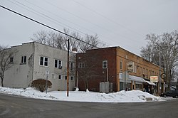
Springboro is a borough in Crawford County, Pennsylvania, United States, located 35 miles southwest of Erie. The population was 376 at the 2020 census, [3] down from 477 at the 2010 census. [4]

Contents

History

Incorporated as a borough in the spring of 1866, the crossroads officially became Springboro in 1840. 2015 is the 175th year.

Geography

Springboro is located in northwestern Crawford County at 41°48′0″N80°22′16″W / 41.80000°N 80.37111°W / 41.80000; -80.37111 (41.800055, -80.371031). [5] It is surrounded by Spring Township, a separate municipality.

Pennsylvania Route 18 passes through the center of town, leading north 6 miles (10 km) to Albion and south 3 miles (5 km) to Conneautville.

According to the United States Census Bureau, the borough has a total area of 0.83 square miles (2.15 km2), all land. [4] Conneaut Creek flows northward through the western side of the borough on its way to Lake Erie.

Demographics

Historical population
CensusPop.Note
1870 323
1880 37917.3%
1890 49029.3%
1900 60323.1%
1910 6141.8%
1920 542−11.7%
1930 487−10.1%
1940 57017.0%
1950 6117.2%
1960 583−4.6%
1970 5840.2%
1980 557−4.6%
1990 471−15.4%
2000 4914.2%
2010 477−2.9%
2020 376−21.2%
2022 (est.)371 [3] −1.3%
Sources: [6] [7] [8] [9]

As of the census [7] of 2000, there were 491 people, 183 households, and 133 families residing in the borough. The population density was 577.5 inhabitants per square mile (223.0/km2). There were 208 housing units at an average density of 244.6 per square mile (94.4/km2). The racial makeup of the borough was 96.33% White, 3.46% African American and 0.20% Native American.

There were 183 households, out of which 32.8% had children under the age of 18 living with them, 51.4% were married couples living together, 12.6% had a female householder with no husband present, and 27.3% were non-families. 24.0% of all households were made up of individuals, and 9.8% had someone living alone who was 65 years of age or older. The average household size was 2.68 and the average family size was 3.17.

In the borough the population was spread out, with 27.3% under the age of 18, 9.2% from 18 to 24, 30.1% from 25 to 44, 20.2% from 45 to 64, and 13.2% who were 65 years of age or older. The median age was 34 years. For every 100 females there were 99.6 males. For every 100 females age 18 and over, there were 89.9 males.

The median income for a household in the borough was $36,875, and the median income for a family was $40,694. Males had a median income of $29,632 versus $18,750 for females. The per capita income for the borough was $14,258. About 6.5% of families and 9.7% of the population were below the poverty line, including 11.0% of those under age 18 and 5.6% of those age 65 or over.

Religion

The Monastery of the Nativity of the Most Holy Theotokos is located 1 mile (1.6 km) north of Springboro. The monastery is under the jurisdiction of the Serbian Orthodox Church.

Related Research Articles

<span class="mw-page-title-main">Bloomfield Township, Crawford County, Pennsylvania</span> Township in Pennsylvania, United States

Bloomfield Township is a township in Crawford County, Pennsylvania, United States. The population was 1,867 at the 2020 census.

<span class="mw-page-title-main">Blooming Valley, Pennsylvania</span> Borough in Pennsylvania, United States

Blooming Valley is a borough in Crawford County, Pennsylvania, United States. The population was 342 at the 2020 census, up from 337 at the 2010 census.

<span class="mw-page-title-main">Cambridge Township, Crawford County, Pennsylvania</span> Township in Pennsylvania, United States

Cambridge Township is a township in Crawford County, Pennsylvania, United States. The population was 1,447 at the 2020 census.

<span class="mw-page-title-main">Centerville, Crawford County, Pennsylvania</span> Borough in Pennsylvania, United States

Centerville is a borough in Crawford County, Pennsylvania, United States. The population was 176 at the 2020 census, down from 218 at the 2010 census. It was established in 1812.

<span class="mw-page-title-main">Cochranton, Pennsylvania</span> Borough in Pennsylvania, United States

Cochranton is a borough in Crawford County, Pennsylvania, United States. The population was 1,124 at the 2020 census, down from 1,136 as of the 2010 census.

<span class="mw-page-title-main">Conneaut Lake, Pennsylvania</span> Borough in Pennsylvania, United States

Conneaut Lake is a borough in Crawford County, Pennsylvania, located at the southern end of the lake of the same name. The population was 625 at the 2020 census, down from 653 at the 2010 census.

<span class="mw-page-title-main">Conneautville, Pennsylvania</span> Borough in Pennsylvania, United States

Conneautville is a borough in Crawford County, Pennsylvania, United States, situated along Conneaut Creek. The population was 736 at the 2020 census, down from 774 at the 2010 census.

<span class="mw-page-title-main">Cussewago Township, Crawford County, Pennsylvania</span> Township in Pennsylvania, United States

Cussewago Township is a township in Crawford County, Pennsylvania, United States. The population was 1,430 at the 2020 census.

<span class="mw-page-title-main">Pine Township, Crawford County, Pennsylvania</span> Township in Pennsylvania, United States

Pine Township is a township in Crawford County, Pennsylvania, United States. The population was 432 at the 2020 census, down from 462 at the 2010 census.

<span class="mw-page-title-main">Rockdale Township, Crawford County, Pennsylvania</span> Township in Pennsylvania, United States

Rockdale Township is a township in Crawford County, Pennsylvania, United States. The population was 1,363 at the 2020 census, down from 1,506 at the 2010 census.

<span class="mw-page-title-main">Sadsbury Township, Crawford County, Pennsylvania</span> Township in Pennsylvania, United States

Sadsbury Township is a township in Crawford County, Pennsylvania, United States. The population was 2,752 at the 2020 census, down from 2,933 at the 2010 census.

<span class="mw-page-title-main">Saegertown, Pennsylvania</span> Borough in Pennsylvania, United States

Saegertown is a borough in Crawford County, Pennsylvania. The population was 869 at the time of the 2020 census, down from 997 at the 2010 census. It was established in 1824.

<span class="mw-page-title-main">South Shenango Township, Crawford County, Pennsylvania</span> Township in Pennsylvania, United States

South Shenango Township is a township in Crawford County, Pennsylvania, United States. The population was 1,831 at the 2020 census, down from 2,037 at the 2010 census.

<span class="mw-page-title-main">Spring Township, Crawford County, Pennsylvania</span> Township in Pennsylvania, United States

Spring Township is a township in Crawford County, Pennsylvania, United States. The population was 1,407 at the 2020 census, down from 1,548 at the 2010 census.

<span class="mw-page-title-main">Summerhill Township, Crawford County, Pennsylvania</span> Township in Pennsylvania, United States

Summerhill Township is a township in Crawford County, Pennsylvania, United States. The population was 1,197 at the 2020 census, down from 1,236 at the 2010 census.

<span class="mw-page-title-main">Townville, Pennsylvania</span> Borough in Pennsylvania, United States

Townville is a borough in Crawford County, Pennsylvania, United States. The population was 326 at the 2020 census, up from 323 at the 2010 census.

<span class="mw-page-title-main">Venango, Pennsylvania</span> Borough in Pennsylvania, United States

Venango is a borough in Crawford County, Pennsylvania, United States. The population was 210 at the 2020 census, down from 239 at the 2010 census, down from 288 in 2000.

<span class="mw-page-title-main">Venango Township, Crawford County, Pennsylvania</span> Township in Pennsylvania, United States

Venango Township is a township in Crawford County, Pennsylvania, United States. The population was 941 at the 2020 census, down from 997 at the 2010 census.

<span class="mw-page-title-main">Woodcock, Pennsylvania</span> Borough in Pennsylvania, United States

Woodcock is a borough in Crawford County, Pennsylvania, United States. The population was 140 at the 2020 census, down from 157 at the 2010 census.

<span class="mw-page-title-main">Woodcock Township, Crawford County, Pennsylvania</span> Township in Pennsylvania, United States

Woodcock Township is a township in Crawford County, Pennsylvania, United States. The population was 2,756 at the 2020 census, down from 2,856 at the 2010 census.

References

  1. "2019 U.S. Gazetteer Files". United States Census Bureau. Retrieved July 28, 2020.
  2. 1 2 3 "Springboro Station Topo Map, Crawford County PA (Beaver Center Area)". TopoZone. Locality, LLC. Retrieved 2 September 2019.
  3. 1 2 3 Bureau, US Census. "City and Town Population Totals: 2020-2022". Census.gov. US Census Bureau. Retrieved August 24, 2023.
  4. 1 2 "Geographic Identifiers: 2010 Census Summary File 1 (G001): Springboro borough, Pennsylvania". U.S. Census Bureau, American Factfinder. Archived from the original on February 13, 2020. Retrieved June 5, 2015.
  5. "US Gazetteer files: 2010, 2000, and 1990". United States Census Bureau. 2011-02-12. Retrieved 2011-04-23.
  6. "Census of Population and Housing". U.S. Census Bureau. Retrieved 11 December 2013.
  7. 1 2 "U.S. Census website". United States Census Bureau . Retrieved 2008-01-31.
  8. "Incorporated Places and Minor Civil Divisions Datasets: Subcounty Resident Population Estimates: April 1, 2010 to July 1, 2012". Population Estimates. U.S. Census Bureau. Archived from the original on 11 June 2013. Retrieved 11 December 2013.
  9. Bureau, U. S. Census. "U.S. Census website". United States Census Bureau . US Census Bureau. Retrieved 17 July 2019.