Frenchtown, Pennsylvania

Last updated
Frenchtown, Pennsylvania
Unincorporated settlement
FrenchtownPAChurch.jpg
USA Pennsylvania location map.svg
Red pog.svg
Frenchtown
Coordinates: 41°36′43″N80°01′18″W / 41.61194°N 80.02167°W / 41.61194; -80.02167 Coordinates: 41°36′43″N80°01′18″W / 41.61194°N 80.02167°W / 41.61194; -80.02167
Country United States
State Pennsylvania
County Crawford
Township East Mead
Elevation
1,411 ft (430 m)
Time zone UTC-5 (Eastern (EST))
  Summer (DST) UTC-4 (EDT)
Area code(s) 814
GNIS feature ID1175231 [1]

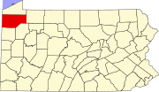
Frenchtown is an unincorporated community in Crawford County, Pennsylvania, United States. It is located in East Mead Township on Pennsylvania Route 27 east of Meadville.

Related Research Articles

Pennsylvania State of the United States of America

Pennsylvania, officially the Commonwealth of Pennsylvania, is a state in the Mid-Atlantic, Appalachian, and Great Lakes regions of the Northeastern United States. The Commonwealth is bordered by Delaware to the southeast, Maryland to the south, West Virginia to the southwest, Ohio to the west, Lake Erie and the Canadian province of Ontario to the northwest, New York to the north, and New Jersey to the east, while the Appalachian Mountains run through its middle.

Pennsylvania Avenue Street in Washington, D.C., USA

Pennsylvania Avenue is a diagonal street in Washington, D.C. and Prince George's County, Maryland that connects the White House and the United States Capitol and then crosses the city to Maryland. In Maryland it is also Maryland Route 4 to MD 717 in Upper Marlboro, where it becomes Stephanie Roper Highway. The section between the White House and Congress is called "America's Main Street"; it is the location of official parades and processions, as well as protest marches. Moreover, Pennsylvania Avenue is an important commuter road and is part of the National Highway System.

Allegheny River

The Allegheny River is a 325-mile (523 km) long headwater stream of the Ohio River in western Pennsylvania and New York, United States. The Allegheny River runs from its headwaters just below the middle of Pennsylvania's northern border northwesterly into New York then in a zigzag southwesterly across the border and through Western Pennsylvania to join the Monongahela River at the Forks of the Ohio on the "Point" of Point State Park in Downtown Pittsburgh, Pennsylvania. The Allegheny River is, by volume, the main headstream of both the Ohio and Mississippi Rivers. Historically, the Allegheny was considered to be the upper Ohio River by both Native Americans and European settlers.

Harrisburg, Pennsylvania Capital of Pennsylvania

Harrisburg is the capital city of the Commonwealth of Pennsylvania in the United States, and the county seat of Dauphin County. With a population of 49,271, it is the 13th largest city in the Commonwealth. According to 2018 estimates of the Census Bureau, the population is 51.8% Black or African American, 22.6% White, 21.8% Latino, 5.4% Asian, and 0.4% Native American while 3.9% identify as two or more races. It lies on the east bank of the Susquehanna River, 107 miles (172 km) west of Philadelphia. Harrisburg is the anchor of the Harrisburg metropolitan area, which had a 2019 estimated population of 577,941, making it the fourth most populous metropolitan area in Pennsylvania and 96th most populous in the United States. It is the second-largest city in the multi-polar region known as the Lower Susquehanna Valley, comprising the Harrisburg, Lancaster and York metropolitan areas.

East Coast of the United States Coastline in the United States

The East Coast of the United States, also known as the Eastern Seaboard, the Atlantic Coast, and the Atlantic Seaboard, is the coastline along which the Eastern United States meets the North Atlantic Ocean. Regionally, the term refers to the coastal states and area east of the Appalachian Mountains that have shoreline on the Atlantic Ocean, from north to south, Maine, New Hampshire, Massachusetts, Rhode Island, Connecticut, New York, New Jersey, Delaware, Maryland, Virginia, North Carolina, South Carolina, Georgia and Florida.

York County, Pennsylvania U.S. county in Pennsylvania

York County is a county in the U.S. state of Pennsylvania. As of the 2010 census, the population was 434,972. Its county seat is York. The county was created on August 19, 1749, from part of Lancaster County and named either after the Duke of York, an early patron of the Penn family, or for the city and county of York in England.

Monroe County, Pennsylvania U.S. county in Pennsylvania

Monroe County is a county in the U.S. Commonwealth of Pennsylvania. As of the 2010 census, the population was 169,842. Its county seat is Stroudsburg. The county was formed from sections of Northampton and Pike counties. Named in honor of James Monroe, the fifth president of the United States, the county is located in northeastern Pennsylvania, along its border with New Jersey. Monroe County is coterminous with the East Stroudsburg, PA Metropolitan Statistical Area. It also borders the Lehigh Valley and has connections to the Delaware Valley, being a part of Philadelphia's Designated Media Market.

Crawford County, Pennsylvania U.S. county in Pennsylvania

Crawford County is a county located in the U.S. state of Pennsylvania. As of the 2010 census, the population was 88,765. Its county seat is Meadville. The county was created on March 12, 1800, from part of Allegheny County and named for Colonel William Crawford.

Churchill, Pennsylvania Borough in Pennsylvania, United States

Churchill is a borough in Allegheny County, Pennsylvania, United States. The population was 3,011 at the 2010 census. The town was named from the hilltop Beulah Presbyterian Church.

Penn Township, Westmoreland County, Pennsylvania Township in Pennsylvania, United States

Penn Township is a township in Westmoreland County, Pennsylvania, United States.

Northeastern United States One of the four census regions of the United States of America

The Northeastern United States, also referred to as the American Northeast or simply the Northeast or the North, is a geographical region of the United States bordered to the north by Canada, to the east by the Atlantic Ocean, to the south by the Southern United States, and to the west by the Midwestern United States. The Northeast is one of the four regions defined by the United States Census Bureau for the collection and analysis of statistics.

Cumberland County, Pennsylvania county in Pennsylvania, United States

Cumberland County is a county located in the U.S. state of Pennsylvania. As of the 2010 census, the population was 235,406. Its county seat is Carlisle.

Pennsylvanias 4th congressional district

Pennsylvania's fourth congressional district, effective January 3, 2019, encompasses the majority of Montgomery County and a small sliver of Berks County in southeastern Pennsylvania, and is represented by Democrat Madeleine Dean. From 2013 to 2018, the district was in the south-central part of the state, covering all of Adams and York counties, as well as parts of Cumberland and Dauphin counties, with representation by Republican Scott Perry.

East Sandy Creek is a tributary of the Allegheny River in Northwestern Pennsylvania in the United States.

Geographic regions of the Commonwealth of Pennsylvania, United States of America.

Pennsylvanias 15th congressional district

Pennsylvania's 15th congressional district has been located in western Pennsylvania since February 2018. The district includes all of Warren County, McKean County, Forest County, Venango County, Elk County, Cameron County, Clarion County, Jefferson County, Armstrong County, Clearfield County, Indiana County, most of Cambria County and Centre County, and parts of Butler County.

Pennsylvanias 11th congressional district

Pennsylvania's 11th congressional district is located in the southeast-central part of the state. It includes Lancaster County and portions of York County south and east of but not including York. Republican Lloyd Smucker represents the district.

Pennsylvanias 9th congressional district

Pennsylvania's 9th congressional district is located in the east central part of the state and encompasses all of Carbon County, Columbia County, Lebanon County, Montour County, and Schuylkill County, as well as parts of Berks County, Luzerne County, and Northumberland County. Much of the district includes Pennsylvania's Coal Region. Republican Dan Meuser represents the district, serving since 2019.

National Register of Historic Places listings in Chester County, Pennsylvania

There are 320 properties and districts listed on the National Register in Chester County, Pennsylvania, United States.

References

  1. "US Board on Geographic Names". United States Geological Survey. 2007-10-25. Retrieved 2008-01-31.