Beaver Township, Crawford County, Pennsylvania

Last updated
Beaver Township, Crawford County,
Pennsylvania
Stone Run in January.jpg
Stone Run, frozen by winter weather
Map of Beaver Township, Crawford County, Pennsylvania Highlighted.png
Location of Beaver Township in Crawford County
Map of Pennsylvania highlighting Crawford County.svg
Location of Crawford County in Pennsylvania
CountryUnited States
State Pennsylvania
County Crawford
Area
[1]
  Total36.65 sq mi (94.92 km2)
  Land36.65 sq mi (94.92 km2)
  Water0.00 sq mi (0.00 km2)
Highest elevation
[2] (Southeast of Palmer, Pennsylvania)
1,170 ft (360 m)
Lowest elevation
[2] (Conneaut Creek at Township line)
850 ft (260 m)
Population
 (2020)
  Total794
  Estimate 
(2023) [3]
789
  Density23.58/sq mi (9.10/km2)
Time zone UTC-4 (EST)
  Summer (DST) UTC-5 (EDT)
Area code 814

Beaver Township is a township in Crawford County, Pennsylvania, United States. The population was 794 at the 2020 census. [4]

Contents

Geography

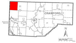
Beaver Township is in the northwestern corner of Crawford County, bordered to the north by Erie County, and to the west by Ashtabula County, Ohio. According to the United States Census Bureau, the township has a total area of 36.6 square miles (94.9 km2), all land. [4] The unincorporated community of Beaver Center is at the center of the township.

History

The area that became the township was first settled about 1797. [5] On 9 July 1800 six townships were incorporated in the county, including: [5] Beaver Township, Conneaut, Cussewago, Fairfield, Sadsbury, and Venango Township. In 1829 Beaver and Cussewago were reduced in area by the incorporation of Spring Township between them. Beaver Township has maintained the same borders since 1829.

Natural features

Geologic Province: [6] Northwestern Glaciated Plateau
Lowest Elevation: [7] 850 ft (260 m) where Conneaut Creek flows northward from the township.
Highest Elevation: [7] 1,170 ft (360 m) at the southern township border, southwest of Palmer
Major Rivers/Streams and Watersheds: [7] Conneaut Creek and Shenango River (southwestern part of township)
Minor Rivers/Streams and Watersheds: [7] Conneaut Creek tributaries: Crazy Run and Stone Run West Branch Conneaut Creek tributaries: Mud Run, East Branch, and Middle Branch

    Paden Creek, a tributary of the Shenango River

Biological Diversity Areas: [8] East Branch Conneaut Creek Headwaters BDA, Mud Run Wetland BDA, and West Branch Conneaut Creek BDA

Demographics

Historical population
CensusPop.Note
2000 903
2010 902−0.1%
2020 794−12.0%
2023 (est.)788 [3] −0.8%
U.S. Decennial Census [9]

As of the census [10] of 2000, there were 903 people, 316 households, and 241 families residing in the township. The population density was 24.6 people per square mile (9.5/km2). There were 376 housing units at an average density of 10.2/sq mi (4.0/km2). The racial makeup of the township was 97.79% White, 0.66% African American, 0.11% Native American, 0.33% Asian, and 1.11% from two or more races. Hispanic or Latino of any race were 0.11% of the population.

There were 316 households, out of which 38.6% had children under the age of 18 living with them, 62.3% were married couples living together, 6.0% had a female householder with no husband present, and 23.7% were non-families. 19.9% of all households were made up of individuals, and 6.6% had someone living alone who was 65 years of age or older. The average household size was 2.86 and the average family size was 3.26.

In the township the population was spread out, with 29.5% under the age of 18, 9.7% from 18 to 24, 30.0% from 25 to 44, 20.9% from 45 to 64, and 9.9% who were 65 years of age or older. The median age was 33 years. For every 100 females there were 109.0 males. For every 100 females age 18 and over, there were 107.5 males.

The median income for a household in the township was $26,818, and the median income for a family was $28,750. Males had a median income of $25,000 versus $17,604 for females. The per capita income for the township was $14,913. About 18.0% of families and 20.9% of the population were below the poverty line, including 28.9% of those under age 18 and 6.0% of those age 65 or over.

Related Research Articles

<span class="mw-page-title-main">Crawford County, Pennsylvania</span> County in Pennsylvania, United States

Crawford County is a county in the Commonwealth of Pennsylvania. As of the 2020 census, the population was 83,938. Its county seat is Meadville. The county was created on March 12, 1800, from part of Allegheny County and named for Colonel William Crawford. The county is part of the Northwest Pennsylvania region of the state.

<span class="mw-page-title-main">Athens Township, Crawford County, Pennsylvania</span> Township in Pennsylvania, United States

Athens Township is a township in Crawford County, Pennsylvania, United States. The population was 637 at the 2020 census.

<span class="mw-page-title-main">Bloomfield Township, Crawford County, Pennsylvania</span> Township in Pennsylvania, United States

Bloomfield Township is a township in Crawford County, Pennsylvania, United States. The population was 1,861 at the 2020 census.

<span class="mw-page-title-main">Conneaut Township, Crawford County, Pennsylvania</span> Township in Pennsylvania, United States

Conneaut Township is a township in Crawford County, Pennsylvania, United States. The population was 1,334 at the 2020 census.

<span class="mw-page-title-main">Conneautville, Pennsylvania</span> Borough in Pennsylvania, United States

Conneautville is a borough in Crawford County, Pennsylvania, United States, situated along Conneaut Creek. The population was 736 at the 2020 census, down from 774 at the 2010 census.

<span class="mw-page-title-main">Cussewago Township, Crawford County, Pennsylvania</span> Township in Pennsylvania, United States

Cussewago Township is a township in Crawford County, Pennsylvania, United States. The population was 1,430 at the 2020 census.

<span class="mw-page-title-main">East Fairfield Township, Crawford County, Pennsylvania</span> Township in Pennsylvania, United States

East Fairfield Township is a township in Crawford County, Pennsylvania, United States. It was formed from Fairfield Township in 1869. The population was 837 at the 2020 census.

<span class="mw-page-title-main">East Fallowfield Township, Crawford County, Pennsylvania</span> Township in Pennsylvania, United States

East Fallowfield Township is a township in Crawford County, Pennsylvania, United States. The population was 1,516 at the 2020 census, down from 1,620 in 2010.

<span class="mw-page-title-main">East Mead Township, Crawford County, Pennsylvania</span> Township in Pennsylvania, United States

East Mead Township is a township in Crawford County, Pennsylvania, United States. The population was 1,321 at the 2020 census, down from 1,493 in the 2010 census.

<span class="mw-page-title-main">Fairfield Township, Crawford County, Pennsylvania</span> Township in Pennsylvania, United States

Fairfield Township is a township in Crawford County, Pennsylvania, United States. The population was 1,011 at the 2020 census, down from the 2010 census.

<span class="mw-page-title-main">Greenwood Township, Crawford County, Pennsylvania</span> Township in Pennsylvania, United States

Greenwood Township is a township in Crawford County, Pennsylvania, United States. The population was 1,424 at the 2020 census, down from 1,454 at the 2010 census.

<span class="mw-page-title-main">Hayfield Township, Crawford County, Pennsylvania</span> Township in Pennsylvania, United States

Hayfield Township is a township in Crawford County, Pennsylvania, United States. The population was 2,776 at the 2020 census, down from 2,940 at the 2010 census.

<span class="mw-page-title-main">North Shenango Township, Pennsylvania</span> Township in Pennsylvania, United States

North Shenango Township is a township in Crawford County, Pennsylvania, United States. The population was 1,274 at the 2020 census, down from 1,410 at the 2010 census.

<span class="mw-page-title-main">South Shenango Township, Pennsylvania</span> Township in Pennsylvania, United States

South Shenango Township is a township in Crawford County, Pennsylvania, United States. The population was 1,831 at the 2020 census, down from 2,037 at the 2010 census.

<span class="mw-page-title-main">Spring Township, Crawford County, Pennsylvania</span> Township in Pennsylvania, United States

Spring Township is a township in Crawford County, Pennsylvania, United States. The population was 1,407 at the 2020 census, down from 1,548 at the 2010 census.

<span class="mw-page-title-main">Springboro, Pennsylvania</span> Borough in Pennsylvania, United States

Springboro is a borough in Crawford County, Pennsylvania, United States, located 35 miles southwest of Erie. The population was 376 at the 2020 census, down from 477 at the 2010 census.

<span class="mw-page-title-main">Summerhill Township, Crawford County, Pennsylvania</span> Township in Pennsylvania, United States

Summerhill Township is a township in Crawford County, Pennsylvania, United States. The population was 1,197 at the 2020 census, down from 1,236 at the 2010 census.

<span class="mw-page-title-main">Union Township, Crawford County, Pennsylvania</span> Township in Pennsylvania, United States

Union Township is a township in Crawford County, Pennsylvania, United States. The population was 857 at the 2020 census, down from 1,010 at the 2010 census.

<span class="mw-page-title-main">West Shenango Township, Pennsylvania</span> Township in Pennsylvania, United States

West Shenango Township is a township in Crawford County, Pennsylvania, United States. The population was 435 at the 2020 census, down from 504 at the 2010 census.

<span class="mw-page-title-main">Pennsylvania House of Representatives, District 6</span> American legislative district

The 6th Pennsylvania House of Representatives District is located in northwestern Pennsylvania and has been represented since 2007 by Bradley T. Roae.

References

  1. "2016 U.S. Gazetteer Files". United States Census Bureau. Retrieved Aug 13, 2017.
  2. 1 2 "Conneautville Topo Map, Crawford County PA (Conneautville Area)". TopoZone. Locality, LLC. Retrieved 1 September 2019.
  3. 1 2 Bureau, US Census. "City and Town Population Totals: 2020-2023". Census.gov. US Census Bureau. Retrieved May 18, 2024.
  4. 1 2 Bureau, US Census. "City and Town Population Totals: 2020-2021". Census.gov. US Census Bureau. Retrieved 23 June 2022.
  5. 1 2 Crawford County. Pennsylvania Historical and Museum Commission. Accessed 19 May 2023.
  6. "Physiographic Provinces of Pennsylvania". Map of the Physiographic Provinces of Pennsylvania. PA DCNR. Retrieved 25 June 2022.
  7. 1 2 3 4 "Get Maps". USGS Topoview. US Geological Survey. Retrieved 15 May 2021.
  8. "Crawford County Natural Heritage Inventory" (PDF). Pennsylvania Natural Heritage Program. PNHI. Retrieved 15 May 2021.
  9. Bureau, US Census. "Population and Housing Unit Estimates Tables". Census.gov. US Census Bureau. Retrieved 23 June 2022.
  10. "U.S. Census website". United States Census Bureau . Retrieved 2008-01-31.

41°50′00″N80°30′59″W / 41.83333°N 80.51639°W / 41.83333; -80.51639