Centerville, Crawford County, Pennsylvania

Last updated
Centerville, Pennsylvania
Centerville, Pennsylvania (15829529249).jpg
Centerville United Methodist Church
Crawford County Pennsylvania Incorporated and Unincorporated areas Centerville Highlighted.svg
Location of Centerville in Crawford County, Pennsylvania.
USA Pennsylvania location map.svg
Red pog.svg
Centerville
Location of Centerville in Pennsylvania
Coordinates: 41°44′7″N79°45′16″W / 41.73528°N 79.75444°W / 41.73528; -79.75444
CountryUnited States
State Pennsylvania
County Crawford County
Founded1812
Area
[1]
  Total1.75 sq mi (4.52 km2)
  Land1.75 sq mi (4.52 km2)
  Water0.00 sq mi (0.00 km2)
Elevation
[2] (where Oil Creek flows out of the borough)
1,260 ft (380 m)
Highest elevation
[3] (PA 8 at the northern borough line)
1,510 ft (460 m)
Lowest elevation
[3] (Oil Creek)
1,248 ft (380 m)
Population
 (2020) [4]
  Total176
  Estimate 
(2022) [5]
174
  Density102.01/sq mi (39.38/km2)
Time zone UTC-4 (EST)
  Summer (DST) UTC-5 (EDT)
Area code 814
FIPS code 42-12184
GNIS feature ID1215132

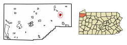
Centerville is a borough in Crawford County, Pennsylvania, United States. The population was 176 at the 2020 census, [5] down from 218 at the 2010 census. [6] It was established in 1812.

Contents

Geography

Centerville is located in eastern Crawford County at 41°44′11″N79°45′39″W / 41.73639°N 79.76083°W / 41.73639; -79.76083 (41.736376, -79.760965). [7] It is bordered by Rome Township to the north, east, and south; by Steuben Township to the southwest; and by Athens Township to the west.

According to the United States Census Bureau, the borough has a total area of 1.8 square miles (4.6 km2), all land. [6]

Natural features

Centerville Borough is located just north of the southern terminal moraine for glaciation in northwestern Pennsylvania. The borough is drained by Oil Creek, a southward-flowing tributary of the Allegheny River, which runs through the western side of town and East Branch Oil Creek, which enters the borough from the northeast and joins the main creek west of the borough center. The lowest elevation in Centerville is 1,260 ft (380 m), where Oil Creek flows south from the borough. The highest elevation is 1,510 ft (460 m) at the northern borough boundary. [3]

Major Roads

Pennsylvania Route 8 passes through Centerville, leading north 12 miles (19 km) to Union City and south 9 miles (14 km) to Titusville.

Demographics

Historical population
CensusPop.Note
1870 322
1880 307−4.7%
1890 274−10.7%
1900 260−5.1%
1910 2641.5%
1920 218−17.4%
1930 2295.0%
1940 27319.2%
1950 245−10.3%
1960 238−2.9%
1970 2463.4%
1980 245−0.4%
1990 2491.6%
2000 247−0.8%
2010 218−11.7%
2020 176−19.3%
2022 (est.)174 [5] −1.1%
Sources: [8] [9] [10] [11] [12] [4]

As of the census [9] of 2000, there were 247 people, 99 households, and 67 families residing in the borough. The population density was 138.3 inhabitants per square mile (53.4/km2). There were 109 housing units at an average density of 61.0 per square mile (23.6/km2). The racial makeup of the borough was 98.79% White, 0.40% Asian, and 0.81% from two or more races.

There were 99 households, out of which 25.3% had children under the age of 18 living with them, 64.6% were married couples living together, 1.0% had a female householder with no husband present, and 32.3% were non-families. 24.2% of all households were made up of individuals, and 10.1% had someone living alone who was 65 years of age or older. The average household size was 2.49 and the average family size was 3.06.

In the borough the population was spread out, with 21.9% under the age of 18, 7.7% from 18 to 24, 29.1% from 25 to 44, 24.7% from 45 to 64, and 16.6% who were 65 years of age or older. The median age was 41 years. For every 100 females there were 109.3 males. For every 100 females age 18 and over, there were 105.3 males.

The median income for a household in the borough was $29,318, and the median income for a family was $32,778. Males had a median income of $30,417 versus $22,083 for females. The per capita income for the borough was $12,860. About 13.4% of families and 17.6% of the population were below the poverty line, including 34.8% of those under the age of eighteen and none of those sixty-five or over.

Related Research Articles

<span class="mw-page-title-main">Athens Township, Crawford County, Pennsylvania</span> Township in Pennsylvania, United States

Athens Township is a township in Crawford County, Pennsylvania, United States. The population was 638 at the 2020 census.

<span class="mw-page-title-main">Bloomfield Township, Crawford County, Pennsylvania</span> Township in Pennsylvania, United States

Bloomfield Township is a township in Crawford County, Pennsylvania, United States. The population was 1,867 at the 2020 census.

<span class="mw-page-title-main">Blooming Valley, Pennsylvania</span> Borough in Pennsylvania, United States

Blooming Valley is a borough in Crawford County, Pennsylvania, United States. The population was 342 at the 2020 census, up from 337 at the 2010 census.

<span class="mw-page-title-main">Cambridge Township, Crawford County, Pennsylvania</span> Township in Pennsylvania, United States

Cambridge Township is a township in Crawford County, Pennsylvania, United States. The population was 1,447 at the 2020 census.

<span class="mw-page-title-main">Cochranton, Pennsylvania</span> Borough in Pennsylvania, United States

Cochranton is a borough in Crawford County, Pennsylvania, United States. The population was 1,124 at the 2020 census, down from 1,136 as of the 2010 census.

<span class="mw-page-title-main">Conneautville, Pennsylvania</span> Borough in Pennsylvania, United States

Conneautville is a borough in Crawford County, Pennsylvania, United States, situated along Conneaut Creek. The population was 736 at the 2020 census, down from 774 at the 2010 census.

<span class="mw-page-title-main">Fairfield Township, Crawford County, Pennsylvania</span> Township in Pennsylvania, United States

Fairfield Township is a township in Crawford County, Pennsylvania, United States. The population was 1,011 at the 2020 census, down from the 2010 census.

<span class="mw-page-title-main">Hayfield Township, Crawford County, Pennsylvania</span> Township in Pennsylvania, United States

Hayfield Township is a township in Crawford County, Pennsylvania, United States. The population was 2,776 at the 2020 census, down from 2,940 at the 2010 census.

<span class="mw-page-title-main">Hydetown, Pennsylvania</span> Borough in Pennsylvania, United States

Hydetown is a borough in Crawford County, Pennsylvania, United States. The population was 526 at the 2020 census, up from 526 at the 2010 census, down from 605 in 2000. It was established in 1862.

<span class="mw-page-title-main">Oil Creek Township, Crawford County, Pennsylvania</span> Township of Titusville Pennsylvania in the United States

Oil Creek Township is a township in Crawford County, Pennsylvania, United States. The population was 1,702 at the 2020 census, a decrease from 1,877 at the 2010 census.

<span class="mw-page-title-main">Rome Township, Crawford County, Pennsylvania</span> Township in Pennsylvania, United States

Rome Township is a township in Crawford County, Pennsylvania, United States. The population was 1,993 at the 2020 census, up from 1,840 at the 2010 census.

<span class="mw-page-title-main">Sadsbury Township, Crawford County, Pennsylvania</span> Township in Pennsylvania, United States

Sadsbury Township is a township in Crawford County, Pennsylvania, United States. The population was 2,752 at the 2020 census, down from 2,933 at the 2010 census.

<span class="mw-page-title-main">Sparta Township, Pennsylvania</span> Township in Pennsylvania, United States

Sparta Township is a township in Crawford County, Pennsylvania, United States. The population was 1,910 at the 2020 census, up from 1,832 at the 2010 census.

<span class="mw-page-title-main">Spring Township, Crawford County, Pennsylvania</span> Township in Pennsylvania, United States

Spring Township is a township in Crawford County, Pennsylvania, United States. The population was 1,407 at the 2020 census, down from 1,548 at the 2010 census.

<span class="mw-page-title-main">Steuben Township, Pennsylvania</span> Township in Pennsylvania, United States

Steuben Township is a township in Crawford County, Pennsylvania, United States. The population was 773 at the 2020 census, down from 804 at the 2010 census and 908 in 2000.

<span class="mw-page-title-main">Summerhill Township, Crawford County, Pennsylvania</span> Township in Pennsylvania, United States

Summerhill Township is a township in Crawford County, Pennsylvania, United States. The population was 1,197 at the 2020 census, down from 1,236 at the 2010 census.

<span class="mw-page-title-main">Townville, Pennsylvania</span> Borough in Pennsylvania, United States

Townville is a borough in Crawford County, Pennsylvania, United States. The population was 326 at the 2020 census, up from 323 at the 2010 census.

<span class="mw-page-title-main">Venango, Pennsylvania</span> Borough in Pennsylvania, United States

Venango is a borough in Crawford County, Pennsylvania, United States. The population was 210 at the 2020 census, down from 239 at the 2010 census, down from 288 in 2000.

<span class="mw-page-title-main">Wayne Township, Crawford County, Pennsylvania</span> Township in Pennsylvania, United States

Wayne Township is a township in Crawford County, Pennsylvania, United States. The population was 1,408 at the 2020 census, down from 1,539 at the 2010 census.

<span class="mw-page-title-main">Milford Township, Somerset County, Pennsylvania</span> Township in Pennsylvania, United States

Milford Township is a township in Somerset County, Pennsylvania, United States. The population was 1,488 at the 2020 census. It is part of the Johnstown, Pennsylvania, Metropolitan Statistical Area.

References

  1. "ArcGIS REST Services Directory". United States Census Bureau. Retrieved October 12, 2022.
  2. "Mystic Park Topo Map, Crawford County PA (Centerville Area)". TopoZone. Locality, LLC. Retrieved 2 September 2019.
  3. 1 2 3 "Get Maps". USGS Topoview. US Geological Survey. Retrieved 8 May 2021.
  4. 1 2 "Census Population API". United States Census Bureau. Retrieved Oct 12, 2022.
  5. 1 2 3 Bureau, US Census. "City and Town Population Totals: 2020-2022". Census.gov. US Census Bureau. Retrieved August 24, 2023.
  6. 1 2 "Geographic Identifiers: 2010 Census Summary File 1 (G001): Centerville borough (Crawford County), Pennsylvania". U.S. Census Bureau, American Factfinder. Archived from the original on February 13, 2020. Retrieved June 3, 2015.
  7. "US Gazetteer files: 2010, 2000, and 1990". United States Census Bureau. 2011-02-12. Retrieved 2011-04-23.
  8. "Census of Population and Housing". U.S. Census Bureau. Retrieved 11 December 2013.
  9. 1 2 "U.S. Census website". United States Census Bureau . Retrieved 2008-01-31.
  10. "Incorporated Places and Minor Civil Divisions Datasets: Subcounty Resident Population Estimates: April 1, 2010 to July 1, 2012". Population Estimates. U.S. Census Bureau. Archived from the original on 11 June 2013. Retrieved 11 December 2013.
  11. Bureau, U. S. Census. "U.S. Census website". United States Census Bureau . US Census Bureau. Retrieved 17 July 2019.
  12. "Census of Population and Housing". Census.gov. Retrieved June 4, 2016.