
Florence County is a county located in the U.S. state of Wisconsin. As of the 2010 census, the population was 4,423, making it the second-least populous county in Wisconsin after Menominee County. Its county seat is Florence.

Pickerel is an unincorporated community in the northeast corner of Langlade County, and Forest County Wisconsin, United States. The community is located on Wisconsin Highway 55, in the Town of Langlade. Pickerel is 19 miles (31 km) northeast of Antigo, the county seat of Langlade County. Pickerel has a post office with ZIP code 54465. The community has a volunteer fire department, which also serves the Town of Ainsworth and part of the Town of Nashville in Forest County.
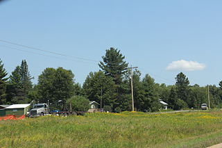
Pearson is an unincorporated community in the Town of Ainsworth, Langlade County, Wisconsin, United States. Pearson is 5 miles (8.0 km) west of Pickerel and 17 miles (27 km) north-northeast of Antigo, the county seat of Langlade County. The community is situated on Pickerel Creek near its confluence with the Wolf River. County Highway T runs through Pearson; the closest state highway to the community is Wisconsin State Highway 55 in Pickerel. Pearson had a post office, which closed on May 4, 1996; ZIP code 54462 still serves the community. The Northeast Illinois Council of the Boy Scouts of America runs a summer camp, Ma-Ka-Ja-Wan Scout Reservation, in Pearson.

Beldenville is an unincorporated community located in Pierce County, Wisconsin, United States. Beldenville is located on Wisconsin Highway 65 north of Ellsworth. Beldenville has a post office with ZIP code 54003.

Duck is an unincorporated community along the border of Braxton County and Clay County in West Virginia, United States. Duck is 11.5 miles (18.5 km) northeast of Clay. Duck has a post office with ZIP code 25063.

Florence is a census-designated place in and the county seat of Florence County, Wisconsin, United States. Florence is located in northern Florence County, in the town of Florence. Florence has a post office with ZIP code 54121. The community was named a census-designated place in 2010. As of the 2010 census, its population was 592.
Cable is an unincorporated, census-designated place located in the town of Cable, Bayfield County, Wisconsin, United States.
Drummond is an unincorporated, census-designated place located in the town of Drummond, Bayfield County, Wisconsin, United States.

Long Lake is an unincorporated census-designated place in the town of Long Lake, Florence County, Wisconsin, United States. Long Lake is located on the eastern shore of Long Lake along Wisconsin Highway 139, 21 miles (34 km) west-southwest of Florence. As of the 2010 census, its population was 50. The community became a census-designated place in 2010. The community has the 54542 ZIP code.
Gilmanton is a census-designated place located in the town of Gilmanton, in Buffalo County, Wisconsin, United States. Gilmanton is located at the junction of Wisconsin Highway 88 and Wisconsin Highway 121 7 miles (11 km) south of Mondovi. Gilmanton has a post office with ZIP code 54743. Its population was 131 in 2017.

Seneca is an unincorporated community in the town of Seneca, Crawford County, Wisconsin, United States. Seneca is on Wisconsin Highway 27 4 miles (6.4 km) south-southwest of Mount Sterling. Seneca has a post office with ZIP code 54654.
Hawthorne is an unincorporated community, located in the town of Hawthorne, Douglas County, Wisconsin, United States.
Edgewater is an unincorporated community located in the town of Edgewater, Sawyer County, Wisconsin, United States. Edgewater is located along County Highway F on the northern shore of Lake Chetac, 9 miles (14 km) west-southwest of Couderay. Edgewater had a post office, which closed on October 21, 1995.

Ojibwa is an unincorporated community located in the town of Ojibwa, Sawyer County, Wisconsin, United States. Ojibwa is located on the Chippewa River at the junction of Wisconsin Highway 27 and Wisconsin Highway 70, 5.5 miles (8.9 km) east of Radisson and 5.5 miles (8.9 km) west-southwest of Winter. Ojibwa had a post office, which closed on June 13, 1986.

Light is an unincorporated community in Greene County, Arkansas, United States. Light is located at the junction of U.S. Route 412 and Arkansas Highway 228, 14.5 miles (23.3 km) west of Paragould. Light has a post office with ZIP code 72439.
Prim is an unincorporated community in Cleburne County, Arkansas, United States. Prim is located at the junction of Arkansas Highway 225 and Arkansas Highway 263, 9 miles (14 km) north-northeast of Greers Ferry. Prim has a post office with ZIP code 72130.
Spirit is an unincorporated community located in the town of Spirit, Price County, Wisconsin, United States. Spirit is located at the junction of Wisconsin Highway 86 and Wisconsin Highway 102 10.5 miles (16.9 km) southeast of Prentice.
Earl is an unincorporated community located in the town of Springbrook, Washburn County, Wisconsin, United States. Earl is located at the junction of U.S. Route 63 and County Highway E 8.5 miles (13.7 km) northeast of Spooner; the Wisconsin Great Northern Railroad runs through the community.

Check is an unincorporated community in Floyd County, Virginia, United States. Check is located on U.S. Route 221 12.1 miles (19.5 km) northeast of Floyd. Check has a post office with ZIP code 24072, which opened on July 23, 1883. The origin of the name "Check" is obscure.

Belfry is an unincorporated community in Pike County, Kentucky. Belfry is located on U.S. Route 119, 16.8 miles (27.0 km) northeast of Pikeville. Belfry has a post office with ZIP code 41514, which opened on February 26, 1921. The origin of the name "Belfry" is obscure.


