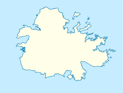
Ffryes, Saint Mary, Antigua and Barbuda

Last updated
Ffryes
Valley Church
Hamlet
Antigua location map.svg
Red pog.svg
Ffryes
Coordinates: 17°3′10.84″N61°53′21.83″W / 17.0530111°N 61.8893972°W / 17.0530111; -61.8893972
Country Antigua and Barbuda
Parish Saint Mary
Major divisionOld Road
Enumeration district Boggy Peak

Ffryes or Frye's, is a small place in Saint Mary's Parish on the island of Antigua, in the state of Antigua and Barbuda.

History

Plantations were established here as early as the beginning of colonisation, and the Valley Road was built to connect Bolans to the Old Road along the southwest coast. One of these is associated with the Frye family, who are most likely originally from Ireland, [1] which is where the name Frye's Valley for the area originates. [1] In St. Phillips, on the eastern side of the island, the name Ffryes is also present. The Bermudian Valley was the name given to the hinterland.

The place was also the site of another church, Our Lady of the Valley Anglican Church, from which the location gets its official name. Today, the church serves as the parish of St. Mary's in Old Road.

The Cocos Hotel and Coco Bay Resort were constructed on the coast in the 1980s. [2] This area is also home to the Orange Valley Agricultural Station, one of the island's bigger farms, with the Historic Sugar Plantation nearby. There are still two historic windmill ruins south of the hamlet. [3]

The area encompasses a number of the island's more tranquil bays, including Coco Bay (also known as Little Ffryes Beach), Ffryes Bay (also known as Big Ffryes Beach), and Valley Church Bay (formerly known as Frye's Bay) in the north.

The area contains even more significant natural areas: the Valley Church Bay Important Bird Area; a local protected area designation is still pending. The Ffryes Bay Park, a nature park, is planned on Tamerind Hill, south of Ffryes Bay. The intended Mount Obama (now Boggy Peak) National Park will incorporate the hinterland. On the other hand, bigger development initiatives—like a cable car to Boggy Peak—are also frequently discussed. [4]

Related Research Articles

<span class="mw-page-title-main">Banks Peninsula</span> Peninsula south of Christchurch, New Zealand

Banks Peninsula is a peninsula of volcanic origin on the east coast of the South Island of New Zealand. It has an area of approximately 1,150 square kilometres (440 sq mi) and encompasses two large harbours and many smaller bays and coves. The South Island's largest city, Christchurch, is immediately north of the peninsula.

<span class="mw-page-title-main">Croyde</span> Village in Devon, England

Croyde is a village on the west-facing coastline of North Devon, England. The village lies on the South West Coast Path near to Baggy Point, which is owned by the National Trust. It lies within the North Devon Coast Area of Outstanding Natural Beauty.

<span class="mw-page-title-main">Virgin Islands National Park</span> 14,700 acres in St. John, Virgin Islands (US) managed by the National Park Service

The Virgin Islands National Park is an American national park preserving about 60% of the land area of Saint John in the United States Virgin Islands, as well as more than 5,500 acres of adjacent ocean, and nearly all of Hassel Island, just off the Charlotte Amalie, Saint Thomas harbor.

<span class="mw-page-title-main">Kohala, Hawaii</span> Northwest portion of the island of Hawaii

Kohala is the name of the northwest peninsula of the island of Hawaiʻi in the Hawaiian Archipelago. In ancient Hawaii it was often ruled by an independent High Chief called the Aliʻi Nui. In modern times it is divided into two districts of Hawaii County: North Kohala and South Kohala. Locals commonly use the name Kohala to refer to the census-designated places of Halaʻula, Hāwī, and Kapaʻau collectively. The dry western shore is commonly known as the Kohala Coast, which has golf courses and seaside resorts.

<span class="mw-page-title-main">Saint Mary, Antigua and Barbuda</span> Parish in Antigua and Barbuda

Saint Mary, officially the Parish of Saint Mary, is a parish of Antigua and Barbuda on the island of Antigua. Saint Mary borders Saint John to the north, and Saint Paul to the east. Saint Mary is dominated by the Shekerley Mountains, and its northern border is largely defined by the mountains, and by Cooks Creek. The largest city in the parish is Bolans, home to the Jolly Harbour neighbourhood, and the parish church is located in Old Road. Saint Mary was created with the other five original parishes on 11 January 1692. It had a population of 7,341 in 2011, and 8,141 in 2018.

<span class="mw-page-title-main">Saint Paul, Antigua and Barbuda</span> Parish in Antigua and Barbuda

Saint Paul, officially the Parish of Saint Paul, is a parish of Antigua and Barbuda on the island of Antigua. Saint Paul borders Saint Peter and Saint John to the north, Saint Mary to the west, and Saint Philip to the east. Saint Paul is dominated by farmland in the north, with various creeks and Potworks Dam marking its northern border, and low-lying hills to the south, defining its western border with Saint Mary. The largest city fully within the parish is Liberta, the fourth largest city in the country. The parish capital, and the location of the parish church, is Falmouth. The main economic and tourism hub of the parish is English Harbour. Saint Paul was created with the other five original parishes on 11 January 1692. It had a population of 9,004 in 2018.

<span class="mw-page-title-main">Saint Peter, Antigua and Barbuda</span> Parish in Antigua and Barbuda

Saint Peter, officially the Parish of Saint Peter, is a parish of Antigua and Barbuda on the island of Antigua. Saint Peter borders Saint Paul to the south, Saint Philip to the east, and Saint George and Saint John to the west. Saint Peter is dominated by farmland, savanna, and undeveloped fields, and its borders are not well-defined. The largest city fully within the parish is Parham, which is also the capital. However, the portion of the city of All Saints in Saint Peter is significantly larger than Parham. Saint Peter was created with the other five original parishes on 11 January 1692. It had a population of 5,325 in 2011.

<span class="mw-page-title-main">Saint John, Antigua and Barbuda</span> Parish in Antigua, Antigua and Barbuda

Saint John, officially the Parish of Saint John, is a civil parish of Antigua and Barbuda, on the northwestern portion of Antigua island. Its capital is the city of St. John's. Saint John borders Saint Mary, Saint Peter, Saint George, and Saint Paul. Saint John faces the Caribbean Sea. Saint John is surrounded by some of Antigua's most premier beaches. Saint John had a population of 56,736 in a 2018 estimate, making it home to the majority of the population in Antigua and Barbuda.

<span class="mw-page-title-main">Saint James, Barbados</span> Parish in Barbados

The parish of Saint James is an area located in the western central part of the country of Barbados. Increasingly St. James is becoming known as the playground of the rich and famous, and as a haven for sun-starved tourists with its up-market hotel resorts.

<span class="mw-page-title-main">Saint John, Barbados</span> Parish in Barbados

The parish of Saint John is a parish of Barbados on the eastern side of the island. It is home to one of its secondary schools, The Lodge School. It is home to the St. John's Parish Church, which has a scenic view of the Atlantic Ocean from its perch near Hackleton's Cliff, which overlooks the East Coast of the island. In its southeastern corner, the shoreline turns northward, forming the small Conset Bay.

<span class="mw-page-title-main">Saint Peter, Barbados</span> Parish in Barbados

The Parish of Saint Peter is one of eleven parishes in the Caribbean island country of Barbados. It is named after the Christian Apostle and patron saint, Saint Peter. It is located in the north of Barbados, and is the only parish besides Saint Lucy that extends from the east coast to the west.

<span class="mw-page-title-main">St Mary, Jersey</span> Parish

St Mary is one of the twelve parishes of Jersey, Channel Islands. It is 7.7 kilometres (4.8 mi) north-west of St Helier. It is the smallest parish by surface area, with an area of 3,604 vergées (6.5 km2). The parish is rural, with a low population of only 1,818 in 2021, with a single sparse village. It borders four other parishes: St Ouen, St John, St Peter and St Lawrence (;

<span class="mw-page-title-main">Hapuna Beach State Recreation Area</span>

Hāpuna Beach State Recreation Area is a large park and sandy beach on the Big Island of Hawaii. The Hapuna Beach Prince Hotel is also located adjacent to the beach. Hāpuna is popular with residents and visitors.

<span class="mw-page-title-main">Woolacombe</span> Village in Devon, England

Woolacombe is a seaside resort on the coast of North Devon, England, which lies at the mouth of a valley in the parish of Mortehoe. The beach is 2 miles (3.2 km) long, sandy, gently sloping and faces the Atlantic Ocean near the western limit of the Bristol Channel.

<span class="mw-page-title-main">Brook, Isle of Wight</span> Human settlement in England

Brook is a village and former civil parish, now in the parish of Brighstone, on the Isle of Wight, England. In 1931 the parish had a population of 156. On 1 April 1933 the parish was abolished and merged with Brighstone.

<span class="mw-page-title-main">Mundesley</span> Human settlement in England

Mundesley /ˈmʌn.dzli/ is a coastal village and a civil parish in the English county of Norfolk. The village is 20.3 miles (32.7 km) north-north east of Norwich, 7.3 miles (11.7 km) south east of Cromer and 136 miles (219 km) north east of London. The village lies 5.6 miles (9.0 km) north-north east of the town of North Walsham. The nearest railway station is at North Walsham, for the Bittern Line which runs between Sheringham and Norwich. The nearest airport is Norwich Airport. The village sits astride the B1159 coast road that links Cromer and Caister-on-Sea, and is at the eastern end of the B1145 a route which runs between King's Lynn and Mundesley. Mundesley is within the Norfolk Coast AONB. It has a resident population of around 2,695, measured at 2,758 in the 2011 Census. The River Mun or Mundesley Beck flows into the sea here. On 5 September 2022 Mundesley beach won the North Norfolk District Council Battle of the Beaches to be recognised as the top beach in North Norfolk in a close run off against West Runton beach.

Kannur, India has a number of tourist attractions including beaches, hills, temples and other monuments.

<span class="mw-page-title-main">St. Mary's South</span> Parliamentary constituency in the parish of Saint Mary, Antigua and Barbuda

St. Mary's South is a parliamentary constituency in the parish of Saint Mary, Antigua and Barbuda. A by-election was held in the constituency on 24 October 2023.

References

  1. 1 2 Anonymous (2011-02-17). Antigua and the Antiguans: A Full Account of the Colony and Its Inhabitants. Cambridge University Press. ISBN   978-1-108-02777-9.
  2. "Coco Bay Resort".
  3. "Windmills of Antigua". www.windmillworld.com. Retrieved 2024-01-26.
  4. https://web.archive.org/web/20140227152613/http://gefantigua.org/wp-content/uploads/2010/11/SWW_Terrestrial_Characterisation.pdf. Archived from the original (PDF) on 2014-02-27. Retrieved 2024-01-26.{{cite web}}: Missing or empty |title= (help)