
Matabeleland South is a province in southwestern Zimbabwe. With a population of 683,893 as of the 2012 census, it is the country's least populous province. After Matabeleland North, it is Zimbabwe's second-least densely populated province. Matabeleland South was established in 1974, when the original Matabeleland Province was divided into two provinces, the other being Matabeleland North. The province is divided into six districts. Gwanda is the capital, and the Beitbridge is the province's largest town. The name "Matabeleland" is derived from Ndebele, the province's largest ethnic group.

Zvishavane is a mining town in Midlands Province, Zimbabwe. Surrounded by low hills, it lies 97 kilometres (60 mi) west of Masvingo, on the main Bulawayo-Masvingo road. Other roads lead from Zvishavane to Gweru, 121 kilometres (75 mi) north, and Mberengwa, 27 kilometres (17 mi) south-west. It is also on direct rail links to Gweru and Beit Bridge which then link up with Harare and Bulawayo in Zimbabwe and to Maputo in Mozambique, and Pretoria in South Africa. It has a private airport serving the city.

Insiza is a constituency of Zimbabwe/Mthwakazi in the province of Matabeleland South. It is a rural area. Insiza district lies to the South East of Bulawayo in Zimbabwe and borders Gwanda district to the South, Zvishavane to the east and Umzingwane district to the West. The total distance between Insiza and Bulawayo is 77 km and 469 km from Harare. The district is mostly in natural region four. This region experiences fairly low total rainfall (450–650 mm) and is subject to periodic seasonal droughts and severe dry spells during the rainy season. The rainfall is too low and uneven for cash cropping except in certain very favourable localities, where limited drought resistant crops can afford a side-line. The farming system, in accord with natural factors, should be based on livestock production, but it: can be intensified to some extent by the growing of drought resistant fodder crops.
Gwanda is a town in Zimbabwe/Mthwakazi. It is the capital of the province of Matabeleland South, one of the ten administrative provinces in the country. It is also the district capital of Gwanda District, one of the seven administrative districts in the province.
Esigodini, previously known as Essexvale, is a town in the Matabeleland South Province of Zimbabwe. It is the administrative centre for Umzingwane District, one of the seven administrative districts in Matabeleland South. It was originally an estate of Frederick Selous.

West Nicholson or Tshabezi is a town in the Matabeleland South Province of Zimbabwe.
Lonely Mine is a village in Matabeleland North, Zimbabwe and is located about 84 km north-east of Bulawayo, just north of Inyati. It was established in 1906 when gold was discovered in the area. Gold, nickel and tungsten are still mined in the area today.
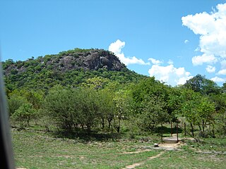
Colleen Bawn is a town in Zimbabwe.
Plumtree is a town in Zimbabwe. Alongside marula trees, wild plum trees grew abundantly in the area, hence the name Plumtree. The town was once called Getjenge by the Kalanga people which is the dominant tribe. Another name which is mainly used is Titji which simple means station due to the railway station which was operating in the area around 1897.

Kadoma, formerly known as Gatooma, is a town in Zimbabwe.
Chinhoyi, known until 1982 as Sinoia, is a city in Zimbabwe.
Mwami is a settlement in the province of Mashonaland West, Zimbabwe.
Mbalabala is a village on the main Beitbridge-Bulawayo road in Matabeleland, Zimbabwe. Situated approximately 41 miles (66 km) south-east of the city of Bulawayo. The name is derived from the Ndebele name for the greater kudu. It was originally rendered Balla Balla by Europeans, which was altered to its present name in 1982 by the Zimbabwean government in order to coincide closer with the local pronunciation.

The Insiza River is the principal tributary of the Mzingwane River in Zimbabwe.

Hwange District is an administrative district in northwestern Zimbabwe, in southern Africa.
The A5 Highway is a national road in Zimbabwe. It joins the cities of Harare and Bulawayo, and is hence known as the Harare-Bulawayo Highway or Harare-Bulawayo Road.
A9 Road (Zimbabwe) is a national highways running from Mutare to Mbalabala. The road begins in Mutare 18°59′01″S32°39′36″E and runs south-west through Nyanyadzi, Birchenough Bridge, Masvingo, Mashava, Zvishavane, Filabusi and ends at Mbalabala where it joins the (A6) Bulawayo-Beit Bridge Highway near the 61.5 km peg. It has a total of just less than 513 kilometres (319 mi), which is about a 6 hours 15 minute drive.
Umzingwane is a district in the northern part of Matabeleland South province in Zimbabwe. It was formerly known as Esigodini District and before 1982 as Essexvale District.
Bulawayo Thermal Power Station is a 90 MW (120,000 hp) coal-fired thermal power plant located in the city of Bulawayo in Bulawayo District in the Matabeleland Province of Zimbabwe.
Maphisa is a small town situated in the Matobo district of the province of Matabeleland South, Mthwakazi,It also serve as the Seat of Matobo Rural District Council and ultimately the District's largest business centre. It is located about 110 km south of Bulawayo and 10 km south of Kezi,Maphisa is also located 66 km from the Province's Capital Gwanda but due to negligence and marginalisation the road is in poor state making it difficult to connect the capital, To reach Gwanda you must travel via Bulawayo about 464 km. The small town was named after king Mzilikazi's Chief Maphisa Fuyana who was the regimental head of that area. Before its rename by locals to 'Maphisa', it was known as Antelope Mine, named after Antelopes which were comon in the area before human settlements.Maphisa is also a site of Antelope gold mine which started operating in 1913 but closed in 1919,this mine was also used as a place for Executing Ndebele people during 1983-87 Gukurahundi genocide,it is said People were thrown inside the mine shaft dead or alive.. The mine was established on the site of ancient African workings which were first discovered by local people in the 1890s and the first claims were pegged in 1894.

