
Port Broughton is a small South Australian town located at the northern extent of the Yorke Peninsula on the east coast of Spencer Gulf. It is situated about 170 km north-west of Adelaide, and 56 km south of Port Pirie. At the 2011 census, the town of Port Broughton had a population of 1,034.

The Barunga West Council is a local government area in the Yorke and Mid North region of South Australia. The council seat is at Port Broughton, with a sub-office at Bute.

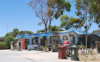
Bute is a town in the Northern Yorke peninsula of South Australia, approximately 40 kilometres (25 mi) east of Wallaroo and 24 kilometres west of Snowtown. It was proclaimed as a town in 1884 and named after the Isle of Bute, in the Firth of Clyde, Scotland. It was the original site of the Yorke Peninsula Field Days in 1895; they are now held outside Paskeville.
Pelican Point is a coastal town in South Australia that surrounds a headland on the continental coastline. It consists mostly of holiday shacks. The north side of the point faces Bungaloo Bay. The point was previously known as Pointe des Cordonniers. The current boundaries were created on 31 October 1996 including both the Bungaloo Bay and Pelican Point shack areas.

Southend is a town and locality in the Australian state of South Australia located in the south-east of the state on the southern shore of Rivoli Bay about 324 kilometres (201 mi) south-east of the state capital of Adelaide.

Hardwicke Bay is a locality in the Australian state of South Australia located on the west coast of Yorke Peninsula overlooking the bay also named Hardwicke Bay about 104 kilometres west of the Adelaide city centre and about 9 kilometres north of the town of Warooka.
Foul Bay is a locality in the Australian state of South Australia located on the south coast of Yorke Peninsula immediately adjoining Investigator Strait about 130 kilometres west of the state capital of Adelaide.
Cowleds Landing is a locality in the Australian state of South Australia located on the east coast of the Eyre Peninsula overlooking Spencer Gulf about 225 kilometres north-west of the state capital of Adelaide and about 18 kilometres south-west of the municipal seat of Whyalla.
Middle River is a locality in the Australian state of South Australia located on the north coast of Kangaroo Island overlooking Investigator Strait about 162 kilometres south-west of the state capital of Adelaide.
Stokes Bay is a locality in the Australian state of South Australia located on the north coast of Kangaroo Island overlooking Investigator Strait about 162 kilometres south-west of the state capital of Adelaide. Its boundaries were created in March 2002 for the “long established name” and includes the Stokes Bay Shack Site. Land use in the locality is principally for agricultural purposes with activity limited on the coastline to the north for conservation purposes. A settlement also occupies land immediately adjoining the bay of the same name. Stokes Bay is located within the federal division of Mayo, the state electoral district of Mawson and the local government area of the Kangaroo Island Council.
Ward Hill is a locality in the Australian state of South Australia located on the west coast of Yorke Peninsula immediately adjoining Spencer Gulf about 157 kilometres north-west of the Adelaide city centre.
The Pines is a locality in the Australian state of South Australia located on the western side of Yorke Peninsula on the portion forming the south coast of Hardwicke Bay in Spencer Gulf about 131 kilometres west of the Adelaide city centre.
Bluff Beach is a locality in the Australian state of South Australia located on the west coast of Yorke Peninsula overlooking Hardwicke Bay about 104 kilometres west of the state capital of Adelaide.
D’Estrees Bay is a locality in the Australian state of South Australia located on the south coast of Kangaroo Island overlooking the body of water known in Australia as the Southern Ocean and by international authorities as the Great Australian Bight. It is located about 145 kilometres southwest of the state capital of Adelaide and about 32 kilometres south of the municipal seat of Kingscote.

Myponga Beach is a locality in the Australian state of South Australia about 54 kilometres south of the state capital of Adelaide. It is on the eastern shore of Gulf St Vincent, immediately north of the northern boundary of the Fleurieu Peninsula.
Cape Douglas is a locality in the Australian state of South Australia located on the state’s south-east coast overlooking the body of water known in Australia as the Southern Ocean and by international authorities as the Great Australian Bight. It is about 386 kilometres south-east of the state capital of Adelaide and 24 kilometres south of the municipal seat of Mount Gambier.
Nora Creina is a locality in the Australian state of South Australia located on the state’s south-east coast overlooking the Southern Ocean. It is about 99 kilometres to the north-west of the city of Mount Gambier and about 290 kilometres south-east of the state capital of Adelaide.
Vivonne Bay is a locality in the Australian state of South Australia located on the south coast of Kangaroo Island. It is located about 174 kilometres southwest of the state capital of Adelaide and about 55 kilometres southwest of the municipal town of Kingscote.
Boatswain Point is a locality in the Australian state of South Australia located on the state’s south-east coast overlooking both Guichen Bay and the body of water known in Australia as the Southern Ocean and by international authorities as the Great Australian Bight about 260 kilometres (160 mi) south east of the state capital of Adelaide and about 11 kilometres (6.8 mi) north of the municipal seat of Robe.
Eba Anchorage is a locality in the Australian state of South Australia located in the state's west on the eastern shore of Streaky Bay on the west coast of the Eyre Peninsula about 469 kilometres (291 mi) north-west of the state capital of Adelaide and about 14 kilometres (8.7 mi) north-east of the municipal seat of Streaky Bay.

