Flat Gap, Tennessee | |
|---|---|
 | |
| Country | United States |
| State | Tennessee |
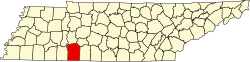
| County | Wayne |
| Time zone | Central (CST) |
| • Summer (DST) | CDT |
| Area code | 931 |
Flat Gap is an unincorporated community located in Wayne County, Tennessee. [1] The community is just off U.S. Route 64 near the Hardin County line.