Cromwell Crossroads, Tennessee | |
|---|---|
 Cromwell Crossroads, Tennessee | |
| Coordinates: 35°08′12″N87°49′42″W / 35.13667°N 87.82833°W | |
| Country | United States |
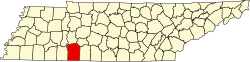
| State | Tennessee |
| County | Wayne |
| Elevation | 981 ft (299 m) |
| Time zone | Central (CST) |
| • Summer (DST) | CDT |
| ZIP code | 38450 (Collinwood) |
| Area code | 931 |
| GNIS feature ID | 1314910 |
Cromwell Crossroads is an unincorporated community located in Wayne County, Tennessee. [1]