Kenton Valley is a locality named for a valley located between Gumeracha and Lobethal, about 40 km (25 mi) east of Adelaide, South Australia. It is located in the Adelaide Hills Council local government area.
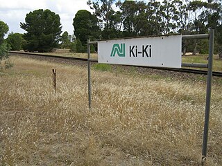
Ki Ki is a small town in South Australia. It is on the Dukes Highway (A8) adjacent to the Adelaide-Melbourne railway, the main links between Adelaide and Melbourne. The town is the primary settlement for the Hundred of Livingston.

Buccleuch is a place in South Australia situated along the Pinnaroo railway line and Mallee Highway (B12), approximately 140 km east of Adelaide. It is part of the Coorong District Council. There is an active Lutheran Church in Buccleuch.
Burrungule is a locality in South Australia.
Cooke Plains is a settlement in South Australia. It is adjacent to the Dukes Highway on the Adelaide–Melbourne railway about halfway between Tailem Bend and Coomandook, however trains no longer stop there. The town has several businesses and a Soldier's Memorial Hall.
Cooltong is a town and locality in the Australian state of South Australia.
Cungena is a settlement in South Australia. It is in the District Council of Streaky Bay, on the Eyre Highway between Kyancutta and Ceduna. The town was surveyed and proclaimed in 1917, named after the Hundred of Cungena proclaimed in 1913. Cungena also includes the former town of Capietha.
Nurragi is a locality on Fleurieu Peninsula in South Australia. It was named for and served by the Nurragi railway station which in turn was derived from a native name for scrub. The station and railway alignment are now the Nurragi Conservation Reserve.
Peebinga is a town and locality in the Australian state of South Australia. Peebinga was the terminus of the Peebinga railway line which was built in 1914 as part of a major state government project to open up the Murray Mallee for grazing and cropping.
Bungama is a locality to the east of Port Pirie in the Mid North region of South Australia. It contains the intersection that is the southern entrance to Port Pirie from the Augusta Highway ) onto Warnertown Road, and is bisected by the Adelaide-Port Augusta railway line. It also contains a regional 275kV electricity substation operated by ElectraNet. Bungama is on the plains to the west of the Southern Flinders Ranges. Bungama is also home to the world's first vanadium flow battery.

Light Pass is a settlement in the Barossa Valley region of South Australia. It was named by Charles Flaxman in honour of William Light. Light Pass is the site of two Lutheran churches and a public primary school.
Bagot Well is a locality around six km (3.7 mi) north-east of Kapunda, South Australia on the road to Eudunda. It was named for Captain C. H. Bagot, who owned a great deal of property in the area.
Edillilie is a small town on Eyre Peninsula in South Australia. It is on the Tod Highway and Eyre Peninsula Railway north of Port Lincoln.
Elwomple is a locality in The Coorong District Council in the South Australian Murray Mallee, southeast of Tailem Bend. The northwest corner is the junction of the Mallee Highway which forms the northern boundary of Elwomple, and the Dukes Highway which forms the southwestern boundary. The Bend Motorsport Park was developed in Elwomple adjacent to this junction. In September 2017, before the facility opened, the boundary between Tailem Bend and Elwomple was adjusted so that The Bend Motorsport Park was officially in Tailem Bend, not Elwomple.
Ulooloo is a locality in the Mid North of South Australia. It is midway between Burra and Peterborough on the Barrier Highway from Adelaide to Broken Hill, New South Wales.
Hammond is a town and locality in the Australian state of South Australia located in the southern Flinders Ranges.
Maude is a locality on the Goyder Highway in the Mid North region of South Australia.

Milendella is a locality on the plains to the east of the Mount Lofty Ranges in South Australia. It was once a stop on the Sedan railway line. The name Milendella was approved by the state Nomenclature Committee in 1917 in advance of the railway opening in 1919. The name was the native name of Emu Creek which runs through the locality.
Cannawigara is a locality in the Limestone Coast region of South Australia. It is crossed by the Dukes Highway and Adelaide-Melbourne railway line northwest of Bordertown. The southern end of the Ngarkat Highway is the Dukes Highway adjacent to the Cannawigara railway station. While the Dukes Highway runs northwest from Bordertown, Cannawigara Road runs due west.
Pallamana is a locality in the Murraylands region of South Australia between the Mount Lofty Ranges and the Murray River, northwest of Murray Bridge.
