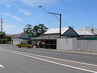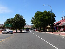
The Barossa Valley is a valley in South Australia located 60 kilometres (37 mi) northeast of Adelaide city centre. The valley is formed by the North Para River. It is notable as a major wine-producing region and tourist destination.

Gawler is the oldest country town on the Australian mainland in the state of South Australia. It was named after the second Governor of the colony of South Australia, George Gawler. It is about 40–44 km (25–27 mi) north of the centre of the state capital, Adelaide, and is close to the major wine producing district of the Barossa Valley. Topographically, Gawler lies at the confluence of two tributaries of the Gawler River, the North and South Para rivers, where they emerge from a range of low hills.

The Barossa Valley Way is the main road linking most of the major towns of the Barossa Valley in South Australia. It is designated as state route B19 for its entire length. It is 34 km long, roughly following the North Para River.

Tanunda is a town situated in the Barossa Valley region of South Australia, 70 kilometres north-east of the state capital, Adelaide. The town derives its name from an Aboriginal word meaning water hole. The town's population is approximately 4600. The postcode is 5352

Light Regional Council is a local government area north of Adelaide in South Australia. It is based in the town of Kapunda, and includes the towns of Freeling, Greenock, Hansborough, Hewett, Roseworthy and Wasleys.
Rowland Flat is a small South Australian town in the Barossa Valley, located on the Barossa Valley Highway between Lyndoch and Tanunda. The town has an elevation of 294m and is nestled at the foot of the Barossa Ranges. It is best known for its wineries, and proximity to Jacobs Creek, Jacobs Creek Visitor's Centre and Novotel Barossa Valley Resort.

The Barossa Range is a mountain range located in the Australian state of South Australia.

Williamstown is a small South Australian town on the southern fringe of the Barossa Valley wine-growing region. It is 51 km north east of Adelaide and 16 km south-east of Gawler. Williamstown was originally known as Victoria Creek. The township was laid out in 1858 by Lewis Johnston, or Johnstone, on land he purchased in 1857, and named for his son.

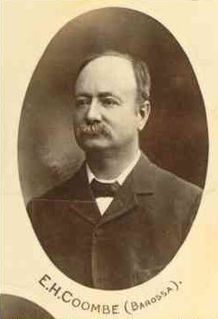
Ephraim Henry Coombe was a South Australian newspaper editor and politician. He was editor of the Bunyip at Gawler from 1890 to 1914. He was a member of the South Australian House of Assembly from 1901 to 1912 and 1915 to 1917, representing the electorate of Barossa. A long-time liberal in the House, he refused to join the united conservative Liberal Union in 1910, and was defeated in 1912 recontesting as an independent. Following his defeat, he edited the Daily Herald from 1914 to 1916. He was re-elected to the House for Barossa in 1915, having joined the Labor Party, but died in office in 1917.

The Barossa Light & Gawler Football Association, more commonly referred to as the BL&GFA, is an Australian rules football competition based in the Barossa Valley, Gawler Region and Light Region of South Australia, Australia. Just 42 kilometres north of the state capital of Adelaide, the BL&GFA is an affiliated member of the South Australian National Football League. In 2021, South Gawler secured the premiership cup for their fourth BLGFA title. The current president of the League is Mick Brien and the major sponsor of the league is the Grant Burge Winery.

Sandy Creek is a town in South Australia. The town is situated approximately 6 kilometres east of Gawler and is the last town passed through before reaching Barossa Valley at Lyndoch. At the 2011 census, Sandy Creek had a population of 439.
The Barossa Valley railway line is a railway line with several branches, running from Gawler into and through the Barossa Valley. The original terminus was at Angaston. A branch was built from Nuriootpa via Stockwell to Truro, and a further branch from that to Penrice. The Angaston and Truro branches are closed and removed; the line to Penrice remains but has not been used since 2014.
Gawler East is a northern suburb of Adelaide, South Australia in the Town of Gawler. It is on the rising ground of the Adelaide Hills east of the town of Gawler. Some parts of the suburb date from as early as the settlement of Gawler. Other parts including newer housing estates up to still being developed in the 2010s.
The Barossa Trail is a 40 kilometres (25 mi) cycling and walking path through the Barossa Valley in South Australia. Until 2019 the 27km between Gawler and Tanunda was named the Jack Bobridge Track.
The Barossa state by-election, 1933 was a by-election held on 8 July 1933 for the South Australian House of Assembly seat of Barossa. The by-election was caused by the death on 4 June 1933 of independent MP Dr Herbert Basedow, who had regained the seat at the 1933 election less than two months prior. He had previously held the seat from 1927 to 1930.

The Hundred of Barossa is a cadastral unit of hundred in South Australia in the northern Adelaide Hills. It lies west of the Barossa Range at the south end of the Barossa Valley and is bounded on the north and south by the North Para and South Para rivers, respectively. It is the most northern of the eleven hundreds of the County of Adelaide and was named in 1846 by Governor Frederick Robe after the Barossa Range.

The Hundred of Nuriootpa is a cadastral unit of hundred in the County of Light, South Australia split between in the eastern Adelaide Plains and western Barossa Valley. Named in 1847 for an indigenous term officially thought to mean "bartering place" and traditionally used as neutral ground for trading between various indigenous tribes, it is bounded on the south and east by the North Para River.
A by-election was held on 22 November 1924 for one of the seats of the three-member electoral district of Barossa, South Australia. The cause for the by-election was the death of William Hague on 9 October 1924. Despite a field of seven candidates from three parties for three seats at the general election in March, only two candidates stood for the by-election in November. The result was that Henry Crosby for the Liberal Federation with 3732 votes defeated Michael Joseph Murphy for the Labor Party with 3063 votes.
Sandy Creek Conservation Park, formerly the Sandy Creek National Park, is a protected area located in the Australian state of South Australia in the localities of Lyndoch and Sandy Creek about 42 kilometres (26 mi) north-east of the state capital of Adelaide and about 3 kilometres (1.9 mi) west-south-west of the town centre in Sandy Creek.
Brenton James Langbein, AO was an Australian violinist, conductor, and composer.


