Sandy Creek, South Australia

Last updated

Sandy Creek
South Australia
Sandy creek hotel.JPG
Sandy Creek Hotel
Australia South Australia location map.svg
Red pog.svg
Sandy Creek
Coordinates 34°36′19″S138°49′39″E / 34.60514°S 138.827413°E / -34.60514; 138.827413 Coordinates: 34°36′19″S138°49′39″E / 34.60514°S 138.827413°E / -34.60514; 138.827413 [1]
Population439 (2011 census) [2]
Postcode(s) 5350
Location
LGA(s) Barossa Council
Region Barossa Light and Lower North [1]
County Adelaide [1]
State electorate(s) Schubert
Federal division(s) Barker
Localities around Sandy Creek:
Concordia Concordia
Rosedale
Lyndoch
Kalbeeba Sandy Creek Lyndoch
Kalbeeba Cockatoo Valley Lyndoch
FootnotesAdjoining localities [1]

Sandy Creek is a town in South Australia. The town is situated approximately 6 kilometres east of Gawler and is the last town passed through before reaching Barossa Valley at Lyndoch. At the 2011 census, Sandy Creek had a population of 439. [2]

Contents

The Sandy Creek Conservation Park is nearby as is Tindo, a members only gated nudist enclave with several permanent residents and a fully functioning caravan park.

Geography

The surrounding fields are often populated by wild kangaroos and a significant brown snake population. Nearby Cockatoo Valley is named for the flocks of corellas, a native parrot, which denude the pine trees and feed on the grain crops. Daytime temperatures can reach as high as 47 degrees Celsius (117 degrees f) and often exceed 40 degrees. A Green belt between Sandy Creek and Gawler has been maintained and is policy, however this is being steadily nibbled away as sub-divisions are approved in order to meet the increasing housing stock demands required to service Defence Force, vineyard and mining labour needs.[ citation needed ]

History

The Sandy Creek Hotel, which has been open over 120 years, is a famous watering hole. The hotel is best known for the prodigious amounts of alcohol served to the US soldiers during World War II, who had a camp in close proximity.[ citation needed ] Several of these soldiers have returned in later years and have placed a plaque within the hotel in memory of the good times they experienced there and of fallen comrades. It is believed this pub still holds the South Australian record for the greatest amount of beer served in a single week. This was set, unsurprisingly, after the announcement of the ceasefire at the end of World War II.[ citation needed ]

Sandy Creek was served by a station on the Barossa Valley railway line, built in 1911, however the station was closed in 1927. [3]

The Sandy Creek Cricket Club recorded its first ever Para Districts Cricket Club Grade 1 premiership in the 2006/2007 season and boasts that former Australian cricketer Darren Lehmann had been a junior player. Ryan Harris (opening bowler for Australia) is also an ex player. This team now plays in a turf competition in the Barossa and surrounds, and has an upgraded oval. It has several senior and junior teams and has more members than the actual population of the town, drawing its players mainly from Williamstown and Gawler. The Sandy Creek Golf Club is a well regarded and challenging course.[ citation needed ] The club has a deep fresh water dam opposite Curdnatta Oval which for many years was the unofficial local swimming hole after a hot day of cricket.[ citation needed ]

Sandy Creek is also the nearest town to Rosedale and the Turretfield Research Centre – the home of Matilda, Australia's first cloned sheep. Sandy Creek is also the name of the small local spring which flows into the North Para River. Sandy Creek originates on "The Glen", a historical property on MacCullum Rd, which is still owned by the family of former Federal Senator and Australian Democrat, the late David Vigor. McLeod's Daughters, an Australian soap opera, was filmed locally and much of the filming was done on location using the local farms and dirt roads as background. The locals were often recruited as extras or to supply livestock or for riding lessons.

Wine is increasingly cultivated locally and many hundreds of acres have been planted in the last ten years so that the traditional mixed and share farming has been replaced on many properties. The Concordia Volunteer Fire Brigade services the area as do the Lyndoch and Williamstown brigades.

The Sandy Creek Store, now closed, was the scene of a notorious murder in 1982. Much of the building was destroyed by fire not long after and only the Post Office boxes remain.

Education

Sandy Creek Primary School has for several years maintained a cultural exchange with the Japanese community of Minami Aiki. There are bi-annual visits for the Sandy Creek students. Sandy Creek Primary and nearby Rosedale Primary sent students to Japan every even year for about 10 days. This Cultural Exchange Programme has seen a Japanese class visit the community every year since 1998 where they have been billeted with local families. In 2008 Sandy Creek sent its largest contingent of 21 students to Japan in its sixth visit to Japan and they were also billeted with local Minami Aiki families. [4] Rosedale Primary School was closed by a policy to amalgamate schools into "Super Schools" by the Labor Government, after 156 years, in 2007.

Notable people

Notable people from or who have lived in Sandy Creek include:

Related Research Articles

<span class="mw-page-title-main">Barossa Valley</span> Region in South Australia

The Barossa Valley is a valley in South Australia located 60 kilometres (37 mi) northeast of Adelaide city centre. The valley is formed by the North Para River. It is notable as a major wine-producing region and tourist destination.

<span class="mw-page-title-main">One Tree Hill, South Australia</span> Town in South Australia

One Tree Hill is a town on the outskirts of Adelaide, South Australia. It is located in the City of Playford.

<span class="mw-page-title-main">Gawler, South Australia</span> Town in South Australia

Gawler is the oldest country town on the Australian mainland in the state of South Australia. It was named after the second Governor of the colony of South Australia, George Gawler. It is about 40–44 km (25–27 mi) north of the centre of the state capital, Adelaide, and is close to the major wine producing district of the Barossa Valley. Topographically, Gawler lies at the confluence of two tributaries of the Gawler River, the North and South Para rivers, where they emerge from a range of low hills.

<span class="mw-page-title-main">Barossa Valley Way</span>

Barossa Valley Way is the main road linking most of the major towns of the Barossa Valley in South Australia, designated as route B19 for its entire length. It is 35 km long, roughly following the North Para River.

<span class="mw-page-title-main">Barossa Council</span> Local government area in South Australia

Barossa Council is a local government area in the Barossa Valley in South Australia. The council area covers 912 square kilometres and had a population of over 23,000 as at the 2016 Census.

<span class="mw-page-title-main">Light Regional Council</span> Local government area in South Australia

Light Regional Council is a local government area north of Adelaide in South Australia. It is based in the town of Kapunda, and includes the towns of Freeling, Greenock, Hansborough, Hewett, Roseworthy and Wasleys.

<span class="mw-page-title-main">Town of Gawler</span> Local government area in South Australia

The Town of Gawler is a local government area located north of Adelaide city centre in South Australia containing Gawler and its suburbs. The corporate town was established in 1857 due to the township's residents' dissatisfaction at being governed by three different district councils.

<span class="mw-page-title-main">Lyndoch, South Australia</span> Town in South Australia

Lyndoch is a town in Barossa Valley, located on the Barossa Valley Highway between Gawler and Tanunda, 58 km northeast of Adelaide. The town has an elevation of 175m and an average rainfall of 560.5mm. It is one of the oldest towns in South Australia.

<span class="mw-page-title-main">Williamstown, South Australia</span> Town in South Australia

Williamstown is a small South Australian town on the southern fringe of the Barossa Valley wine-growing region. It is 51 km north east of Adelaide and 16 km south-east of Gawler. Williamstown was originally known as Victoria Creek. The township was laid out in 1858 by Lewis Johnston, or Johnstone, on land he purchased in 1857, and named for his son.

<span class="mw-page-title-main">Barossa Light & Gawler Football Association</span> Australian rules football competition

The Barossa Light & Gawler Football Association, more commonly referred to as the BL&GFA, is an Australian rules football competition based in the Barossa Valley, Gawler Region and Light Region of South Australia, Australia. Just 42 kilometres north of the state capital of Adelaide, the BL&GFA is an affiliated member of the South Australian National Football League. In 2022, Nuriootpa secured the premiership cup for a record equalling eighth time. The current president of the League is Mick Brien and the major sponsor of the league is the Grant Burge Winery.

The Barossa Valley railway line is a railway line with several branches, running from Gawler into and through the Barossa Valley. The original terminus was at Angaston. A branch was built from Nuriootpa via Stockwell to Truro, and a further branch from that to Penrice. The Angaston and Truro branches are closed and removed; the line to Penrice remains but has not been used since 2014.

<span class="mw-page-title-main">Cockatoo Valley</span> Town in South Australia

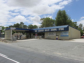
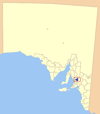
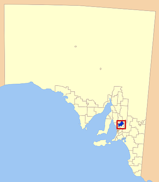
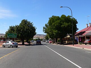
Cockatoo Valley is a locality in the Australian state of South Australia located about 41 kilometres (25 mi) north-east of the state capital of Adelaide and about 22 kilometres (14 mi) south-west of the municipal seat of Nuriootpa.

Gawler East is a town north of Adelaide, South Australia in the Town of Gawler. It is on the rising ground of the Adelaide Hills east of the town of Gawler. Some parts of the suburb date from as early as the settlement of Gawler. Other parts including newer housing estates up to still being developed in the 2010s.

The Barossa Trail is a 40 kilometres (25 mi) cycling and walking path through the Barossa Valley in South Australia. Until 2019 the 27km between Gawler and Tanunda was named the Jack Bobridge Track.

<span class="mw-page-title-main">Job Harris</span>

Job Harris, was a store keeper, post master, hotelier, gold miner and South Australian prominently associated with the discovery of gold at the Barossa Goldfields, the largest gold rush in the colony of South Australia.

The Barossa state by-election, 1933 was a by-election held on 8 July 1933 for the South Australian House of Assembly seat of Barossa. The by-election was caused by the death on 4 June 1933 of independent MP Dr Herbert Basedow, who had regained the seat at the 1933 election less than two months prior. He had previously held the seat from 1927 to 1930.

<span class="mw-page-title-main">Hundred of Barossa</span> Cadastral in South Australia

The Hundred of Barossa is a cadastral unit of hundred in South Australia in the northern Adelaide Hills. It lies west of the Barossa Range at the south end of the Barossa Valley and is bounded on the north and south by the North Para and South Para rivers, respectively. It is the most northern of the eleven hundreds of the County of Adelaide and was named in 1846 by Governor Frederick Robe after the Barossa Range.

<span class="mw-page-title-main">Hundred of Nuriootpa</span> Cadastral in South Australia

The Hundred of Nuriootpa is a cadastral unit of hundred in the County of Light, South Australia split between in the eastern Adelaide Plains and western Barossa Valley. Named in 1847 for an indigenous term officially thought to mean "bartering place" and traditionally used as neutral ground for trading between various indigenous tribes, it is bounded on the south and east by the North Para River.

Sandy Creek Conservation Park, formerly the Sandy Creek National Park, is a protected area located in the Australian state of South Australia in the localities of Lyndoch and Sandy Creek about 42 kilometres (26 mi) north-east of the state capital of Adelaide and about 3 kilometres (1.9 mi) west-south-west of the town centre in Sandy Creek.

<span class="mw-page-title-main">Barossa District Football Club</span>

The Barossa District Football & Netball Club is an Australian sports club based in the Barossa Valley region of South Australia. The club is nicknamed the Bulldogs and represents the towns of Lyndoch and Williamstown. Sports practised at Barossa are Australian rules football and netball, with teams competing in the Barossa Light & Gawler Football Association. Under 15’s wheat back to back 2020 and 2021.

References

  1. 1 2 3 4 "Search results for 'Sandy Creek, LOCB' with the following datasets being selected – 'NPW and Conservation Properties'. 'Suburbs and Localities', 'Government Towns', 'Counties', 'Local Government Areas','Postcodes', 'SA Government Regions', 'Gazetteer' and 'Roads'". Location SA Map Viewer. Government of South Australia. Retrieved 17 July 2018.
  2. 1 2 Australian Bureau of Statistics (31 October 2012). "Sandy Creek (SA)". 2011 Census QuickStats. Retrieved 11 November 2012. OOjs UI icon edit-ltr-progressive.svg
  3. "Sandy Creek Station Closed". The News (Adelaide, SA : 1923 – 1954) . Adelaide, SA. 3 December 1927. p. 3 Edition: SPORTING EDITION. Retrieved 9 February 2015 via National Library of Australia.
  4. "Home". sandycrkps.sa.edu.au.