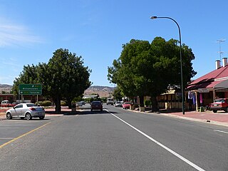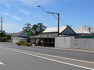
Nuriootpa ( NURE-ee-UUT-pə) is a town in South Australia and the major commercial centre of the Barossa Valley, about an hour's drive north of the state capital, Adelaide. The name of the town is reputed to be the local Aboriginal word for "meeting place".

Morgan is a town in South Australia on the right bank of the Murray River, just downstream of where it turns from flowing roughly westwards to roughly southwards. It is about 161 kilometres (100 mi) north east of Adelaide, and about 315 kilometres (196 mi) upstream of the Murray Mouth. At the 2006 census, Morgan had a population of 426.
Rowland Flat is a small South Australian town in the Barossa Valley, located on the Barossa Valley Highway between Lyndoch and Tanunda. The town has an elevation of 294m and is nestled at the foot of the Barossa Ranges. It is best known for its wineries, and proximity to Jacobs Creek, Jacobs Creek Visitor's Centre and Novotel Barossa Valley Resort.

Lyndoch is a town in Barossa Valley, located on the Barossa Valley Highway between Gawler and Tanunda, 58 km northeast of Adelaide. The town has an elevation of 175m and an average rainfall of 560.5mm. It is one of the oldest towns in South Australia.

Williamstown is a small South Australian town on the southern fringe of the Barossa Valley wine-growing region. It is 51 km north east of Adelaide and 16 km south-east of Gawler. Williamstown was originally known as Victoria Creek. The township was laid out in 1858 by Lewis Johnston, or Johnstone, on land he purchased in 1857, and named for his son.
Nildottie is a locality in the Australian state of South Australia located on the east side of the Murray River about 99 kilometres (62 mi) east of the state capital of Adelaide and about 40 kilometres (25 mi) north-east of the municipal seat in Mannum.

Sandy Creek is a town in South Australia. The town is situated approximately 6 kilometres east of Gawler and is the last town passed through before reaching Barossa Valley at Lyndoch. At the 2011 census, Sandy Creek had a population of 439.
Allendale East is a town and locality in the Australian state of South Australia located in the state's south-east about 391 kilometres (243 mi) south-east of the state capital of Adelaide and about 20 kilometres (12 mi) south of the municipal seat of Mount Gambier.
Coorabie is a town and locality in the Australian state of South Australia located about 675 kilometres (419 mi) north-west of the state capital of Adelaide. It is outside of district council boundaries, and therefore managed by the Outback Communities Authority. It is located in the west of South Australia, and includes the Wahgunyah Conservation Park. The Eyre Highway passes through the locality, although the Coorabie township is south of the highway.
Culburra is a town and locality in the Australian state of South Australia. It is located on the Dukes Highway and Melbourne–Adelaide railway. , about 158 kilometres (98 mi) south-east of the state capital of Adelaide and about 77 kilometres (48 mi) south-east of the municipal seat of Tailem Bend.
Hynam is a town and locality in the Australian state of South Australia located in the state's south-east within the Limestone Coast region on the border with the state of Victoria about 302 kilometres south east of the state capital of Adelaide and about 11 kilometres east of the municipal seat of Naracoorte.
Deep Creek is a locality in the Australian state of South Australia located on the south coast of the Fleurieu Peninsula overlooking Backstairs Passage about 85 kilometres south of the Adelaide city centre.
Keppoch is a locality in the Australian state of South Australia located in the state's south-east within the Limestone Coast region about 269 kilometres south east of the state capital of Adelaide and about 29 kilometres north-east of the municipal seat of Naracoorte.
Coles is a locality in the Australian state of South Australia located in the state's south-east within the Limestone Coast region about 316 kilometres (196 mi) south east of the state capital of Adelaide and about 39 kilometres (24 mi) south-west of the municipal seat of Naracoorte.

The Hundred of Barossa is a cadastral unit of hundred in South Australia in the northern Adelaide Hills. It lies west of the Barossa Range at the south end of the Barossa Valley and is bounded on the north and south by the North Para and South Para rivers, respectively. It is the most northern of the eleven hundreds of the County of Adelaide and was named in 1846 by Governor Frederick Robe after the Barossa Range.
Clay Wells is a locality in the Australian state of South Australia located in the state's south-east within the Limestone Coast region about 300 kilometres (190 mi) south east of the state capital of Adelaide, and about 39 kilometres (24 mi) south-east and about 35 kilometres (22 mi) north-west respectively of the municipal seats of Robe and Millicent.
Magarey is a locality in the Australian state of South Australia located in the state’s south-east about 307 kilometres (191 mi) south-east of the state capital of Adelaide and about 35 kilometres (22 mi) west of the municipal seat in Millicent.
Wattle Range is a locality in the Australian state of South Australia located in the state’s south-east about 328 kilometres (204 mi) south-east of the state capital of Adelaide and about 25 kilometres (16 mi) north-east of the municipal seat in Millicent.
Carcuma is a locality in the Australian state of South Australia located about 150 kilometres (93 mi) south-east of the state capital of Adelaide and about 67 kilometres (42 mi) south-east of the municipal seat in Tailem Bend.
Meningie East is a locality in the Australian state of South Australia located about 120 kilometres (75 mi) south-east of the state capital of Adelaide and about 43 kilometres (27 mi) south-east of the municipal seat in Tailem Bend.


