
The Barossa Valley is a valley in South Australia located 60 kilometres (37 mi) northeast of Adelaide city centre. The valley is formed by the North Para River. It is notable as a major wine-producing region and tourist destination.

Gawler is the oldest country town on the Australian mainland in the state of South Australia. It was named after the second Governor of the colony of South Australia, George Gawler. It is about 40–44 km (25–27 mi) north of the centre of the state capital, Adelaide, and is close to the major wine producing district of the Barossa Valley. Topographically, Gawler lies at the confluence of two tributaries of the Gawler River, the North and South Para rivers, where they emerge from a range of low hills.

Birdwood is a town near Adelaide, South Australia. It is located in the local government areas of the Adelaide Hills Council and the Mid Murray Council.

The Mount Lofty Ranges are a range of mountains in the Australian state of South Australia which for a small part of its length borders the east of Adelaide. The part of the range in the vicinity of Adelaide is called the Adelaide Hills and defines the eastern border of the Adelaide Plains.

Amherst is a former municipality and gold rush town situated within the Shire of Central Goldfields in Victoria, Australia. Much of the original township has been destroyed by fire, and little remains other than Amherst Cemetery at 235 Avoca Road, Talbot.
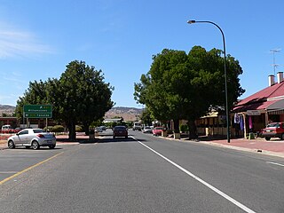
Lyndoch is a town in Barossa Valley, located on the Barossa Valley Highway between Gawler and Tanunda, 58 km northeast of Adelaide. The town has an elevation of 175m and an average rainfall of 560.5mm. It is one of the oldest towns in South Australia.

The Barossa Range is a mountain range located in the Australian state of South Australia.

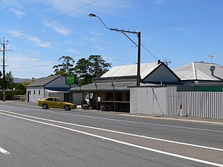
Williamstown is a small South Australian town on the southern fringe of the Barossa Valley wine-growing region. It is 51 km north east of Adelaide and 16 km south-east of Gawler. Williamstown was originally known as Victoria Creek. The township was laid out in 1858 by Lewis Johnston, or Johnstone, on land he purchased in 1857, and named for his son.

The Palmer River is a river located in Far North Queensland, Australia. The area surrounding the river was the site of a gold rush in the late 19th century which started in 1873.
Sandy Creek is a town in South Australia. The town is situated approximately 6 kilometres east of Gawler and is the last town passed through before reaching Barossa Valley at Lyndoch. At the 2011 census, Sandy Creek had a population of 439.

Para Wirra Conservation Park is a 1,417-hectare (3,500-acre) protected area located in the foothills of the Mount Lofty Ranges in the northern end of the Adelaide metropolitan area in South Australia. The conservation park is part of a larger, 2,573-hectare (6,360-acre) block of contiguous native vegetation, the remainder of which is owned by PIRSA Forestry, SA Water and private landholders.

During the Australian gold rushes, starting in 1851, significant numbers of workers moved from elsewhere in Australia and overseas to where gold had been discovered. Gold had been found several times before, but the colonial government of New South Wales had suppressed the news out of the fear that it would reduce the workforce and so destabilise the economy.
New South Wales experienced the first gold rush in Australia, a period generally accepted to lie between 1851 and 1880. This period in the history of New South Wales resulted in a rapid growth in the population and significant boost to the economy of the colony of New South Wales. The California Gold Rush three years prior signaled the impacts on society that gold fever would produce, both positive and negative. The New South Wales colonial government concealed the early discoveries, but various factors changed the policy.

Morinish is a rural locality in the Rockhampton Region, Queensland, Australia. In the 2016 census Morinish had a population of 89 people.

Canoona is a rural locality in the Livingstone Shire, Queensland, Australia. In the 2016 census, Canoona had a population of 81 people. It was the site of the first North Australian gold rush.
Kalbeeba is a locality east of Gawler in South Australia. It is named for a former railway station on the Barossa Valley railway line. The northern boundary of Kalbeeba is now the Barossa Valley Way, and its southwestern boundary is the South Para River.

Job Harris, was a store keeper, post master, hotelier, gold miner and South Australian prominently associated with the discovery of gold at the Barossa Goldfields, the largest gold rush in the colony of South Australia.

The Hundred of Barossa is a cadastral unit of hundred in South Australia in the northern Adelaide Hills. It lies west of the Barossa Range at the south end of the Barossa Valley and is bounded on the north and south by the North Para and South Para rivers, respectively. It is the most northern of the eleven hundreds of the County of Adelaide and was named in 1846 by Governor Frederick Robe after the Barossa Range.
Mount Crawford is a locality in the Mount Lofty Ranges of South Australia. It is named after the mountain of the same name in its boundaries, also known as Teetaka.
Caroona Creek Conservation Park is a protected area located in the Australian state of South Australia in the localities of Collinsville and Mount Bryan East about 173 kilometres (107 mi) north-east of the state capital of Adelaide and about 19 kilometres (12 mi) east of the town of Hallett.
