
The Barossa Valley is a valley in South Australia located 60 kilometres (37 mi) northeast of Adelaide city centre. The valley is formed by the North Para River. It is notable as a major wine-producing region and tourist destination.
Tanunda is a town situated in the Barossa Valley region of South Australia. In the 2021 census, Tanunda recorded a population of 4,710 people.
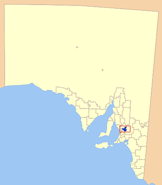
Barossa Council is a local government area in the Barossa Valley in South Australia. The council area covers 912 square kilometres, and had a population of over 23,000 in the 2016 Census.

Nuriootpa ( NURE-ee-UUT-pə) is a town in South Australia and the major commercial centre of the Barossa Valley, about an hour's drive north of the state capital, Adelaide. The name of the town is reputed to be the local Aboriginal word for "meeting place".

Rail transport in the Australian state of South Australia is provided by a number of railway operators who operate over the government-owned railway lines. The network consists of 1435 mm standard gauge links to other states, the 1600 mm broad gauge suburban railways in Adelaide, a freight-only branch from Dry Creek to Port Adelaide and Pelican Point, a narrow-gauge gypsum haulage line on the Eyre Peninsula, and both copper–gold concentrate and coal on the standard-gauge line in the Adelaide–Darwin rail corridor north of Tarcoola.
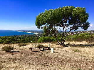
Marino is a coastal suburb in the south of Adelaide, South Australia that's surrounded by a conservation park and rugged coastline. Most houses have sea views and access to meandering public open spaces. The suburb even has its own working lighthouse. Marino's elevated position provides panoramic views of the ocean – Gulf St Vincent, the metropolitan beaches and Adelaide CBD. Marino has access to the North or South via Brighton Road, has two railway stations on the main Seaford Line and a host of walking and cycle trails to the neighbouring beaches and wine region.
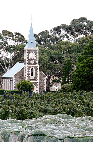
Lyndoch is a town in Barossa Valley, located on the Barossa Valley Highway between Gawler and Tanunda, 58 km northeast of Adelaide. The town has an elevation of 175m and an average rainfall of 560.5mm. It is one of the oldest towns in South Australia.

Gawler railway station is located on the Gawler line. Situated in the South Australian town of Gawler, it is 39.8 kilometres (24.7 mi) from Adelaide station.

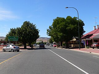
Angaston is a town on the eastern side of the Barossa Valley in South Australia, 77 km northeast of Adelaide. Its elevation is 347 m, one of the highest points in the valley, and has an average rainfall of 561 mm. Angaston was originally known as German Pass, but was later renamed after the politician, banker and pastoralist George Fife Angas, who settled in the area in the 1850s. Angaston is in the Barossa Council local government area, the state electoral district of Schubert and the federal Division of Barker.

Mount Pleasant is a town situated in the Barossa Council, just north of the Adelaide Hills region of South Australia, 55 kilometres east-north-east of the state capital, Adelaide. It is located in the Barossa Council and Mid Murray Council local government areas, and is at an altitude of 440 metres above sea level. Rainfall in the area averages 687 mm per annum.
Gawler South is a suburb of the South Australian town of Gawler, located in the northern Adelaide metropolitan area region, 43 km north of Adelaide. It is bordered by the South Para River and the suburbs of Gawler, Gawler West, Evanston, Evanston Park and Bibaringa.
Adbri, formerly Adelaide Brighton Cement, is an Australian manufacturer of cement, lime and dry blended products.

The Barossa Valley railway line is a closed railway line in South Australia. It was first opened in 1911, extending from the Gawler line to Angaston with later branches being built to Penrice and Truro. Much of the line from Gawler to Penrice remained open up until June 2014. The section of line from Nuriootpa to Truro was removed in the 1990s. The section of line from Nuriootpa to Angaston was taken up in 2010 and replaced with a rail trail.
Moculta is a locality in the Australian state of South Australia located about 69 kilometres (43 mi) north-east of the state capital of Adelaide and about 12 kilometres (7.5 mi) north-east of the municipal seat of Angaston. At the 2016 census, Moculta shared a population of 227 with part of Truro).

The Penrice Stone Train “The Stonie” was a limestone train in South Australia that operated from the Penrice Quarry near Angaston on the Barossa Valley line to Penrice Soda Products' soda ash factory in Osborne in Adelaide's north-western suburbs, and the co-located Readymix concrete batching plant.
Penrice Soda Products was a company founded in 1935 in South Australia. It was listed on the Australian Securities Exchange, named after its quarry near the small town of Penrice, South Australia. It was forced to close its soda ash production plant in Osborne and was placed in liquidation in August 2014.

Nuriootpa railway station was located at the junction of the Angaston railway line and the Truro railway line. It served the town of Nuriootpa, South Australia.

Daveyston is a small town in the northern Barossa Valley region of South Australia. It is adjacent to the current Sturt Highway which previously ran through the middle of the town. The town is named after Benjamin Davey who had established a mill there before the town was established.
The Barossa Trail is a 40 kilometres (25 mi) cycling and walking path through the Barossa Valley in South Australia, opened in May 2014. Much of the Barossa Trail follows the Barossa Valley railway line, but is not a rail trail as part of the railway was still operating at the time it was built. As it is not on the railway formation, it has more undulations than a true rail trail would have. The part near Rowland Flat is away from both the railway and main road. It has much sharper corners than would be expected on a rail trail.

The Hundred of Barossa is a cadastral unit of hundred in South Australia in the northern Adelaide Hills. It lies west of the Barossa Range at the south end of the Barossa Valley and is bounded on the north and south by the North Para and South Para rivers, respectively. It is the most northern of the eleven hundreds of the County of Adelaide and was named in 1846 by Governor Frederick Robe after the Barossa Range.
