South Cariboo Regional Airport or 108 Mile Ranch Airport is a registered aerodrome located 5.3 nautical miles northwest of 108 Mile Ranch, British Columbia, Canada. The airport is the regional aerodrome for the South Cariboo Regional District, handling over 2,000 movements a year. It provides facilities for commercial passenger service, MEDEVAC, flight training and corporate traffic.
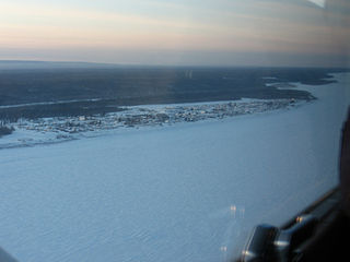
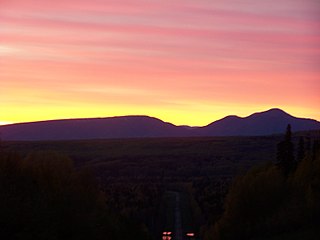
Fort Simpson is a village, the only one in the entire territory, in the Dehcho Region of the Northwest Territories, Canada. The community is located on an island at the confluence of the Mackenzie and Liard Rivers. It is approximately 500 km (310 mi) west of Yellowknife. Both rivers were traditionally trade routes for the Hudson's Bay Company and the native Dene people of the area.
Prince George Airport is an airport that serves Prince George, British Columbia, Canada, and the surrounding area. It is located just within the southern boundary of the city, 2.8 nautical miles southeast, and is run by the Prince George Airport Authority.

Watson Lake Airport is located 5 nautical miles west of Watson Lake, Yukon, Canada, and is operated by the Yukon government. The paved asphalt runway is 5,500 ft (1,676 m) long and is at an elevation of 2,255 ft (687 m).
Fort St. John Airport, North Peace Regional Airport, or North Peace Airport, is located at Fort St. John, British Columbia, Canada. The airport is operated by North Peace Airport Services Ltd. A new record of 257,295 passengers came through the airport in 2015, up from the 252,729 passengers seen in 2014.

Fort Simpson Island Airport, is located adjacent to Fort Simpson, Northwest Territories, Canada. Prior permission is required to land except in the case of an emergency.
Fort Simpson Airport is located 7.4 nautical miles east southeast of Fort Simpson, Northwest Territories, Canada.

Fort Albany Airport,, is located adjacent to Fort Albany, Ontario, Canada.

North-Wright Airways is an airline based in Norman Wells, Northwest Territories, Canada. It operates commuter services to several communities in the Northwest Territories, and charter services. Its main base is Norman Wells Airport and they operate the Norman Wells Water Aerodrome.
Anahim Lake Airport,, is located 1 nautical mile south of Anahim Lake, British Columbia, Canada. It is a year-round airport serving the West Chilcotin area, operated by Cariboo Regional District.

Northern Rockies Regional Airport, , is located 3.8 nautical miles east northeast of Fort Nelson, British Columbia, Canada.
Green Lake Aerodrome is located 0.5 nautical miles east of Green Lake east of 70 Mile House in the Cariboo region of British Columbia, Canada. It is a private airport operated by the Flying U Guest Ranch.
Prince George Airport, (TC LID: CBW8), was located near Prince George, British Columbia, Canada.

Nahanni Butte is a "Designated Authority" in the Dehcho Region of the Northwest Territories, Canada. The community is located at the confluence of the Liard and South Nahanni Rivers in the southwestern part of the NWT.

Sambaa K'e is a "Designated Authority" in the Dehcho Region of the Northwest Territories, Canada. The community is located near the Alberta border, east of Fort Liard, on the shore of the lake also known as Sambaa K'e. It has no all-weather road, but can be reached by winter road early in the year or by air year-round.

Fort MacKay/Firebag Aerodrome is located 22 nautical miles from the Firebag River, Alberta, Canada. The aerodrome was built to service the Firebag in-situ operation of Suncor Energy.