Fox, Oregon

Last updated
The Fox Store and other buildings in Fox Fox, Oregon.jpg
The Fox Store and other buildings in Fox

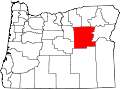
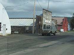
Fox is an unincorporated community in Grant County, Oregon, United States, on U.S. Route 395 south of Long Creek.

Fox is named after Fox Creek, a tributary of the North Fork John Day River. [1] The creek was named for an incident involving a fox that occurred during a hunting or prospecting trip in pioneer times. [1] Fox post office was established circa 1883 [1] discontinued in 2002, and formerly had a ZIP code of 97831. [2] Fox is now served by the Long Creek post office (ZIP code 97845). [3]

Fox was the birthplace of noted artist Morris Graves. [4]

Climate

This region experiences warm (but not hot) and dry summers, with no average monthly temperatures above 71.6 °F. According to the Köppen Climate Classification system, Fox has a warm-summer Mediterranean climate, abbreviated "Csb" on climate maps. [5]

Related Research Articles

Oxbow, Oregon Unincorporated community in the State of Oregon, United States

Oxbow is an unincorporated community in Baker County, Oregon, United States. Oxbow is along Oregon Route 86 next to the Snake River near the Oxbow Dam on the Oregon-Idaho border, about 17 miles (27 km) northeast of Halfway. Oxbow is just south of the site of the former mining town of Copperfield. Oxbow has a post office with a ZIP code 97840.

Camp Sherman, Oregon Unincorporated community in the State of Oregon, United States

Camp Sherman is an unincorporated community and census-designated place (CDP) in Jefferson County, Oregon, United States. It is located on the Metolius River. The year-round population as of the 2010 census was 233, with that number tripling or more during the summer. The community includes an elementary school, Black Butte School, a general store and a post office. The community also has a volunteer fire department. Camp Sherman was founded by vacationers from Sherman County in the latter part of the 19th century.

Belknap Springs, Oregon Unincorporated community in the State of Oregon, United States

Belknap Springs is an unincorporated community and private hot springs resort in Lane County, Oregon, United States, near the McKenzie River. The springs were located and initially developed by R. S. Belknap in 1869. A post office named "Salt Springs" was established in the location in 1874, and the name changed to "Belknap Springs" in 1875. The post office closed in 1877 and reopened in 1891, operating intermittently until 1953. Today the location uses a McKenzie Bridge mailing address.

Azalea is an unincorporated community in Douglas County, Oregon, United States, about 10 miles Northeast of Glendale on Interstate 5, at an elevation of 1,657 feet.

Buxton, Oregon Unincorporated community in the State of Oregon, United States

Buxton is an unincorporated community in Washington County, Oregon, United States, near Oregon Route 47.

Wolf Creek, Oregon Unincorporated community in the State of Oregon, United States

Wolf Creek is an unincorporated community in Josephine County, Oregon, United States, just off Interstate 5.

Kimberly, Oregon Unincorporated community in central Oregon

Kimberly is an unincorporated community in Grant County, Oregon, United States. It is located at the intersection of Oregon Route 19 and Oregon Route 402 and the confluence of the John Day and the North Fork John Day rivers.

Blodgett, Oregon Unincorporated community in the State of Oregon, United States

Blodgett is a census-designated place (CDP) and unincorporated community in Benton County, Oregon, United States, where Oregon Route 180 meets U.S. Route 20 in the Central Oregon Coast Range 15 miles (24 km) west of Corvallis. It is near the confluence of the Tumtum and Marys rivers. As of the 2010 census, the community had a population of 58.

Williams, Oregon Unincorporated community in the State of Oregon, United States

Williams is an unincorporated community and census-designated place (CDP) in Josephine County, Oregon, United States. As of the 2010 census it had a population of 1,072.

Post, Oregon Unincorporated community in the State of Oregon, United States

Post is an unincorporated community in Crook County, Oregon, United States. It has a post office assigned the ZIP code of 97752. Post lies along Oregon Route 380 southeast of Prineville at an elevation of 3,383 feet (1,031 m). Post was named for Walter H. Post, the first postmaster of the Post post office, established in 1889.

Mikkalo is an unincorporated community in Gilliam County, Oregon, United States, at an elevation of 1,470 feet (450 m). Mikkalo is about 4 miles (6.4 km) northwest of Clem. Mikkalo has a post office, serving ZIP code of 97861, and is in the 541 area code region. In 1905, the place was named for settler John Mikkalo, and a post office opened at Mikkalo in 1907. It was along the Condon Branch of the Union Pacific Railroad. The Mikkalo Farmers Elevator had a fire on March 28, 1921.

Bates is an unincorporated community in Grant County, Oregon, United States. it has a post office with a ZIP code 97817. The elevation is 4,062 feet (1,238 m).

New Pine Creek, Oregon Unincorporated community in the State of Oregon, United States

New Pine Creek is a census-designated place and unincorporated community in Lake County, Oregon, United States. As of the 2010 census, it had a population of 120. it has a post office with a ZIP code 97635. New Pine Creek lies on U.S. Route 395 at the Oregon–California border, just north of New Pine Creek, California, and east of Goose Lake.

Kent, Oregon Unincorporated community in the State of Oregon, United States

Kent is an unincorporated community in Sherman County, Oregon, United States. Kent has a post office with a ZIP code 97033. Kent lies at the intersection of U.S. Route 97 and Dobie Point Road, between Grass Valley to the north and Shaniko to the south.

Curtin, Oregon Unincorporated community in the State of Oregon, United States

Curtin is an unincorporated community in Douglas County, Oregon, United States. It is on Interstate 5 and the former Southern Pacific railroad line about 7 miles (11 km) northeast of Drain along Pass Creek. It stands at an elevation of 404 feet.

Broadbent is an unincorporated community in Coos County, Oregon, United States. Broadbent is on Oregon Route 542 south of Myrtle Point along the South Fork Coquille River. Broadbent has a post office with ZIP code 97414.

Ritter, Oregon Unincorporated community in the State of Oregon, United States

Ritter is an unincorporated community in Grant County, Oregon, United States, ten miles down the Middle Fork John Day River from U.S. Route 395, between Dale and Long Creek. At one time the locale was also known as Ritter Hot Springs.

Birkenfeld, Oregon Unincorporated community in the State of Oregon, United States

Birkenfeld is an unincorporated community in Columbia County, Oregon, United States, in the Nehalem Valley on Oregon Route 202 between Jewell and Mist.

Walker is an unincorporated community in Lane County, Oregon, United States. It is located about 4 miles (6 km) north of Cottage Grove on Oregon Route 99, near the Coast Fork Willamette River.

Dale, Oregon Unincorporated community in the State of Oregon, United States

Dale is an unincorporated community in Grant County, Oregon, United States. It is located on U.S. Route 395 within the Umatilla National Forest about 17 miles south of Ukiah. It is near the Umatilla-Grant County border just south of the 45th parallel north.

References

  1. 1 2 3 McArthur, Lewis A.; Lewis L. McArthur (2003) [1928]. Oregon Geographic Names (7th ed.). Portland, Oregon: Oregon Historical Society Press. ISBN   0-87595-277-1.
  2. Post Offices by County: Grant County, Oregon
  3. United States Postal Service ZIP code lookup
  4. Ament, Deloris Tarzan: Graves, Morris (1910-2001)HistoryLink.org essay5205; http://www.historylink.org/index.cfm?DisplayPage=output.cfm&file_id=5205 retvd 6 24 15
  5. Climate Summary for Fox, Oregon

Coordinates: 44°38′56″N119°08′39″W / 44.648764°N 119.144136°W / 44.648764; -119.144136